Pleasant Grove, Utah
Pleasant Grove, originally named Battle Creek, is a city in Utah County, Utah, United States known as "Utah's City of Trees". It is part of the Provo–Orem Metropolitan Statistical Area. The population was 33,509 at the 2010 Census.[5]
Pleasant Grove, Utah | |
|---|---|
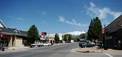 Pleasant Grove Main Street | |
| Nickname(s): Utah's City of Trees | |
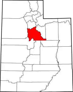
 Location in Utah County and the state of Utah | |
| Coordinates: 40°22′13″N 111°43′53″W | |
| Country | United States |
| State | Utah |
| County | Utah |
| Settled | 1850 |
| Incorporated | January 18, 1855 |
| Area | |
| • Total | 9.18 sq mi (23.77 km2) |
| • Land | 9.18 sq mi (23.77 km2) |
| • Water | 0.00 sq mi (0.00 km2) |
| Elevation | 4,623 ft (1,409 m) |
| Population (2010) | |
| • Total | 33,509 |
| • Estimate (2019)[2] | 38,258 |
| • Density | 4,169.35/sq mi (1,609.84/km2) |
| Time zone | UTC−7 (Mountain (MST)) |
| • Summer (DST) | UTC−6 (MDT) |
| ZIP code | 84062 |
| Area code(s) | 385, 801 |
| FIPS code | 49-60930[3] |
| GNIS feature ID | 1444479[4] |
| Website | www |
History
Settlement and incorporation
On July 19, 1850, William H. Adams, John Mercer and Philo T. Farnsworth,[6] Mormon pioneers sent by Brigham Young, arrived at the area now known as Pleasant Grove and staked out farms in what is now the southwest corner of the city. A small community was established September 13, 1850, consisting of George S. Clark and his wife, Susannah Dalley Clark, Richard and Ann Elizabeth Sheffer Clark, John Greenleaf Holman and Nancy Clark Holman, Lewis Harvey and his wife Lucinda Clark Harvey, Johnathan Harvey and Sarah Herbert Harvey, Charles Price and wife and child, Widow Harriet Marler and children, John Wilson, Ezekiel Holman, and possibly one or two others, relatives of those mentioned. Of note, Bro William Fletcher and Sis Anne Hawley Reynolds in 1852 brought Ellis Reynolds Shipp to live, which Shipp became the legendary MD, Obstetrician, and Pediatrician, through the young women's midwife training program of Dr. Richards and Eliza Snow, beginning her training in young women's MIA in Pleasant Grove.[7] Pleasant Grove was officially incorporated as a town January 18, 1855, by which time the settlement had grown to 623 people.
Early relations with Native Americans
The original name of the city was Battle Creek. It was named for a battle which took place there in 1849 between Mormon settlers and a small band of Ute Indians, wherein all the male Utes were massacred because Brigham Young believed they had stolen some of his horses (which were found before the attack on the Utes occurred).[8] The settlers later decided they needed a more uplifting name and began calling their town Pleasant Grove after a grove of cottonwood trees located between Battle Creek and Grove Creek, near the current-day intersection of Locust Avenue and Battle Creek Drive. A monument with a plaque describing this battle is located at Kiwanis Park, at the mouth of Battle Creek Canyon.
During the Walker Indian War in the 1850s, citizens built a fort with walls two or three feet thick and six feet tall that occupied an area the size of sixteen city blocks. The settlers in the area at the time built homes inside the fort. While the fort no longer stands, memorial cornerstones were erected by local historians. The northeast monument was erected near the intersection of 100 North and 300 East streets. The northwest monument was erected four blocks west of that point at 100 West Street and the southeast monument erected four blocks south at 300 South Street. The southwest monument would have been located near 300 South 100 West, the area is now occupied by a large parking lot and retail store.
Recent events
This city was one of the filming locations for Universal's 1995 film Gold Diggers: The Secret of Bear Mountain. Also some filming of Stephen King's "The Stand".
Geography

According to the United States Census Bureau, the city has a total area of 9.2 square miles (23.7 km2), all land.[10] Sloping off the Mt. Timpanogos bench, Pleasant Grove is represented by a large, white hillside letter "G" just above the city.
Demographics
| Historical population | |||
|---|---|---|---|
| Census | Pop. | %± | |
| 1860 | 526 | — | |
| 1870 | 930 | 76.8% | |
| 1880 | 1,775 | 90.9% | |
| 1890 | 1,926 | 8.5% | |
| 1900 | 2,460 | 27.7% | |
| 1910 | 1,618 | −34.2% | |
| 1920 | 1,682 | 4.0% | |
| 1930 | 1,754 | 4.3% | |
| 1940 | 1,941 | 10.7% | |
| 1950 | 3,195 | 64.6% | |
| 1960 | 4,772 | 49.4% | |
| 1970 | 5,327 | 11.6% | |
| 1980 | 10,833 | 103.4% | |
| 1990 | 13,476 | 24.4% | |
| 2000 | 23,468 | 74.1% | |
| 2010 | 33,509 | 42.8% | |
| 2019 (est.) | 38,258 | [2] | 14.2% |
| U.S. Decennial Census[11] | |||
As of the census[3] of 2010, there were 33,509 people, 6,109 households, and 5,388 families residing in the city. The population density was 2,691.5 per square mile (1,039.1/km2). There were 6,334 housing units at an average density of 726.4 per square mile (280.5/km2). The racial makeup of the city was 95.15% White, 0.29% African American, 0.38% Native American, 0.54% Asian, 0.39% Pacific Islander, 1.75% from other races, and 1.50% from two or more races. Hispanic or Latino of any race were 4.56% of the population.
There were 6,109 households, out of which 58.0% had children under the age of 18 living with them, 77.0% were married couples living together, 8.6% had a female householder with no husband present, and 11.8% were non-families. 9.2% of all households were made up of individuals, and 3.6% had someone living alone who was 65 years of age or older. The average household size was 3.83 and the average family size was 4.11.
In the city, the population was spread out, with 41.0% under the age of 18, 11.3% from 18 to 24, 28.0% from 25 to 44, 13.8% from 45 to 64, and 5.9% who were 65 years of age or older. The median age was 24 years. For every 100 females, there were 100.8 males. For every 100 females age 18 and over, there were 98.2 males.
The median income for a household in the city was $52,036, and the median income for a family was $54,182. Males had a median income of $42,042 versus $23,296 for females. The per capita income for the city was $15,268. About 5.4% of families and 6.8% of the population were below the poverty line, including 8.1% of those under age 18 and 3.1% of those age 65 or over.
Government
The city's government consists of a mayor and a city council. As of January 2018, the city's mayor is Guy L. Fugal. The city council is made up of five members: Dianna Anderson, Eric Jensen, Todd N. Williams, Cyd LeMone and Brent Bullock. Council members serve staggered terms that end in either 2020 or 2022.[12]
Strawberry Days
Pleasant Grove is home to the summer festival known as Strawberry Days. The first annual “Strawberry Day” (initially a single-day event) was held on June 21, 1922, with 10,000-15,000 people in attendance.[13][14][15] The festival was organized by the Wasatch Club,[16] a forerunner of today’s Chamber of Commerce. This first celebration included strawberries and cream and a parade;[13] both remain staples of modern-day Strawberry Days.
The festival’s name originated when strawberry farming was a major economic activity in the city. (Approximately 250 acres of strawberries were being grown in the area when the first festival was held in 1922.[16]) The festival retains the traditional name, even though large-scale commercial growing of the fruit no longer occurs in the city.[17] The festival is Utah’s second oldest community harvest festival, younger only than Brigham City's Peach Days–a festival Strawberry Days’ founders hoped to rival.[16]
Today, a rodeo held in conjunction with this festival brings competitors and spectators from throughout the West. The festival includes parades, a carnival, pageants and other activities.[17] The festival is usually held the third week of June, a period chosen in 1922, which would generally correspond with the end of the strawberry harvest for the area.
First amendment case
In November 2008, the United States Supreme Court heard oral arguments in the case of Pleasant Grove City v. Summum. The case regarded whether Pleasant Grove, which allowed the display of a privately-donated Ten Commandments on public property, must also allow the religion of Summum to display a monument to its "Seven Aphorisms" alongside. Pleasant Grove had declined the Summum offer in 2003.[18] The city lost in the Tenth Circuit. However, the city appealed to the Supreme Court which overturned the Court of Appeals decision, citing the permanence of monuments as opposed to forms of constitutionally-protected free speech as well as the fact that governments take ownership of monuments on their properties and thus must "take some care in accepting donated monuments."[19]
Education

Public schools in Pleasant Grove are part of the Alpine School District. Charter schools include John Hancock Charter School[20] and Lincoln Academy.[21] Liahona Preparatory Academy is an accredited K-12 private school serving the area.
Elementary schools
Junior high/middle schools
- Lincoln Academy
- Liahona Preparatory Academy
- Pleasant Grove Junior High School[27]
High schools
- Liahona Preparatory Academy
- Pleasant Grove High School
Attractions
- Evermore Park[30]
- Christa McAuliffe Space Education Center
- Taco Amigo
- Mount Timpanogos Utah Temple (on the border in neighboring American Fork)
- Pleasant Grove Pioneers Parade
- Purple Turtle
- Water Gardens Cinemas
- Chubby's Cafe
Notable people
- Quinn Allman, musician, The Used
- Howard Roscoe Driggs, Western historian and educator; born in Pleasant Grove; brother of William King Driggs, Sr.
- Todd Herzog, winner of reality TV show Survivor: China
- Chelsie Hightower, contestant on So You Think You Can Dance
- Dane Iorg, former Major League Baseball player (St. Louis Cardinals, Kansas City Royals); World Series champion
- The King Sisters, and their father, agent and organizer William King Driggs, Sr.
- A. Ray Olpin, President of University of Utah from 1946 to 1964
- C. J. Wilcox, 28th overall pick in the 2014 NBA draft; shooting guard for the Orlando Magic
Gallery
 View of the Wasatch range from Pleasant Grove
 The old Los Angeles and Salt Lake Railroad line cutting through the city (currently part of Union Pacific's Provo Industrial Lead).
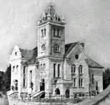
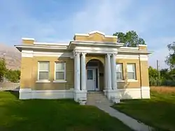 The historic Tithing Office
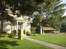
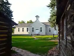 The historic Old Bell School
References
- "2019 U.S. Gazetteer Files". United States Census Bureau. Retrieved August 7, 2020.
- "Population and Housing Unit Estimates". United States Census Bureau. May 24, 2020. Retrieved May 27, 2020.
- "U.S. Census website". United States Census Bureau. Retrieved 2008-01-31.
- "US Board on Geographic Names". United States Geological Survey. 2007-10-25. Retrieved 2008-01-31.
- "Profile of General Population and Housing Characteristics: 2010 Demographic Profile Data (DP-1): Pleasant Grove city, Utah". United States Census Bureau. Retrieved March 8, 2012.
- Not the same Philo T. Farnsworth as the inventor born in 1906. See also, Philo T. Farnsworth's witness testimony in regard to the Mountain Meadows Massacre
- Ellis Reynolds Shipp: Autobiography, E>R>S, 1898 Deseret Book
- http://en.wikipedia.com/wiki/battle_creek_massacre
- Rayburn, Jim (9 December 1993). "Better ways to show school spirit than littering mountain with letters". Deseret News. Salt Lake City, UT. Retrieved 12 August 2016.
- "Geographic Identifiers: 2010 Demographic Profile Data (G001): Pleasant Grove city, Utah". United States Census Bureau. Retrieved March 8, 2012.
- "Census of Population and Housing". Census.gov. Retrieved June 4, 2015.
- http://plgrove.org/pleasant-grove-information-25006/mayor-a-city-council
- "Thousands of People Celebrate First Big Strawberry Day". American Fork Citizen. American Fork, Utah. June 24, 1922. Retrieved May 24, 2020.
- "10,000 Attend Strawberry Festival". The Daily Herald. Provo, Utah. June 22, 1922. Retrieved May 24, 2020.
More than 10,000 people from every section of the state attended the first annual Utah Strawberry day held here.
- Holzapfel, Richard N. (1999). A History of Utah County. Utah State Historical Society. p. 200. ISBN 0-913738-09-3.
- "Pleasant Grove To Have Big Strawberry Day This Summer". American Fork Citizen. American Fork, Utah. April 29, 1922. Retrieved May 24, 2020.
- "Strawberry Days Edition" (PDF). Pleasant Grove: Utah's City of Trees. June 2007. Archived from the original (PDF) on 2008-09-10. Retrieved 2008-07-02.
- Liptak, Adam (November 11, 2008). "From Tiny Sect, a Weighty Issue for the Justices". New York Times. Retrieved May 18, 2018.
- "Court rules for Utah city in religious marker case". Associated Press. 2009-02-25. Retrieved 2009-02-25.
- John Hancock Charter School
- Lincoln Academy
- Central
- Grovecrest
- Manila
- Mount Mahogany
- Valley View
- "Pleasant Grove Junior High School". Archived from the original on 2010-02-13. Retrieved 2010-02-13.
- Community Center
- Veterans Memorial Pool
- Evermore
External links
| Wikimedia Commons has media related to Pleasant Grove, Utah. |
