Sallis, Mississippi
Sallis is a town in Attala County, Mississippi, United States. The population was 134 at the 2010 census.[3]
Sallis, Mississippi | |
|---|---|
.jpg.webp) Sallis Cemetery | |
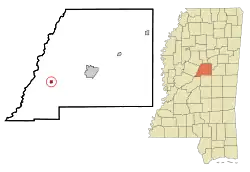 Location of Sallis, Mississippi | |
 Sallis, Mississippi Location in the United States | |
| Coordinates: 33°1′14″N 89°45′52″W | |
| Country | United States |
| State | Mississippi |
| County | Attala |
| Area | |
| • Total | 0.41 sq mi (1.06 km2) |
| • Land | 0.41 sq mi (1.06 km2) |
| • Water | 0.00 sq mi (0.00 km2) |
| Elevation | 325 ft (99 m) |
| Population (2010) | |
| • Total | 134 |
| • Estimate (2019)[2] | 128 |
| • Density | 311.44/sq mi (120.19/km2) |
| Time zone | UTC-6 (Central (CST)) |
| • Summer (DST) | UTC-5 (CDT) |
| ZIP code | 39160 |
| Area code(s) | 662 |
| FIPS code | 28-64800 |
| GNIS feature ID | 0677299 |
History
Sallis was founded in 1874, and named for Dr. James D. Sallis, the former owner of the town site.[4]
By 1906, Sallis had a post-office, school, steam grist mill, and several churches. The population was estimated at 850.[4]
Sallis is located along a now-abandoned section of the Illinois Central Railroad, and a station was located there.[4]
The mayor of Sallis is Jack Ables.[5]
Geography
According to the United States Census Bureau, the town has a total area of 0.4 square miles (1.0 km2), all land.
Demographics
| Historical population | |||
|---|---|---|---|
| Census | Pop. | %± | |
| 1880 | 132 | — | |
| 1890 | 156 | 18.2% | |
| 1900 | 195 | 25.0% | |
| 1910 | 247 | 26.7% | |
| 1920 | 273 | 10.5% | |
| 1930 | 364 | 33.3% | |
| 1940 | 287 | −21.2% | |
| 1950 | 228 | −20.6% | |
| 1960 | 223 | −2.2% | |
| 1970 | 213 | −4.5% | |
| 1980 | 211 | −0.9% | |
| 1990 | 139 | −34.1% | |
| 2000 | 114 | −18.0% | |
| 2010 | 134 | 17.5% | |
| 2019 (est.) | 128 | [2] | −4.5% |
| U.S. Decennial Census[6] | |||
As of the census[7] of 2000, there were 114 people, 50 households, and 34 families residing in the town. The population density was 273.5 people per square mile (104.8/km2). There were 58 housing units at an average density of 139.2 per square mile (53.3/km2). The racial makeup of the town was 71.93% White and 28.07% African American.
There were 50 households, out of which 30.0% had children under the age of 18 living with them, 54.0% were married couples living together, 14.0% had a female householder with no husband present, and 32.0% were non-families. 30.0% of all households were made up of individuals, and 18.0% had someone living alone who was 65 years of age or older. The average household size was 2.28 and the average family size was 2.79.
In the town, the population was spread out, with 24.6% under the age of 18, 5.3% from 18 to 24, 24.6% from 25 to 44, 25.4% from 45 to 64, and 20.2% who were 65 years of age or older. The median age was 43 years. For every 100 females, there were 83.9 males. For every 100 females age 18 and over, there were 72.0 males.
The median income for a household in the town was $27,500, and the median income for a family was $33,750. Males had a median income of $22,500 versus $13,750 for females. The per capita income for the town was $14,432. There were 23.5% of families and 24.8% of the population living below the poverty line, including 53.8% of under eighteens and 25.0% of those over 64.
Education
The town of Sallis is served by the Attala County School District.
Notable people
- David Barksdale, Chicago-raised gangster
- Jimmy Holiday, R&B singer and songwriter[8]
- Larry Hoover, Chicago-based gangster
- Patricia Wells-Thomas, The first African-American female Colonel in the United States Air Force from Attala County in Mississippi
References
- "2019 U.S. Gazetteer Files". United States Census Bureau. Retrieved July 26, 2020.
- "Population and Housing Unit Estimates". United States Census Bureau. May 24, 2020. Retrieved May 27, 2020.
- "Geographic Identifiers: 2010 Demographic Profile Data (G001): Sallis town, Mississippi". U.S. Census Bureau, American Factfinder. Archived from the original on February 12, 2020. Retrieved June 19, 2013.
- Rowland, Dunbar (1907). Mississippi: Comprising Sketches of Counties, Towns, Events, Institutions, and Persons, Arranged in Cyclopedic Form. 2. Southern Historical Publishing Association. p. 591.
- https://www.citydirectory.us/town-sallis.html#cityhall. Retrieved 25 July 2019. Missing or empty
|title=(help) - "Census of Population and Housing". Census.gov. Retrieved June 4, 2015.
- "U.S. Census website". United States Census Bureau. Retrieved 2008-01-31.
- Pavlić, Ed (March 19, 2015). "Portrait of the Artist as a Daughter". Chimurenga.
Municipalities and communities of Attala County, Mississippi, United States | ||
|---|---|---|
| Cities | 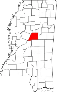 Map of Mississippi highlighting Attala County | |
| Towns | ||
| Unincorporated communities | ||
| Ghost towns | ||
| Indian reservation | ||
| Footnotes | ‡This populated place also has portions in an adjacent county or counties | |
| ||
| Authority control |
|---|