Shahrituz
Shahrituz (Tajik: Шаҳритуз, also Шаҳритӯс Shahritŭs, شهر توس, Russian: Шаартуз Shaartuz, Uzbek: Shaartuz) is a town in Khatlon Region, southwestern Tajikistan. Situated on the river Kofarnihon, the city was founded in 1938. Its population is 17,200 (January 2020 estimate).[2] It is the seat of the Shahrituz District.
Shahrituz
Шаҳритуз | |
|---|---|
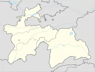 Shahrituz Location in Tajikistan | |
| Coordinates: 37°16′N 68°08′E | |
| Country | |
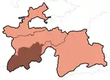
| Region | Khatlon Region |
| District | Shahrituz District |
| Elevation | 367 m (1,204 ft) |
| Population (2020) | |
| • Total | 17,200 |
| Time zone | UTC+5 |
Geography
Climate
Shahrituz has a cold semi-arid climate (Köppen climate classification BSk). The average annual temperature is 17.2°C (63.0°F). The warmest month is July with an average temperature of 30.2°C (86.4°F) and the coolest month is January with an average temperature of 3.3°C (37.9°F). The average annual precipitation is 235.7mm (9.2") and has an average of 59.2 days with precipitation. The wettest month is March with an average of 58.0mm (2.3") of precipitation and the driest month is August with an average of 0mm of precipitation.[1]
| Climate data for Shahrituz | |||||||||||||
|---|---|---|---|---|---|---|---|---|---|---|---|---|---|
| Month | Jan | Feb | Mar | Apr | May | Jun | Jul | Aug | Sep | Oct | Nov | Dec | Year |
| Daily mean °C (°F) | 3.3 (37.9) |
5.8 (42.4) |
11.6 (52.9) |
18.2 (64.8) |
23.5 (74.3) |
28.6 (83.5) |
30.2 (86.4) |
28.1 (82.6) |
23.2 (73.8) |
17.0 (62.6) |
10.7 (51.3) |
5.8 (42.4) |
17.2 (63.0) |
| Average precipitation mm (inches) | 34.5 (1.36) |
37.2 (1.46) |
58.0 (2.28) |
39.0 (1.54) |
18.8 (0.74) |
0.5 (0.02) |
0.2 (0.01) |
0.0 (0.0) |
0.1 (0.00) |
5.7 (0.22) |
16.0 (0.63) |
25.7 (1.01) |
235.7 (9.28) |
| Average precipitation days (≥ 0.1 mm) | 7.9 | 8.6 | 11.1 | 9.1 | 5.9 | 0.8 | 0.4 | 0.0 | 0.1 | 2.8 | 4.8 | 7.7 | 59.2 |
| Average relative humidity (%) | 74.1 | 70.8 | 67.7 | 62.5 | 49.1 | 33.7 | 32.3 | 33.4 | 36.4 | 46.8 | 60.3 | 71.5 | 53.2 |
| Source: "The Climate of Shahrituz". Weatherbase. Retrieved 4 August 2014. | |||||||||||||
Transport
The railway crosses the river at this point.
See also
References
- "Climate of Shahritus". Weatherbase.com. Retrieved 4 August 2014.
- "Population of the Republic of Tajikistan as of 1 January 2020" (PDF) (in Russian). Statistics office of Tajikistan. Retrieved 9 October 2020.
External links
Capital: Qurghonteppa (Bokhtar) | |||||||||||||||||||||||||||||||||||||||||||||||
|  | ||||||||||||||||||||||||||||||||||||||||||||||
|
| |||||||||||||||||||||||||||||||||||||||||||||||
| |||||||||||||||||||||||||||||||||||||||||||||||