Shamrock Park, New Zealand
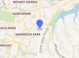
Shamrock Park is an eastern suburb of the city of Auckland, New Zealand. The area is bounded on the northwest by Chapel Road, on the northeast by Whitford Road, and on the east by Mangemangeroa Creek.
Shamrock Park | |
|---|---|
Suburb | |
| |
| Country | New Zealand |
| Local authority | Auckland Council |
| Electoral ward | Howick Ward |
| Local board | Howick Local Board |
| Population (2018)[1] | |
| • Total | 2,532 |
| Northpark | Somerville | |
| Northpark |
|
Whitford |
| Dannemora | East Tāmaki Heights |
The earliest houses date from the 1890s, but most of the houses were built in the 1990s.[2] In 1998, the major streets were defined, but the land to the south was rural.[3]
Demographics
| Year | Pop. | ±% p.a. |
|---|---|---|
| 2006 | 2,049 | — |
| 2013 | 2,100 | +0.35% |
| 2018 | 2,532 | +3.81% |
| Source: [1] | ||
The statistical area of Botany North, which corresponds to Shamrock Park, had a population of 2,532 at the 2018 New Zealand census, an increase of 432 people (20.6%) since the 2013 census, and an increase of 483 people (23.6%) since the 2006 census. There were 777 households. There were 1,200 males and 1,332 females, giving a sex ratio of 0.9 males per female. The median age was 49.1 years, with 390 people (15.4%) aged under 15 years, 405 (16.0%) aged 15 to 29, 987 (39.0%) aged 30 to 64, and 753 (29.7%) aged 65 or older.
Ethnicities were 50.1% European/Pākehā, 2.6% Māori, 2.3% Pacific peoples, 47.5% Asian, and 2.7% other ethnicities (totals add to more than 100% since people could identify with multiple ethnicities).
The proportion of people born overseas was 50.8%, compared with 27.1% nationally.
Although some people objected to giving their religion, 42.5% had no religion, 38.2% were Christian, 5.5% were Hindu, 2.0% were Muslim, 3.2% were Buddhist and 2.5% had other religions.
Of those at least 15 years old, 612 (28.6%) people had a bachelor or higher degree, and 357 (16.7%) people had no formal qualifications. The median income was $28,200. The employment status of those at least 15 was that 798 (37.3%) people were employed full-time, 228 (10.6%) were part-time, and 45 (2.1%) were unemployed.[1]
Education
Point View School is a coeducational contributing primary school (years 1–6) with a roll of 692 as of March 2020.[4][5] The school opened in 1997.[6]
References
- "Statistical area 1 dataset for 2018 Census". Statistics New Zealand. March 2020. Botany North (154700). 2018 Census place summary: Botany North
- "Shamrock Park, Manukau City". One Roof. Retrieved 8 September 2020.
- Auckland (Map). 1:50000. NZMS260. LINZ / Lands and Survey. 1998. § R11.
- "New Zealand Schools Directory". New Zealand Ministry of Education. Retrieved 26 April 2020.
- Education Counts: Point View School
- "About Us". Point View School. Retrieved 8 September 2020.
