Shawnee State Park (Ohio)
Shawnee State Park is a 1,095-acre (443 ha) public recreation area surrounded by the 63,000-acre (25,000 ha) Shawnee State Forest in Scioto County, Ohio, United States. The park is in the foothills of the Appalachian Mountains near the Ohio River in Southern Ohio on State Route 125, just north of Friendship.[2]
| Shawnee State Park | |
|---|---|
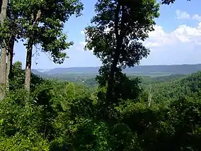 View from Picnic Point | |
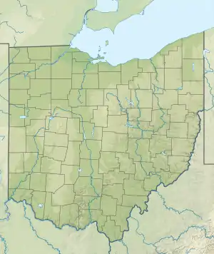 Shawnee State Park Location in Ohio | |
| Location | Scioto County, Ohio, United States |
| Nearest city | Portsmouth, Ohio |
| Coordinates | 38°44′05″N 83°11′54″W[1] |
| Area | 1,095 acres (443 ha) |
| Elevation | 892 feet (272 m)[1] |
| Established | 1922 |
| Administered by | Ohio Department of Natural Resources |
| Designation | Ohio state park |
| Website | Shawnee State Park |
History
The area was once a hunting ground for the Shawnee Indians. The park was first opened in 1922 as Theodore Roosevelt State Game Preserve. The game preserve saw further development and improvements by the Civilian Conservation Corps in the 1930s. The area became a state park and forest following creation of the Ohio Department of Natural Resources and the Division of Parks and Recreation in 1949.[2]
Activities and amenities
The park's recreational activities include golf, fishing, swimming, hiking, and boating on Roosevelt Lake and Turkey Creek Lake. The state park marina on the Ohio River is located on US 52 just west of Friendship.[2] The park's golf course was closed in 2019.[3]
Gallery
 Marina Entrance Sign (with U.S. 52 in the background)
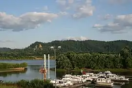 A view of the marina and the Ohio River from the park's parking lot
 Back porch rockers at the park lodge
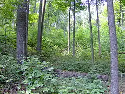 View of second growth forest from a hiking trail in the park
References
- "Shawnee State Park". Geographic Names Information System. United States Geological Survey.
- "Shawnee State Park". Ohio Department of Natural Resources. Retrieved October 31, 2020.
- Potter, Ivy (August 22, 2019). "ODNR states decision to close golf course is definite". Portsmouth Daily Times. Retrieved October 31, 2020.
External links
| Wikimedia Commons has media related to Shawnee State Park. |
- Shawnee State Park Ohio Department of Natural Resources
- Shawnee State Park Map Ohio Department of Natural Resources