Shibata, Miyagi
Shibata (柴田町, Shibata-machi) is a town located in Miyagi Prefecture, Japan. As of 31 March 2020, the town had an estimated population of 37,617, and a population density of 700 persons per km² in 15,590 households.[1] The total area of the town is 54.03 square kilometres (20.86 sq mi).
Shibata
柴田町 | |
|---|---|
Town | |
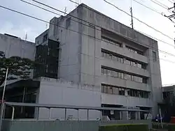 Shibata Town Office | |
 Flag  Seal | |
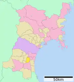 Location of Shibata in Miyagi Prefecture | |
 Shibata | |
| Coordinates: 38°03′23.7″N 140°45′57.0″E | |
| Country | Japan |
| Region | Tōhoku |
| Prefecture | Miyagi |
| District | Shibata |
| Area | |
| • Total | 54.03 km2 (20.86 sq mi) |
| Population (May 31, 2020) | |
| • Total | 37,617 |
| • Density | 700/km2 (1,800/sq mi) |
| Time zone | UTC+9 (Japan Standard Time) |
| - Tree | Momi Fir |
| - Flower | Sakura |
| - Bird | Pheasant |
| Phone number | 0224-55-2111 |
| Address | 2-3-45 Funaoka-chuo, Shibata-machi, Shibata-gun, Miyagi-ken 989-1692 |
| Website | Official website |
Geography
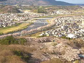
Shibata is located in south-central Miyagi Prefecture in the Tōhoku region of northern Japan. The Abukuma River runs through the town.
Climate
Shibata has a humid climate (Köppen climate classification Cfa) characterized by mild summers and cold winters. The average annual temperature in Shibata is 12.5 °C. The average annual rainfall is 1263 mm with September as the wettest month. The temperatures are highest on average in August, at around 24.9 °C, and lowest in January, at around 1.4 °C.[2]
Demographics
Per Japanese census data,[3] the population of Shibata has steadily increased over the past 40 years.
| Year | Pop. | ±% |
|---|---|---|
| 1920 | 11,096 | — |
| 1930 | 12,218 | +10.1% |
| 1940 | 14,386 | +17.7% |
| 1950 | 22,682 | +57.7% |
| 1960 | 23,515 | +3.7% |
| 1970 | 26,388 | +12.2% |
| 1980 | 32,106 | +21.7% |
| 1990 | 37,315 | +16.2% |
| 2000 | 39,485 | +5.8% |
| 2010 | 39,341 | −0.4% |
History
The area of present-day Shibata was part of ancient Mutsu Province, and was part of the holdings of Sendai Domain under the Edo period Tokugawa shogunate. The villages of Funaoka and Tsukinoki were established on April 1, 1889 with the establishment of the post-Meiji restoration modern municipalities system. Tsukioki was promoted to town status on April 1, 1904 and Funaoki on November 3, 1941. The two towns merged to form Shibata on April 1, 1956.
Government
Shibata has a mayor-council form of government with a directly elected mayor and a unicameral town council of 18 members. Shibata, together with the rest of Shibata District, collectively contributes two seats to the Miyagi Prefectural legislature. In terms of national politics, the town is part of Miyagi 3rd district of the lower house of the Diet of Japan.
Economy
The economy of Shibata is largely based on agriculture.
Education
- Sendai University
- Shibata has six public elementary schools and three public middle schools operated by the town government, and one public high school operated by the Miyagi Prefectural Board of Education. The prefecture also operates one special education school for the handicapped.
Local attractions
- Site of Funaoka Castle
Sister city relations
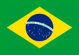 Brazil – Assis Chateaubriand (Paraná), Brazil[4] since April 13, 1981
 China – Danyang, Jiangsu, China,[4] since February 23, 1994
 Japan - Kitakami, Iwate, Japan, since January 25, 1980
- Japan - Date, Hokkaido, Japan, since May 30, 1988 (friendship city)
References
- Shibata town official statistics (in Japanese)
- Shibata climate data
- Shibata population statistics
- "International Exchange". List of Affiliation Partners within Prefectures. Council of Local Authorities for International Relations (CLAIR). Archived from the original on 22 December 2015. Retrieved 21 November 2015.
External links
![]() Media related to Shibata, Miyagi at Wikimedia Commons
Media related to Shibata, Miyagi at Wikimedia Commons
- Official Website (in Japanese)
| Sendai |
| ||
|---|---|---|---|
| Cities | |||
| Districts | |||
| Authority control |
|---|