Shirin Tagab River
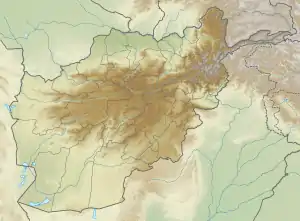
The Shirin Tagab River is a river in Afghanistan, and travels 320 kilometres (200 mi) before ending in an inland delta around Andkhoi.[1] The river's watershed has 504 settlements with a population of 605972, and covers the majority of Faryab Province.[2] Downstream, the river is brackish/saltwater. In addition, the river is a source of water-borne diseases.
| Shirin Tagab | |
|---|---|
 Mouth location | |
| Location | |
| Country | Afghanistan |
| Province | Faryab |
| Physical characteristics | |
| Source | Runoff |
| • location | Eastern Bilchiragh District |
| • coordinates | 35.93°N 65.65°E |
| • elevation | 1,800 m (5,900 ft) |
| Mouth | Inland Delta |
• location | Area surrounding Andkhoy |
• coordinates | 36°57′N 65°07′E |
• elevation | 300 m (980 ft) |
| Length | 320 km (200 mi) |
| Basin size | 13,600 km2 (5,300 sq mi) |
| Discharge | |
| • location | Khisht Pu |
| • average | 4,450 l/s (157 cu ft/s) |
| Discharge | |
| • location | Dawlatabad |
| • average | 2,340 l/s (83 cu ft/s) |
| Discharge | |
| • location | Pata Baba (371 m) |
| • average | 3,980 l/s (141 cu ft/s) |
| Basin features | |
| Tributaries | |
| • left | Chashma-i Khwab, Shor Darya |
| • right | Astana |
Course
The river begins flowing west in the eastern part of Bilchiragh District, and is joined by the river Chashma-i Khwab near the district center, after the Chashma has flowed through scenic rapids.[2] The Tagab then turns north, flowing through the northeast corner of Pashtun Kot District and western Khwaja Sabz Posh District. As it enters Shirin Tagab District, the river is joined by the Astana river. At Araba, an irrigation canal takes the majority of the river's water. Then, near Pata Baba in Dawlat Abad District, it is joined by the Shor Darya River, which carries the water from the Almar, Qaysar, and Maimana rivers. The Shirin Tagab then dissipates around the city of Andkhoy, on the edge of the Dasht-i Shortepa.[1][3]
The river used to run to the Amu Darya before the development of irrigation and the diversion of water.[2]
Economy
Most of the river's water is used for irrigation. Sometimes, the large amount of water being diverted leaves the natural waterway nearly dry; little water reaches Andkhoy in the summer months.[1]
About 1,000 square kilometres (390 sq mi) of its watershed is cultivated, and another 6,000 serving as rangeland.[2]
References
- "A Hydrogeological Atlas of Faryab Province, Northern Afghanistan" (PDF). norplan.af. 2014. Retrieved 24 July 2020.
- "Description of Watersheds Part IV" (PDF). aizon.org. Retrieved 26 July 2020.
- Mohamad hassan Saffi (June 2010). "Integrated Groundwater Study in Jalaier Valley, Shirin Tagab District of Faryab Province, Afghanistan". researchgate.net. Retrieved 25 July 2020.
External links
- Astana River Valley Study
- Streamflow Characteristics at Streamgages in Northern Afghanistan and Selected Locations
- Map of Watersheds in Afghanistan
| Districts | 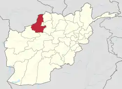 | |
|---|---|---|
| Populated places | ||
| Other | ||