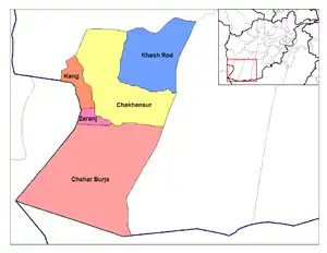
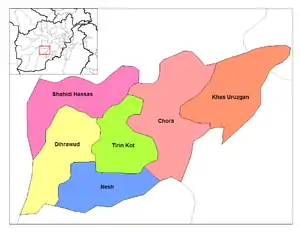
Districts of Afghanistan
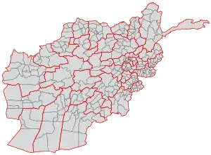
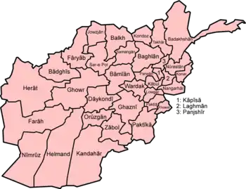
This is a list of districts of Afghanistan, known as wuleswali (Pashto: ولسوالۍ, wuləswāləi; Persian: شهرستان, shahrestān). These are secondary level administrative units, one level below the provinces. The Afghan government issued its first district map in 1973.[1][2] It recognized 325 districts, counting wuleswalis (districts), alaqadaries (sub-districts), and markaz-e-wulaiyat (provincial center districts).[2] In the ensuing years additional districts have been added through splits, and a few eliminated through mergers. In June 2005, the Afghan government issued a map of 398 districts.[3] It was widely adopted as by many information management systems, though usually with the addition of Sharak-e-Hayratan for a 399 district total. Here is a link to a clean rendering of the 399 district set as a spreadsheet from an official Afghan source.[4] It remains the de facto standard, as of late 2018, despite a string of government announcements of the creation of new districts.
 |
|---|
| This article is part of a series on the politics and government of Afghanistan |
|
|
The latest set includes 421 districts. "Almost unnoticed,the country’s Central Statistics Office (CSO) and the Independent Directorate of Local Governance (IDLG) have come up with a joint, consolidated list of how many districts Afghanistan has. It has handed this list over to the Independent Election Commission (IEC) that has used it in preparing the elections. The number is: 387. [Or 387 "districts" and 34 "provincial center districts" for 421 districts in total].[5] Here is an external link to a spreadsheet of some of the more recent generations of district sets.[6]
The list below includes districts with links to other Wikipedia pages. It doesn't correspond with any particular district set. It lacks a number of districts currently recognized by the Afghan government, and lacks some others that are popularly but not officially recognized.
Northern Afghanistan
Badakhshan Province
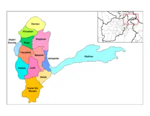
- Arghanj Khwa - formerly part of Fayzabad District
- Argo - formerly part of Fayzabad District
- Baharak
- Darayim - formerly part of Fayzabad District
- Fayzabad
- Ishkashim
- Jurm
- Khash - formerly part of Jurm District
- Khwahan
- Kishim
- Kohistan - formerly part of Baharak District
- Kuf Ab - formerly part of Khwahan District
- Kuran Wa Munjan
- Maimay -formerly part of Darwaz District
- Nusay - formerly part of Darwaz District
- Ragh
- Shahri Buzurg
- Shekay - formerly part of Darwaz District
- Shighnan
- Shuhada - formerly part of Baharak District
- Tagab - formerly part of Fayzabad District
- Tishkan - formerly part of Kishim District
- Wakhan
- Wurduj - formerly part of Baharak District
- Yaftali Sufla - formerly part of Fayzabad District
- Yamgan - formerly part of Baharak District
- Yawan - formerly part of Ragh District
- Zebak
Baghlan Province
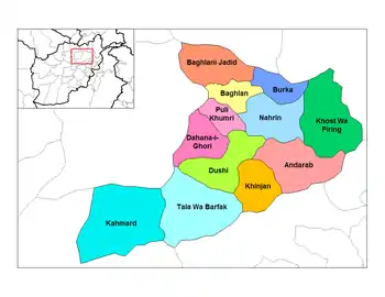
- Andarab
- Baghlan - now part of Baghlani Jadid District
- Baghlani Jadid
- Burka
- Dahana i Ghuri
- Dih Salah - formerly part of Andarab District
- Dushi
- Farang wa Gharu - formerly part of Khost Wa Fereng District
- Guzargahi Nur - formerly part of Khost Wa Fereng District
- Khinjan
- Khost wa Fereng
- Khwaja Hijran - formerly part of Andarab District
- Nahrin
- Puli Hisar - formerly part of Andarab District
- Puli Khumri
- Tala Wa Barfak
Kunduz Province
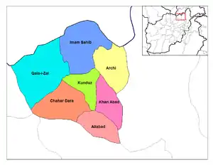
Takhar Province
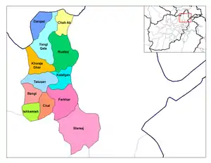
- Baharak - formerly part of Taluqan District
- Bangi
- Chah Ab
- Chal
- Darqad
- Dashti Qala - formerly part of Khwaja Ghar District
- Farkhar
- Hazar Sumuch - formerly part of Taluqan District
- Ishkamish
- Kalafgan
- Khwaja Bahauddin - formerly part of Yangi Qala District
- Khwaja Ghar
- Namak Ab - formerly part of Taluqan District
- Rustaq
- Taluqan
- Warsaj
- Yangi Qala
Balkh Province
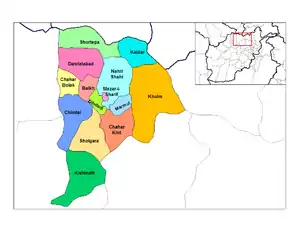
- Balkh
- Chahar Bolak
- Chahar Kint
- Chimtal
- Dawlatabad
- Dihdadi
- Kaldar
- Khulmi
- Kishindih
- Marmul
- Mazar-e Sharif
- Nahri Shahi
- Sholgara
- Shortepa
- Zari - formerly part of Kishindih District
Faryab Province
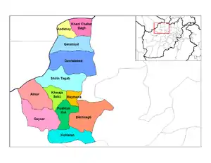
- Almar
- Andkhoy
- Bilchiragh
- Dawlat Abad
- Gurziwan - formerly part of Bilchiragh District
- Khani Chahar Bagh
- Khwaja Sabz Posh
- Kohistan
- Maymana
- Pashtun Kot
- Qaramqol
- Qaysar
- Qurghan - formerly part of Andkhoy District
- Shirin Tagab
Jowzjan Province
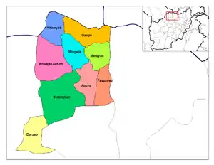
Samangan Province
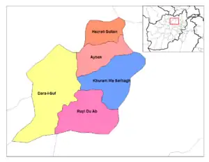
- Aybak
- Dara-I-Sufi Balla - part of the former Dara-I-Suf District
- Dara-I-Sufi Payan - part of the former Dara-I-Suf District
- Feroz Nakhchir - formerly part of Khulmi District; shifted from Balkh Province
- Hazrati Sultan
- Khuram Wa Sarbagh
- Ruyi Du Ab
Sar-e Pol Province
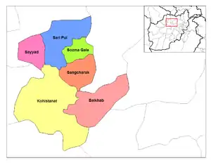
- Balkhab
- Gosfandi - formerly part of Sayyad District
- Kohistanat
- Sangcharak
- Sar-e Pul
- Sayyad
- Sozma Qala
Central Afghanistan
Bamyan Province
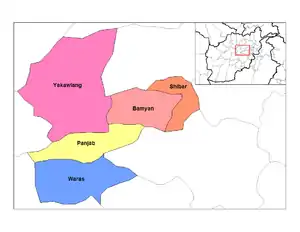
Kabul Province
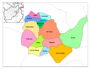
- Bagrami
- Chahar Asyab
- Deh Sabz
- Farza - formerly part of Mir Bacha Kot District
- Guldara
- Istalif
- Kabul
- Kalakan
- Khaki Jabbar
- Mir Bacha Kot
- Mussahi
- Paghman
- Qarabagh
- Shakardara
- Surobi
Kapisa Province
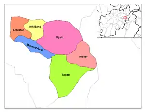
- Alasay
- Hesa Awal Kohistan - part of the former Kohistan District
- Hesa Duwum Kohistan - part of the former Kohistan District
- Koh Band
- Mahmud Raqi
- Nijrab
- Tagab
Logar Province
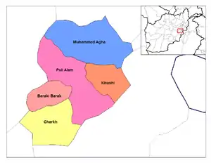
- Azra - shifted from Paktia Province
- Baraki Barak
- Charkh
- Kharwar - formerly part of Charkh District
- Khoshi
- Mohammad Agha
- Puli Alam
Panjshir Province
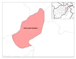
- Anaba - part of the former Panjsher District
- Bazarak - part of the former Panjsher District
- Darah - part of the former Hisa Duwum Panjsher District
- Khenj - part of the former Hisa Awal Panjsher District
- Paryan - part of the former Hisa Awal Panjsher District
- Rokha - created from parts of the former Hisa Duwum Panjsher and Panjsher Districts
- Shotul - part of the former Panjsher District
Parwan Province
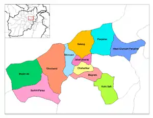
- Bagram
- Chaharikar
- Ghorband
- Jabal Saraj
- Kohi Safi
- Salang
- Sayed Khel - formerly part of Jabul Saraj District
- Shekh Ali
- Shinwari
- Surkhi Parsa
Wardak Province
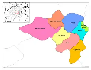
- Chaki
- Day Mirdad
- Hisa-I-Awali Bihsud
- Jaghatu - shifted from Ghazni Province
- Jalrez
- Markazi Bihsud
- Maydan Shahr
- Nirkh
- Saydabad
Kunar Province
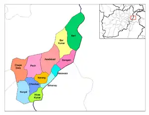
- Asadabad
- Bar Kunar
- Chapa Dara
- Chawkay
- Dangam
- Dara-I-Pech
- Ghaziabad - formerly part of Nurgal District
- Khas Kunar
- Marawara
- Narang Wa Badil
- Nari
- Nurgal
- Shaygal Wa Shiltan - formerly part of Chapa Dara District
- Sirkanay
- Wata Pur - formerly part of Asadabad District
- Shultan - formerly part of Shaygl District
Laghman Province
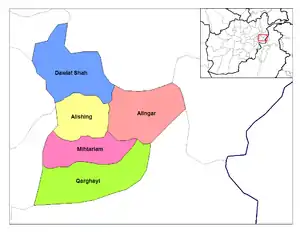
Nangarhar Province
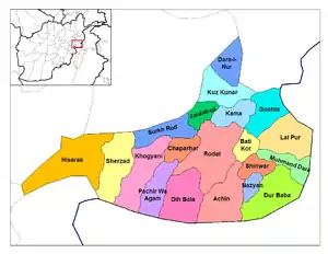
Nuristan Province
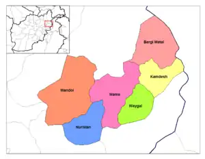
Badghis Province
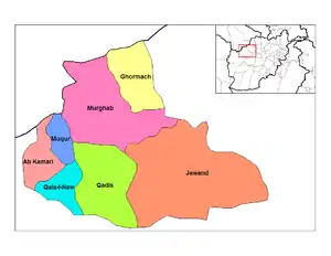
Farah Province
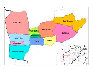
Ghor Province
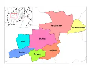
- Chaghcharan (Ferozkoh)
- Marghab District - formerly part of ferozkoh.
- Charsada
- Dawlat Yar
- Du Layna District
- Lal Wa Sarjangal
- Pasaband
- Saghar
- Shahrak
- Taywara
- Tulak
Herat Province
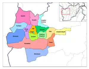
Southern Afghanistan
Ghazni Province
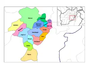
- Ab Band
- Ajristan
- Andar
- Dih Yak
- Gelan
- Ghazni City
- Giro
- Jaghatū District
- Jaghuri
- Khugiani - created from parts of Waeez Shahid and Ghazni Districts
- Khwaja Umari - formerly part of Waeez Shahid District
- Malistan
- Muqur
- Nawa
- Nawur
- Qarabagh
- Rashidan - formerly part of Waeez Shahid District
- Waghaz - formerly part of Muqur District
- Zana Khan
Khost Province
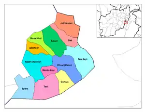
- Bak
- Gurbuz
- Jaji Maydan
- Khost (Matun)
- Mandozai
- Musa Khel
- Nadir Shah Kot
- Qalandar
- Sabari
- Shamal - shifted from Paktia Province
- Spera
- Tani
- Tere Zayi
Paktia Province
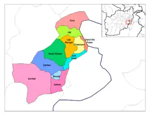
Paktika Province
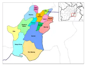
Daykundi Province
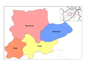
- Ishtarlay - part of the former Daykundi District; shifted from Uruzgan Province
- Kajran - shifted from Uruzgan Province
- Khadir - part of the former Daykundi District; shifted from Uruzgan Province
- Kiti - formerly part of Kajran District; shifted from Uruzgan Province
- Miramor - formerly part of Sharistan District; shifted from Uruzgan Province
- Nili - part of the former Daykundi District; shifted from Uruzgan Province
- Sangtakht - part of the former Daykundi District; shifted from Uruzgan Province
- Shahristan - shifted from Uruzgan Province
Helmand Province
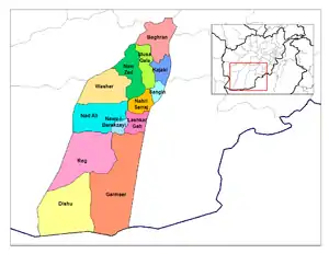
Kandahar Province
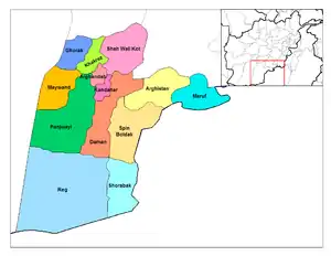
Zabul Province
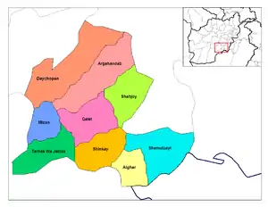
- Argahandab
- Atghar
- Daychopan
- Kakar - formerly part of Argahandab District
- Mezana
- Naw Bahar - created from parts of Shamulzuyi and Shinkay Districts in Zabul Province .
- Qalat (technically only a municipality, not a district)
- Shah Joy
- Shamulzayi
- Shinkay
- Tarnak Wa Jaldak
References
- Minor Civil Divisions Map 1:1,000,000 scale Afghan Demographic Studies, Ministry of Planning, Ashraf et al., 1973
- Afghanistan; Districts and Codes by Province, Edition 2.0, AID / Rep. DC&A Mapping Unit, October 1991, Peshawar, Pakistan
- Empirical Studies of Conflict program, Princeton University. "Administrative Boundaries : 398 Districts". Retrieved February 24, 2019.
- "District names in English and Dari, latitude/longitude centerpoint for each of the 399 district-level entities recognized by the Afghanistan government. It is based on data provided by the Afghanistan Geodesic and Cartographic Head Office (AGCHO) in August 2010. It was formatted and posted by Princeton University's Empirical Studies of Conflict site". August 2010. Retrieved February 2, 2019.
- Ruttig, Thomas. "Good news and bad news about district numbers". Afghanistan Analysts Network. Retrieved February 23, 2019.
- Spreadsheet listing of the 399, 407, 419 and 421 district sets. "Afghanistan District Maps; Lookup Tool tab". Retrieved February 24, 2019.CS1 maint: multiple names: authors list (link)
External links
- Afghanistan Information Management Service, accessed 2006-07-27. [The link is broken. AIMS is defunct.]
- AIMS District Matching, accessed 2009-01-01. [The link is broken. AIMS is defunct.]
- Afghanistan District Maps, their history and application to population and control mapping. Accessed 2019-02-14.
