Sidlow
Sidlow is a mainly rural, lightly populated village in the parish of Salfords and Sidlow, in the south of the borough of Reigate and Banstead in Surrey, England.
| Sidlow | |
|---|---|
| Village | |
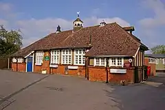 Sidlow Bridge Centre | |
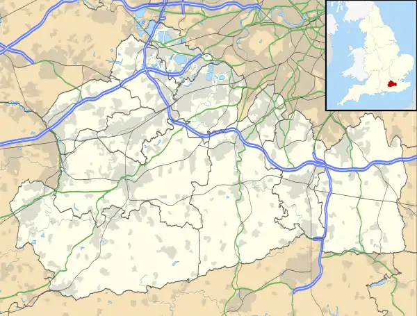 Sidlow Location within Surrey | |
| Area | 11.93 km2 (4.61 sq mi) |
| Population | 636 (2011 census)[1] |
| • Density | 53/km2 (140/sq mi) |
| OS grid reference | TQ259470 |
| Civil parish | |
| District | |
| Shire county | |
| Region | |
| Country | England |
| Sovereign state | United Kingdom |
| Post town | REIGATE |
| Postcode district | RH2 |
| Dialling code | 01737 |
| Police | Surrey |
| Fire | Surrey |
| Ambulance | South East Coast |
| UK Parliament | |
Amenities
Sidlow has a Church of England church: Emmanuel, Sidlow Bridge dating to 1861 (designed by architect Henry Clutton) which is in the medieval-founded Diocese of Southwark and a listed building pub, the Three Horseshoes Inn. Other than residential, goods distribution, timber-related industry and agricultural uses, the village has the Sidlow Bridge Centre, a pupil referral unit one of several such units which takes its admissions from schools of Surrey County Council and those independent of the local authority.[2][3]
Geography and sublocalities
Sidlow is the west of the civil parish; a high proportion of its land is taken up by farms; no motorways or railways bisect this part of the parish instead the area has three small tributaries' end points (confluences) into the upper River Mole. Urban to suburban development is residential and concentred into a linear settlement along a lane west of a road junction with the north-south A217 road which has the Anglican church opposite. Beyond this the road forms a crescent which briefly becomes urban again at the Ironsbottom neighbourhood, a sub-settlement. Two lines of further development are towards the crescent return of the lane named Ironsbottom at Wrays and south along the A217 at Crutchfield. The A217 direct, traffic light-controlled route between the economic centres of Reigate and Gatwick Airport is bypassed for long-distance traffic by the M23 motorway 3 miles (4.8 km) east. Less than 5% of the land of Sidlow is at flood risk, in built terms, restricted to homes opposite the church of Sidlow Bridge and the church itself.[4]
References
- Key Statistics: Population Density: Population and Area. Output Areas E00156202 and E00156205: 307 in 6.78 square km and 329 in 5.15, includes a small part ecclesiastically of Salfords an eastern area however associated with Sidlow and with Salfords physically and administratively. Retrieved 2015-02-27.
- "Sidlow. The Church of England. Accessed 2015-04-18". Archived from the original on 18 April 2015. Retrieved 18 April 2015.
- Sidlow Bridge Centre
- Flood Risk Map of surrounding areas of 'Sidlow' - showing Riparian risk levels Archived 2015-04-18 at the Wayback Machine Environment Agency. Accessed 2015-04-15.
External links
| Wikimedia Commons has media related to Sidlow. |
Neighbouring areas of Surrey | |
|---|---|
| Towns, villages, neighbourhoods and hamlets |
|  | ||||||||||||||
|---|---|---|---|---|---|---|---|---|---|---|---|---|---|---|---|---|
| Most notable parks | ||||||||||||||||
| Places of worship | ||||||||||||||||
| Education | ||||||||||||||||
| Transport |
| |||||||||||||||
| Buildings and structures | ||||||||||||||||
| Sport | ||||||||||||||||
| Politics and Administration | ||||||||||||||||
Places listed are articles notable as settlements, arranged by post town The two principal towns are emboldened The M23 motorway follows approximately a boundary and is chiefly included for its regional importance. | ||||||||||||||||