Simmerath
Simmerath is a municipality in the district of Aachen, in North Rhine-Westphalia, Germany. It is located approximately 20 km south-east of Aachen, near the border to Belgium.
Simmerath | |
|---|---|
 Coat of arms | |
Location of Simmerath within Aachen district 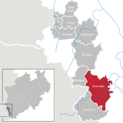 | |
 Simmerath 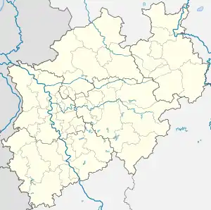 Simmerath | |
| Coordinates: 50°36′25″N 6°18′00″E | |
| Country | Germany |
| State | North Rhine-Westphalia |
| Admin. region | Köln |
| District | Aachen |
| Subdivisions | 17 |
| Government | |
| • Mayor | Karl-Heinz Hermanns (CDU) |
| Area | |
| • Total | 111.430 km2 (43.023 sq mi) |
| Highest elevation | 560 m (1,840 ft) |
| Lowest elevation | 280 m (920 ft) |
| Population (2019-12-31)[1] | |
| • Total | 15,404 |
| • Density | 140/km2 (360/sq mi) |
| Time zone | UTC+01:00 (CET) |
| • Summer (DST) | UTC+02:00 (CEST) |
| Postal codes | 52152 |
| Dialling codes | 02473 |
| Vehicle registration | AC, MON |
| Website | www.simmerath.de |
The administrative area was expanded in 1972 and includes the following localities:
- Dedenborn
- Eicherscheid
- Einruhr
- Erkensruhr
- Hammer
- Hirschrott
- Huppenbroich
- Kesternich
- Lammersdorf
- Paustenbach
- Rollesbroich
- Rurberg
- Simmerath
- Steckenborn
- Strauch
- Witzerath
- Woffelsbach
Gallery
 Simmerath: the parish church
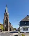 Lammersdorf, catholic church in the street
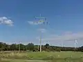 near Lammersdorf, panorama with transmission tower and modern windmills
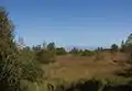 near Lammersdorf, panorama
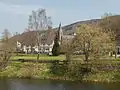 Einruhr, church of St. Nicholas in the village
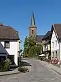 Einruhr, church of St Nicholas
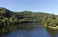 near Einruhr, river Rur
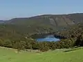 between Einruhr and Kesternich, the Eiserbachtal(de)
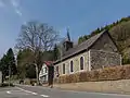 Hammer, quarry-stone church
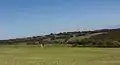 between Kesternich and Einruhr, panorama
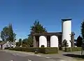 Paustenbach, view of a street
References
- "Bevölkerung der Gemeinden Nordrhein-Westfalens am 31. Dezember 2019" (in German). Landesbetrieb Information und Technik NRW. Retrieved 17 June 2020.
Towns and municipalities in Aachen (district) | ||
|---|---|---|
Coat of Arms of Aachen district | ||
| Authority control |
|---|
This article is issued from Wikipedia. The text is licensed under Creative Commons - Attribution - Sharealike. Additional terms may apply for the media files.
