Snaith and Cowick
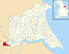
Snaith and Cowick is a civil parish in the East Riding of Yorkshire, England. It is situated approximately 6 miles (9.7 km) west of the town of Goole and covers an area of 2,406.612 hectares (5,946.87 acres).[2]
| Snaith and Cowick | |
|---|---|
 Wesleyan Methodist Chapel in Snaith | |
 | |
| Population | 3,579 (2011 Census)[1] |
| OS grid reference | SE640220 |
| Civil parish |
|
| Unitary authority | |
| Ceremonial county | |
| Region | |
| Country | England |
| Sovereign state | United Kingdom |
| Post town | GOOLE |
| Postcode district | DN14 |
| Dialling code | 01405 |
| Police | Humberside |
| Fire | Humberside |
| Ambulance | Yorkshire |
| UK Parliament | |
The civil parish is formed by the town of Snaith and the villages of East Cowick and West Cowick. According to the 2011 UK census, Snaith and Cowick had a population of 3,579,[1] an increase on the 2001 UK census figure of 3,028.[3]
The parish was part of the Goole Rural District in the West Riding of Yorkshire from 1894 to 1974, then in Boothferry district of Humberside until 1996.[4]
References
- UK Census (2011). "Local Area Report – Snaith and Cowick Parish (1170211263)". Nomis. Office for National Statistics. Retrieved 25 February 2018.
- "2001 Census Area Profile" (PDF). East Riding of Yorkshire Council. 2004. Archived (PDF) from the original on 18 March 2012. Retrieved 8 February 2013.
- UK Census (2001). "Local Area Report – Snaith and Cowick Parish (1543504305)". Nomis. Office for National Statistics. Retrieved 18 February 2019.
- "History of Snaith, in East Riding of Yorkshire and West Riding | Map and description". www.visionofbritain.org.uk. Retrieved 25 November 2020.
- Gazetteer — A–Z of Towns Villages and Hamlets. East Riding of Yorkshire Council. 2006. pp. 4, 10.
This article is issued from Wikipedia. The text is licensed under Creative Commons - Attribution - Sharealike. Additional terms may apply for the media files.
