So Phisai District
So Phisai (Thai: โซ่พิสัย, pronounced [sôː pʰí.sǎj]) is a district (amphoe) of Bueng Kan Province, northeastern Thailand.
So Phisai
โซ่พิสัย | |
|---|---|
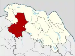 District location in Bueng Kan Province | |
| Coordinates: 18°4′42″N 103°26′36″E | |
| Country | Thailand |
| Province | Bueng Kan |
| Seat | So |
| Tambons | 7 |
| Mubans | 89 |
| District established | 1972 |
| Area | |
| • Total | 985.262 km2 (380.412 sq mi) |
| Population (2010) | |
| • Total | 69,450 |
| • Density | 68.6/km2 (178/sq mi) |
| Time zone | UTC+7 (ICT) |
| Postal code | 38170 |
| Geocode | 3803 |
History
The minor district (king amphoe) So Phisai was established on 1 March 1972, when the three tambons So, Si Chomphu, and Nong Phan Tha were split off from Phon Phisai District.[1] It was upgraded to a full district on 13 April 1977.[2]
Geography
Neighboring districts are (from the west clockwise): Fao Rai and Rattanawapi of Nong Khai Province; Pak Khat, Mueang Bueng Kan, and Phon Charoen of Bueng Kan Province; and Ban Muang of Sakon Nakhon Province.
Administration
The district is divided into seven sub-districts (tambons), which are further subdivided into 89 villages (mubans). So Phisai is a sub-district municipality (thesaban tambon) which covers parts of tambon So. There are a further seven tambon administrative organizations (TAO).
| No. | Name | Villages | Thai | Pop.[3] |
|---|---|---|---|---|
| 1. | So | โซ่ | 17 | 16,589 |
| 2. | Nong Phan Tha | หนองพันทา | 11 | 8,659 |
| 3. | Si Chomphu | ศรีชมภู | 15 | 12,165 |
| 4. | Kham Kaeo | คำแก้ว | 13 | 9,576 |
| 5. | Bua Tum | บัวตูม | 13 | 9,383 |
| 6. | Tham Charoen | ถ้ำเจริญ | 11 | 7,757 |
| 7. | Lao Thong | เหล่าทอง | 9 | 5,321 |
References
- ประกาศกระทรวงมหาดไทย เรื่อง แบ่งท้องที่อำเภอโพนพิสัย จังหวัดหนองคาย ตั้งเป็นกิ่งอำเภอโซ่พิสัย (PDF). Royal Gazette (in Thai). 89 (31 ง special): 9. March 1, 1972.
- พระราชกฤษฎีกาตั้งอำเภอปลายพระยา อำเภอห้วยเม็ก อำเภอละแม อำเภอแม่จริม อำเภอหนองกี่ อำเภอโคกปีบ อำเภอเกาะพะงัน อำเภอสนม อำเภอโซ่พิสัย อำเภอโนนสะอาด และอำเภอนาจะหลวย พ.ศ. ๒๕๒๐ (PDF). Royal Gazette (in Thai). 98 (31 ก): 326–330. April 12, 1977.
- "Population statistics 2010". Department of Provincial Administration. Archived from the original on 2011-09-10.
