Soni, Nara
Soni (曽爾村, Soni-mura) is a village located in Uda District, Nara Prefecture, Japan.
Soni
曽爾村 | |||||||||||||
|---|---|---|---|---|---|---|---|---|---|---|---|---|---|
village | |||||||||||||
 Flag  Seal | |||||||||||||
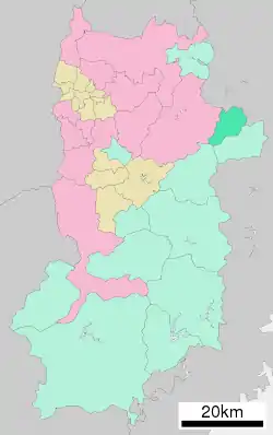 Location of Soni in Nara Prefecture | |||||||||||||
 Soni Location in Japan | |||||||||||||
| Coordinates: 34°31′N 136°7′E | |||||||||||||
| Country | Japan | ||||||||||||
| Region | Kansai | ||||||||||||
| Prefecture | Nara Prefecture | ||||||||||||
| District | Uda | ||||||||||||
| Government | |||||||||||||
| • Mayor | Yoshinori Uyama | ||||||||||||
| Area | |||||||||||||
| • Total | 47.84 km2 (18.47 sq mi) | ||||||||||||
| Population (April 1, 2017) | |||||||||||||
| • Total | 1,528 | ||||||||||||
| • Density | 32/km2 (83/sq mi) | ||||||||||||
| Time zone | UTC+09:00 (JST) | ||||||||||||
| City hall address | 495-1 Ōaza Imai, Soni-mura, Uda-gun, Nara-ken 633-1212 | ||||||||||||
| Website | www | ||||||||||||
| |||||||||||||
As of April 2017, the village has an estimated population of 1,528[1] and a density of 32 persons per km2. The total area is 47.84 km2.
Geography
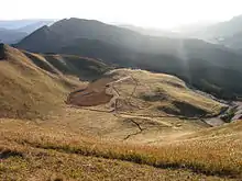
Soni Plateau of later fall
The village of Soni is located in the northeastern portion of Nara Prefecture, in Uda District. It is situated in a cool climate, and most dwellings are located near the valley. Many mountains, including the Byōbu-iwa, are close to the valley. Also, the Shōrenji River flows through the village.[2]
Surrounding municipalities
Notable locations
- Soni Plateau
- Koochi Valley
- Soni Plateau Hot Springs
- Byōbu-iwa
References
- "Official website of Soni Village" (in Japanese). Japan: Soni Village. Retrieved 25 April 2017.
- 2005.Kangaeru Shakaika Chizu.Tokyo:Yotsuya-Ōtsuka Publishing, p.36
External links
 Media related to Soni, Nara at Wikimedia Commons
- Soni village Official Site (in Japanese)
 Geographic data related to Soni, Nara at OpenStreetMap
| Core city | ||
|---|---|---|
| Cities | ||
| Districts | ||
| Authority control |
|---|
This article is issued from Wikipedia. The text is licensed under Creative Commons - Attribution - Sharealike. Additional terms may apply for the media files.