Sorell, Tasmania
Sorell is a town in Tasmania, Australia, north-east of Hobart. It is located on the Tasman Highway at the junction with the Arthur Highway. Sorell is one of Tasmania's oldest towns, being first settled in 1808 as a small farming community and becoming an official township in 1821.[2] At the 2006 census, Sorell had a population of 1,546,[3] and at the 2011 census, a population of 2,476.[1] and at the 2016 census, a population of 2,907.[4]
| Sorell Tasmania | |
|---|---|
 St George's Parish Hall containing the Tourist Information Centre - Gordon Street, Sorell | |
 Sorell | |
| Coordinates | 42°47′S 147°34′E |
| Population | 2,907 (2016 census)[1] |
| Established | 1808 |
| Postcode(s) | 7172 |
| Location |
|
| LGA(s) | Sorell Council |
| Region | Hobart |
| State electorate(s) | Lyons |
| Federal Division(s) | Lyons |
History
Sorell was named after William Sorell, the third Lieutenant-Governor of Van Diemen's Land. Historically, it was known as a major town on the route from Hobart to Port Arthur on the Tasman Peninsula. It was the centre of an agricultural area and an important market town. It is now a dormitory town of Hobart, as well as the seat of the Sorell Council.
In 1872 the Sorell Causeway was opened, from the Cambridge direction, across Pitt Water and Orielton Lagoon to Sorell, stopping at Midway Point in the middle. This shortened the route considerably from the original road via Richmond.
Sorell Post Office opened on 1 June 1832.[5]
There is also a mountain in the West Coast Range with the same name. Port Sorell is located on the mid north coast of Tasmania.
Heritage walks
There are a number of interesting heritage walks in Sorell and many old buildings from the colonial period have been preserved to the present day.[6] These include:
- The Barracks - Built 1827
- St Georges Church - Built in 1828 - Rebuilt 1884
- The old Post Office - Built 1840
- Pembroke Inn - Built in the 1840s
- Scots Uniting Church - Built 1842
- The Gordon Highlander Hotel - Opened 1844
- Police Magistrates House - Built 1848
- St Thomas Catholic Church - Built 1864
- Pelham House (Originally a Maternity hospital and Doctors Surgery) - Built 1864
- Sorell Antiques Centre (Originally a Library) - Built in 1861
- Railway House/Terminal - Railway opened 1892
The area also has a local historical society [7] as well as a Freemasons Lodge (Lodge Pembroke).[8]
Gallery
| Wikimedia Commons has media related to Sorell, Tasmania. |
 Sorell Causeway
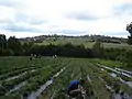 Berry farm near Sorell
 Aerial photo
References
- Australian Bureau of Statistics (31 October 2012). "Sorell (State Suburb)". 2011 Census QuickStats. Retrieved 7 January 2012.

- http://www.sorell.tas.gov.au/our-municipality/history-of-sorell/
- Australian Bureau of Statistics (25 October 2007). "Sorell (State Suburb)". 2006 Census QuickStats. Retrieved 23 November 2011.
- Australian Bureau of Statistics (27 June 2017). "Sorell (State Suburb)". 2016 Census QuickStats. Retrieved 24 December 2017.
- Premier Postal History. "Post Office List". Premier Postal Auctions. Retrieved 16 June 2012.
- http://www.sorell.tas.gov.au/download/publications_-_all/brochures/Sorell-Heritage-Walk-Brochure-2016-Web.pdf
- http://sorellhistory.org/
- https://www.facebook.com/masoniclodgepembroke/