City of Hobart
Hobart City Council (or City of Hobart) is a local government body in Tasmania, covering the central metropolitan area of the state capital, Hobart. The Hobart local government area has a population of 53,684[1] and includes the suburbs of West Hobart, Mount Stuart, South Hobart, New Town, Sandy Bay and most of Fern Tree, North Hobart and Mount Nelson .
| Hobart City Council Tasmania | |||||||||||||||
|---|---|---|---|---|---|---|---|---|---|---|---|---|---|---|---|
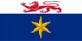 Flag of the City of Hobart | |||||||||||||||

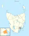
Map showing the Hobart local government area. | |||||||||||||||
| Coordinates | 42.8978°S 147.2877°E | ||||||||||||||
| Population | 53,684 (2018)[1] | ||||||||||||||
| • Density | 689.1/km2 (1,784.9/sq mi) | ||||||||||||||
| Established | 1 January 1852 | ||||||||||||||
| Area | 77.9 km2 (30.1 sq mi)[1] | ||||||||||||||
| Mayor | Anna Reynolds | ||||||||||||||
| Council seat | Hobart | ||||||||||||||
| Region | Central Hobart | ||||||||||||||
| State electorate(s) | Clark | ||||||||||||||
| Federal Division(s) | Clark | ||||||||||||||
| Website | Hobart City Council | ||||||||||||||
| |||||||||||||||
History and attributes
The present city council was created in 1852 by act of parliament, and the city mayor raised to Lord Mayor in 1934.[2][3]
Mount Wellington and the River Derwent are major features of the natural environment of the City of Hobart. 61% of the area is bushland.[4]
Government
The City of Hobart is governed by the Hobart City Council, consisting of twelve aldermen headed by the Lord Mayor of Hobart. The current Lord Mayor is Anna Reynolds, after winning the 2018 Council Election. Aldermen are elected every four years.
| Name | Position[6] | Party affiliation |
|---|---|---|
| Anna Reynolds | Lord Mayor/Councillor | Independent |
| Helen Burnet | Deputy Lord Mayor/Councillor | Tasmanian Greens |
| Simon Behrakis | Alderman | Independent |
| Jax Ewin | Councillor | Independent |
| Marti Zucco | Alderman | Independent |
| Will Coats | Councillor | Independent |
| Mike Dutta | Councillor | Independent |
| Bill Harvey | Councillor | Tasmanian Greens |
| Jeff Briscoe | Alderman | Independent |
| Peter Sexton | Alderman | Independent |
| Damon Thomas | Alderman | Independent |
| Zelinda Sherlock | Councillor | Independent |
Localities
Hobart suburbs
• Battery Point • Dynnyrne • Fern Tree • Glebe • Hobart city centre • Lenah Valley • Mount Nelson • Mount Stuart • New Town • North Hobart • Ridgeway • Sandy Bay • South Hobart • Tolmans Hill • West Hobart
Other localities
• Kingston • Neika • Queens Domain • Wellington Park • West Moonah
Economy
The Hobart City Council estimates that on weekdays "close to 50% of the population of Greater Hobart would be in the City for working, shopping, education, personal business or leisure purposes".[4]
Major industries by employment:[4]
- Health and Community Services 17%
- Retail Trade 13%
- Property and Business Services 12%
- Government Administration 12%
- Education 9%
The City has five major hospitals and fire, police, and emergency service headquarters.[4]
Demographics
Hobart is classified as an urban capital city (UCC) under the Australian Classification of Local Governments.[7]
| Selected historical census data for City of Hobart local government area | ||||||
|---|---|---|---|---|---|---|
| Census year | 2001[8] | 2006[9] | 2011[10] | 2016[11] | ||
| Population | Estimated residents on census night | 46,622 | 47,700 | 48,703 | 50,439 | |
| LGA rank in terms of size within Tasmania | 3rd | |||||
| % of Tasmania population | 10.25% | |||||
| % of Australian population | 0.25% | |||||
| Cultural and language diversity | ||||||
| Ancestry, top responses | English | 29.6% | ||||
| Australian | 26.6% | |||||
| Irish | 9.1% | |||||
| Scottish | 7.8% | |||||
| Chinese | 3.2% | |||||
| Language, top responses (other than English) | Mandarin | 0.7% | ||||
| Cantonese | 0.6% | |||||
| Italian | 1.0% | |||||
| Greek | 1.1% | |||||
| German | 0.5% | |||||
| Arabic | 0.8% | |||||
| Religious affiliation | ||||||
| Religious affiliation, top responses | Anglican | 25.8% | ||||
| No religion | 23.5% | |||||
| Catholic | 20.7% | |||||
| Uniting | 4.6% | |||||
| Presbyterian | 2.2% | |||||
| Buddhism | 1.9% | |||||
| Median weekly incomes | ||||||
| Personal income | Median weekly personal income | A$526 | A$641 | A$718 | ||
| % of Australian median income | 112.9% | 111.1% | 108.5% | |||
| Family income | Median weekly family income | A$1380 | A$1782 | A$2023 | ||
| % of Australian median income | 117.9% | 120.3% | 116.7% | |||
| Household income | Median weekly household income | A$1036 | A$1260 | A$1439 | ||
| % of Australian median income | 100.9% | 102.1% | 100.0% | |||
| Dwelling structure | ||||||
| Dwelling type | Separate house | 67.1% | ||||
| Semi-detached, terrace or townhouse | 9.3% | 10.6% | ||||
| Flat or apartment | 22.1% | |||||
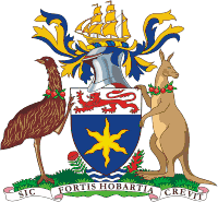
Coat of arms
See also
- List of local government areas of Tasmania
References
- "3218.0 – Regional Population Growth, Australia, 2017-18: Population Estimates by Local Government Area (ASGS 2018), 2017 to 2018". Australian Bureau of Statistics. Australian Bureau of Statistics. 27 March 2019. Retrieved 25 October 2019. Estimated resident population, 30 June 2018.
- "About Council". hobartcity.com.au. Hobart City Council. Archived from the original on 15 February 2015. Retrieved 1 February 2015.
- "Agency Details: Hobart City Council". search.archives.tas.gov.au. Tasmanian Government. Retrieved 11 June 2018.
- Draft City of Hobart Planning Scheme 2009 Archived 2009-10-20 at the Wayback Machine, Hobart City Council
- Sister Cities. City of Hobart (2006). Retrieved on 24 December 2006.
- "Alderman - Hobart City". hobartcity.com.au. Hobart City Council. Archived from the original on 23 January 2015. Retrieved 1 February 2015.
- "Local government national report 2014-2015". regional.gov.au. Australian Government. Retrieved 8 June 2018.
- Australian Bureau of Statistics (9 March 2006). "City of Hobart (C)". 2001 Census QuickStats. Retrieved 3 December 2017.
- Australian Bureau of Statistics (25 October 2007). "City of Hobart (C)". 2006 Census QuickStats. Retrieved 3 December 2017.
- Australian Bureau of Statistics (31 October 2012). "City of Hobart (C)". 2011 Census QuickStats. Retrieved 3 December 2017.

- Australian Bureau of Statistics (27 June 2017). "Hobart (C)". 2016 Census QuickStats. Retrieved 23 November 2017.
External links
- Hobart City Council official website
- Local Government Association Tasmania
- Tasmanian Electoral Commission - local government
