Souba
Souba is a village and rural commune in the Cercle of Ségou in the Ségou Region of southern-central Mali. The commune contains 24 villages in an area of approximately 1,104 square kilometers.[3] In the 2009 census it had a population of 17,961.[2] The village of Souba, the chef-lieu of the commune, sits on the left (north) bank of the Niger River.
- SoubaCommune and village
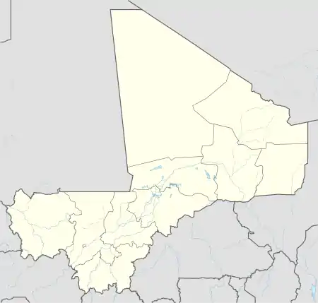
 SoubaLocation in Mali
Coordinates: 13°24′50″N 6°35′50″W Country  Mali
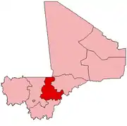
MaliRegion Ségou Region Cercle Ségou Cercle Area • Total 1,104 km2 (426 sq mi) Population (2009 census)[2]• Total 17,961 • Density 16/km2 (42/sq mi) Time zone UTC+0 (GMT)
References
- Common and Fundamental Operational Datasets Registry: Mali, United Nations Office for the Coordination of Humanitarian Affairs. commune_mali.zip (Originally from the Direction Nationale des Collectivités Territoriales, République du Mali)
- Resultats Provisoires RGPH 2009 (Région de Ségou) (PDF) (in French), République de Mali: Institut National de la Statistique.
- Communes de la Région de Ségou (PDF) (in French), Ministère de l’administration territoriale et des collectivités locales, République du Mali.
External links
- Plan de Sécurité Alimentaire Commune Rurale de Souba 2008-2012 (PDF) (in French), Commissariat à la Sécurité Alimentaire, République du Mali, USAID-Mali, 2008.
- Situation des points d'eau modernes au Mali en 2003: Souba (in French), Ministère des Mines, de l'Energie et de l'Eau, République du Mali, 2003.
This article is issued from Wikipedia. The text is licensed under Creative Commons - Attribution - Sharealike. Additional terms may apply for the media files.