South Cumberland State Park
South Cumberland State Park is a state park in the middle and southeast portions of Tennessee on the Cumberland Plateau.
| South Cumberland State Park | |
|---|---|
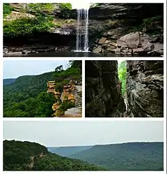
 South Cumberland State Park points of interest. Clockwise: Greeter Falls, the trail down Stone Door, Laurel Gulf Overlook, Stone Door Scenic Overlook. | |

| |
| Type | Tennessee State Park |
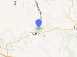
| Location | Franklin, Grundy, Marion and Sequatchie counties |
| Coordinates | 35.259°N 85.789°W |
| Area | 25,539 acres (103.35 km2) |
| Website | South Cumberland State Park |
The park is one of Tennessee's newer state parks, established in 1978. It is a collection of nine discrete tracts scattered across Franklin, Marion, Grundy and Sequatchie counties, totaling approximately 30,899 acres (as of 2020).[1] Twelve trailheads provide hiking access to most sections of the park,[2] which protects a series of unique ecosystems on the escarpments and in the ravines of the Southern Cumberland Plateau. There are over a dozen large waterfalls in the park,[3] the tallest of which is Foster Falls, in Marion County.
Areas
.jpg.webp)
Distinct areas contained within the park include:
- Savage Gulf State Natural Area
- Fiery Gizzard Trail
- Grundy Forest State Natural Area
- Grundy Lakes
- Denny Cove
- Carter State Natural Area (Lost Cove ["Buggytop"] Cave)
- Foster Falls
- Sewanee Natural Bridge State Natural Area
- Hawkins Cove State Natural Area
- Sherwood Forest
Savage Gulf State Natural Area has been named as a National Natural Landmark.[4] Crossing in and out of the park's various sections, the Fiery Gizzard Trail is renowned for its beauty and diversity.[5]
Camping
Camping may be done at the park's Foster Falls Campground, which includes 26 tent/pop-up camper sites and at 93 backcountry campsites throughout the park.
See also
External links
References
- https://tnmap.tn.gov/assessment/
- https://www.friendsofsouthcumberland.org/trailhead-and-trail-info.html
- https://www.friendsofsouthcumberland.org/waterfalls.html
- "National Natural Landmarks - National Natural Landmarks (U.S. National Park Service)". www.nps.gov. Retrieved 2019-03-28.
Year designated: 1971
- "Fiery Gizzard Trail: Difficult but interesting overnight trail along Fiery Creek Gorge". Secret Falls. Retrieved May 6, 2012.
