South Dakota Highway 106
South Dakota Highway 106 (SD 106) is a 4.935-mile-long (7.942 km) state highway in the northeastern part of the U.S. state of South Dakota. It links Claire City with Hammer. It was commissioned in 1976, following the former route of SD 15.[3]
| ||||
|---|---|---|---|---|
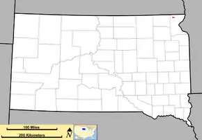 Route of SD 106 (in red) | ||||
| Route information | ||||
| Defined by SDCL §31-4-189 | ||||
| Maintained by SDDOT | ||||
| Length | 4.935 mi[1] (7.942 km) | |||
| Existed | 1975[2]–present | |||
| Major junctions | ||||
| West end | ||||
| East end | ||||
| Location | ||||
| Counties | Roberts | |||
| Highway system | ||||
| ||||

Route description
SD 106 begins as 455th Avenue at a junction with SD 25 and continues south into Claire City. It continues south out of the town as Main Street after crossing the railroad tracks before turning east as 106th Street. SD 106 continues east to its terminus at SD 127.[4]
Major intersections
The entire route is in Roberts County.
| Location | mi[1] | km | Destinations | Notes | |
|---|---|---|---|---|---|
| | 0.000 | 0.000 | Western terminus | ||
| | 4.935 | 7.942 | Eastern terminus of SD 106; southern terminus of CR 14 | ||
| 1.000 mi = 1.609 km; 1.000 km = 0.621 mi | |||||
References
- "Transportation Inventory Management". South Dakota Department of Transportation. Retrieved 2011-09-09.
- "Highway Division Makes Road Numbering Changes". The Sioux Falls Argus-Leader. March 20, 1975. p. 2 (32). Retrieved March 18, 2020 – via Newspapers.com.

- Geelhart, Chris. "The Unofficial South Dakota Highways Page, Highways 101-190". Archived from the original on 2012-12-20. Retrieved 2007-03-23.
- Google (2011-09-08). "Highway 106" (Map). Google Maps. Google. Retrieved 2011-09-08.
This article is issued from Wikipedia. The text is licensed under Creative Commons - Attribution - Sharealike. Additional terms may apply for the media files.