South Dakota Highway 109
South Dakota Highway 109 (SD 109) is a 12.167-mile (19.581 km) state highway in Grant and Roberts counties in South Dakota, United States, runs along the south side of Big Stone Lake and the Minnesota border from U.S. Route 12 in Big Stone City to South Dakota Highway 15.
| ||||
|---|---|---|---|---|
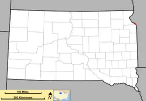 Route of SD 109 (in red) | ||||
| Route information | ||||
| Defined by SDCL §31-4-190 | ||||
| Maintained by SDDOT | ||||
| Length | 12.167 mi[1] (19.581 km) | |||
| Existed | 1975[2]–present | |||
| History | SD 15Y: 1962–1975[2] | |||
| Major junctions | ||||
| South end | ||||
| North end | ||||
| Location | ||||
| Counties | Grant, Roberts | |||
| Highway system | ||||
| ||||

Route description
SD 109 begins at an intersection with US 12 in Big Stone City. It immediately crosses a bridge spanning railroad tracks and it heads northwest out of town. The highway follows the curvature of Big Stone Lake on the Minnesota River to the northwest and west for 12 miles (19 km). It ends at a 90-degree bend in SD 15 east of Hartford Beach State Park.[3]
History
SD 109 was originally designated Highway 15Y. It was renumbered to 109 in 1975.[2]
Major intersections
| County | Location | mi[1] | km | Destinations | Notes |
|---|---|---|---|---|---|
| Grant | Big Stone City | 0.000 | 0.000 | ||
| Roberts | Geneseo Township | 12.167 | 19.581 | ||
| 1.000 mi = 1.609 km; 1.000 km = 0.621 mi | |||||
See also
 U.S. roads portal
References
- "Transportation Inventory Management". South Dakota Department of Transportation. Retrieved September 9, 2011.
- "Highway Division Makes Road Numbering Changes". The Sioux Falls Argus-Leader. March 20, 1975. p. 2 (32). Retrieved March 18, 2020 – via Newspapers.com.

- Google (September 9, 2011). "South Dakota Highway 109" (Map). Google Maps. Google. Retrieved September 9, 2011.
This article is issued from Wikipedia. The text is licensed under Creative Commons - Attribution - Sharealike. Additional terms may apply for the media files.