South Dakota Highway 17
South Dakota Highway 17 (SD 17) is a 2.000-mile (3.219 km) state highway in southeastern South Dakota, United States. It runs along the eastern edge of Lennox. SD 17 formerly continued south to what is now SD 46 near Centerville, and north to SD 42 west of Sioux Falls.
| ||||
|---|---|---|---|---|
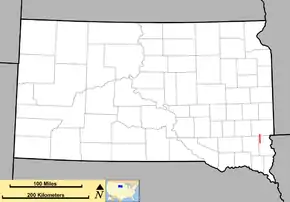 Map of South Dakota with SD 17 in red | ||||
| Route information | ||||
| Defined by SDCL §31-4-140 | ||||
| Maintained by SDDOT | ||||
| Length | 2.000 mi[1] (3.219 km) | |||
| Existed | c. 1929–present | |||
| Major junctions | ||||
| South end | ||||
| North end | 278th St / | |||
| Location | ||||
| Counties | Lincoln | |||
| Highway system | ||||
| ||||

Route description
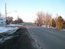
SD 17 begins at an intersection with SD 44 and 280th St one mile south of Lennox, in the west-central part of Lincoln County. It travels to the north, concurrent with SD 44, for one mile until SD 44 departs to the west. SD 17 then enters the city of Lennox. It intersects the eastern terminus of Fourth Avenue, which is signed as a "city truck route". North of Second Avenue, the highway crosses over some railroad tracks of BNSF Railway. At an intersection with the eastern terminus of Boynton Avenue and the western terminus of County Road 122 (CR 122; 278th Street), SD 17 meets its northern terminus.[2]
History
The original SD 17 was established in 1926, from west of Milbank to Peever. This became part of SD 15 by 1929 when it extended north.[3] The current SD 17 was established by 1929. It originally began at an intersection with what is now SD 46 near Centerville. This segment was decommissioned in the 1990s.
In 2018, the South Dakota State Legislature removed the portion of SD 17 that ran from its current northern terminus up to SD 42 from the state highway system and turned it over to local control [4]
Major intersections
| County | Location | mi[1] | km | Destinations | Notes |
|---|---|---|---|---|---|
| Lincoln | | 0.000 | 0.000 | Southern terminus; southern end of SD 44 concurrency | |
| Lennox | 1.000 | 1.609 | Northern end of SD 44 concurrency | ||
| 2.000 | 3.219 | Northern terminus; roadway continues as 466th Avenue. | |||
| 1.000 mi = 1.609 km; 1.000 km = 0.621 mi | |||||
References
- "State Highway Log – Mitchell Region" (PDF). South Dakota Department of Transportation. January 2017. p. 10. Retrieved January 23, 2018.
- https://sdlegislature.gov/Statutes/Codified_Laws/DisplayStatute.aspx?Type=Statute&Statute=31-4-140
- https://www.davidrumsey.com/luna/servlet/detail/RUMSEY~8~1~33755~1171471:Rand-McNally-junior-auto-road-map-S?sort=Pub_List_No_InitialSort%2CPub_Date%2CPub_List_No%2CSeries_No&qvq=q:south%2Bdakota;sort:Pub_List_No_InitialSort%2CPub_Date%2CPub_List_No%2CSeries_No;lc:RUMSEY~8~1&mi=132&trs=138. Missing or empty
|title=(help) - https://sdlegislature.gov/Legislative_Session/Bills/Bill.aspx?File=SB15P.htm&Session=2018&Version=Introduced&Bill=15
External links
| Wikimedia Commons has media related to South Dakota Highway 17. |