Lincoln County, South Dakota
Lincoln County is a county in the U.S. state of South Dakota. As of the 2010 United States Census, the population was 44,828,[3] making it the third-most populated county in the state. Its county seat is Canton.[4] The county was named for Abraham Lincoln, 16th President of the United States.[2]
Lincoln County | |
|---|---|
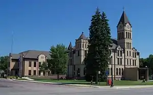 Lincoln County Courthouse in Canton | |
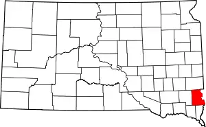 Location within the U.S. state of South Dakota | |
 South Dakota's location within the U.S. | |
| Coordinates: 43°17′N 96°43′W | |
| Country | |
| State | |
| Founded | December 30, 1867 |
| Named for | Lincoln County, Maine[1] OR Abraham Lincoln[2] |
| Seat | Canton |
| Largest city | Sioux Falls |
| Area | |
| • Total | 578 sq mi (1,500 km2) |
| • Land | 577 sq mi (1,490 km2) |
| • Water | 0.5 sq mi (1 km2) 0.08% |
| Population (2010) | |
| • Total | 44,828 |
| • Estimate (2019) | 61,128 |
| • Density | 78/sq mi (30/km2) |
| Time zone | UTC−6 (Central) |
| • Summer (DST) | UTC−5 (CDT) |
| Congressional district | At-large |
| Website | lincolncountysd |
Lincoln County is included in the Sioux Falls, SD, Metropolitan Statistical Area.
It is one of the top 10 fastest-growing counties in the United States in terms of rate of population increase, rate of housing unit increase, and many other factors. This is due to the southward growth of Sioux Falls, and the expansion of its suburbs.
Geography
The Big Sioux River flows south-southeastward along the east line of Lincoln County. Lincoln County is on the eastern line of South Dakota. Its east boundary line abuts the west boundary line of the state of Iowa (across the river).
The county terrain consists of low rolling hills. The county area is largely devoted to agriculture.[5] The terrain slopes to the southeast, and drops off to the river valley along its east edge.[6] The county has a total area of 578 square miles (1,500 km2), of which 577 square miles (1,490 km2) is land and 0.5 square miles (1.3 km2) (0.08%) is water.[7]
Lakes
- Lake Alvin
- Lake Lakota
Protected areas[5]
- Atkins Waterfowl Production Area
- Gitchie Manitou State Preserve
- Good Earth State Park
- Lake Alvin State Recreation Area
- Newton Hills State Park
Major highways
Adjacent counties
- Minnehaha County – north
- Lyon County, Iowa – northeast
- Sioux County, Iowa – southeast
- Union County – south
- Clay County – southwest
- Turner County – west
Demographics
| Historical population | |||
|---|---|---|---|
| Census | Pop. | %± | |
| 1870 | 712 | — | |
| 1880 | 5,896 | 728.1% | |
| 1890 | 9,148 | 55.2% | |
| 1900 | 12,161 | 32.9% | |
| 1910 | 12,712 | 4.5% | |
| 1920 | 13,893 | 9.3% | |
| 1930 | 13,918 | 0.2% | |
| 1940 | 13,171 | −5.4% | |
| 1950 | 12,767 | −3.1% | |
| 1960 | 12,371 | −3.1% | |
| 1970 | 11,761 | −4.9% | |
| 1980 | 13,942 | 18.5% | |
| 1990 | 15,427 | 10.7% | |
| 2000 | 24,131 | 56.4% | |
| 2010 | 44,828 | 85.8% | |
| 2019 (est.) | 61,128 | [8] | 36.4% |
| US Decennial Census[9] 1790-1960[10] 1900-1990[11] 1990-2000[12] 2010-2018[3] | |||
2000 census
As of the 2000 United States Census,[13] there were 24,131 people, 8,782 households, and 6,665 families in the county. The population density was 42 people per square mile (16/km2). There were 9,131 housing units at an average density of 16 per square mile (6/km2). The racial makeup of the county was 97.55% White, 0.34% Black or African American, 0.53% Native American, 0.46% Asian, 0.02% Pacific Islander, 0.29% from other races, and 0.81% from two or more races. 0.70% of the population were Hispanic or Latino of any race.
There were 8,782 households, out of which 41.00% had children under the age of 18 living with them, 66.50% were married couples living together, 6.70% had a female householder with no husband present, and 24.10% were non-families. 19.50% of all households were made up of individuals, and 8.00% had someone living alone who was 65 years of age or older. The average household size was 2.72 and the average family size was 3.14.
The county population contained 29.70% under the age of 18, 7.60% from 18 to 24, 31.90% from 25 to 44, 20.40% from 45 to 64, and 10.40% who were 65 years of age or older. The median age was 34 years. For every 100 females, there were 99.80 males. For every 100 females age 18 and over, there were 97.50 males.
The median income for a household in the county was $48,338, and the median income for a family was $55,401. Males had a median income of $34,486 versus $24,133 for females. The per capita income for the county was $22,304. About 3.20% of families and 4.40% of the population were below the poverty line, including 4.70% of those under age 18 and 7.80% of those age 65 or over.
2010 census
As of the 2010 United States Census, there were 44,828 people, 16,649 households, and 12,287 families in the county.[14] The population density was 77.7 inhabitants per square mile (30.0/km2). There were 17,875 housing units at an average density of 31.0 per square mile (12.0/km2).[15] The racial makeup of the county was 96.1% white, 1.0% Asian, 0.7% black or African American, 0.5% American Indian, 0.3% from other races, and 1.4% from two or more races. Those of Hispanic or Latino origin made up 1.2% of the population.[14] In terms of ancestry, 47.1% were German, 20.9% were Norwegian, 11.7% were Irish, 7.2% were Dutch, 5.2% were English, and 3.9% were American.[16]
Of the 16,649 households, 41.0% had children under the age of 18 living with them, 63.3% were married couples living together, 7.3% had a female householder with no husband present, 26.2% were non-families, and 20.2% of all households were made up of individuals. The average household size was 2.68 and the average family size was 3.11. The median age was 32.8 years.[14]
The median income for a household in the county was $67,365 and the median income for a family was $75,231. Males had a median income of $43,537 versus $34,715 for females. The per capita income for the county was $33,261. About 2.7% of families and 4.3% of the population were below the poverty line, including 4.9% of those under age 18 and 7.5% of those age 65 or over.[17]
Communities
Cities
- Beresford (partial)
- Canton (county seat)
- Harrisburg
- Lennox
- Sioux Falls (partial)
- Tea
- Worthing
Census-designated place
Unincorporated communities[5]
- Naomi (partial)
- Norway Center
Politics
Lincoln County voters have been reliably Republican for decades. In no national election since 1964 has the county selected a Democratic Party candidate.
| Year | Republican | Democratic | Third parties |
|---|---|---|---|
| 2020 | 60.6% 19,617 | 37.0% 11,981 | 2.5% 798 |
| 2016 | 61.4% 15,499 | 32.0% 8,076 | 6.6% 1,656 |
| 2012 | 62.0% 13,611 | 36.4% 7,982 | 1.6% 359 |
| 2008 | 56.8% 11,803 | 41.6% 8,642 | 1.6% 322 |
| 2004 | 65.4% 11,161 | 33.4% 5,703 | 1.2% 202 |
| 2000 | 62.0% 6,546 | 36.4% 3,844 | 1.6% 166 |
| 1996 | 48.9% 4,201 | 42.4% 3,643 | 8.7% 743 |
| 1992 | 42.5% 3,365 | 37.2% 2,943 | 20.4% 1,615 |
| 1988 | 52.4% 3,537 | 47.2% 3,190 | 0.4% 30 |
| 1984 | 60.1% 3,988 | 39.6% 2,626 | 0.3% 22 |
| 1980 | 57.5% 3,848 | 33.8% 2,261 | 8.8% 589 |
| 1976 | 51.0% 3,105 | 48.6% 2,957 | 0.4% 22 |
| 1972 | 54.9% 3,201 | 44.9% 2,617 | 0.2% 10 |
| 1968 | 59.9% 3,259 | 36.0% 1,961 | 4.1% 222 |
| 1964 | 49.1% 2,740 | 50.9% 2,836 | |
| 1960 | 64.2% 3,553 | 35.8% 1,985 | |
| 1956 | 62.2% 3,529 | 37.8% 2,141 | |
| 1952 | 78.4% 4,387 | 21.7% 1,212 | |
| 1948 | 59.5% 2,771 | 39.2% 1,826 | 1.3% 59 |
| 1944 | 67.0% 3,298 | 33.0% 1,625 | |
| 1940 | 66.6% 4,081 | 33.4% 2,048 | |
| 1936 | 48.4% 2,918 | 42.2% 2,541 | 9.4% 567 |
| 1932 | 38.9% 2,160 | 59.4% 3,300 | 1.8% 100 |
| 1928 | 71.4% 3,463 | 28.1% 1,364 | 0.5% 23 |
| 1924 | 43.8% 1,825 | 6.4% 265 | 49.8% 2,076 |
| 1920 | 73.5% 2,790 | 11.6% 441 | 14.8% 563 |
| 1916 | 60.3% 1,591 | 35.5% 936 | 4.2% 112 |
| 1912 | 0.0% 0 | 28.5% 719 | 71.5% 1,802 |
| 1908 | 69.4% 1,887 | 25.7% 699 | 4.9% 133 |
| 1904 | 80.5% 2,471 | 12.3% 378 | 7.2% 221 |
| 1900 | 60.0% 1,908 | 38.5% 1,226 | 1.5% 48 |
| 1896 | 51.9% 1,516 | 47.7% 1,393 | 0.5% 14 |
| 1892 | 55.5% 1,130 | 10.1% 206 | 34.4% 699 |
See also
| Wikimedia Commons has media related to Lincoln County, South Dakota. |
References
- "RootsWeb.com Home Page". www.rootsweb.ancestry.com. Retrieved April 15, 2018.
- Gannett, Henry (1905). The Origin of Certain Place Names in the United States. US Government Printing Office. p. 187.
- "State & County QuickFacts". United States Census Bureau. Archived from the original on June 7, 2011. Retrieved November 25, 2013.
- "Find a County". National Association of Counties. Retrieved June 7, 2011.
- Lincoln County SD Google Maps (accessed 5 February 2019)
- ""Find an Altitude" Google Maps (accessed 5 February 2019)". Archived from the original on May 21, 2019. Retrieved February 6, 2019.
- "2010 Census Gazetteer Files". US Census Bureau. August 22, 2012. Retrieved March 28, 2015.
- "Annual Estimates of the Resident Population for Counties: April 1, 2010 to July 1, 2019". Retrieved April 10, 2020.
- "US Decennial Census". US Census Bureau. Retrieved March 28, 2015.
- "Historical Census Browser". University of Virginia Library. Retrieved March 28, 2015.
- Forstall, Richard L., ed. (March 27, 1995). "Population of Counties by Decennial Census: 1900 to 1990". US Census Bureau. Retrieved March 28, 2015.
- "Census 2000 PHC-T-4. Ranking Tables for Counties: 1990 and 2000" (PDF). US Census Bureau. April 2, 2001. Retrieved March 28, 2015.
- "U.S. Census website". US Census Bureau. Retrieved May 14, 2011.
- "Profile of General Population and Housing Characteristics: 2010 Demographic Profile Data". US Census Bureau. Archived from the original on February 13, 2020. Retrieved March 12, 2016.
- "Population, Housing Units, Area, and Density: 2010 - County". US Census Bureau. Archived from the original on February 13, 2020. Retrieved March 12, 2016.
- "Selected Social Characteristics in the US – 2006-2010 American Community Survey 5-Year Estimates". US Census Bureau. Archived from the original on February 13, 2020. Retrieved March 12, 2016.
- "Selected Economic Characteristics – 2006-2010 American Community Survey 5-Year Estimates". US Census Bureau. Archived from the original on February 13, 2020. Retrieved March 12, 2016.
- "Townships". Lincoln County. Retrieved October 16, 2010.
- Leip, David. "Dave Leip's Atlas of U.S. Presidential Elections". uselectionatlas.org. Retrieved April 15, 2018.
External links
Places adjacent to Lincoln County, South Dakota | ||||||||||
|---|---|---|---|---|---|---|---|---|---|---|
| ||||||||||
Municipalities and communities of Lincoln County, South Dakota, United States | ||
|---|---|---|
| Cities | | |
| Towns | ||
| Townships |
| |
| CDP | ||
| Footnotes | ‡This populated place also has portions in an adjacent county or counties | |
| ||

| Authority control |
|---|