South Granville, New South Wales
South Granville is a suburb in western Sydney, in the state of New South Wales, Australia. It is located 18 kilometres (11 mi) west of the Sydney central business district, in the local government area of the Cumberland City Council.
| South Granville Sydney, New South Wales | |||||||||||||||
|---|---|---|---|---|---|---|---|---|---|---|---|---|---|---|---|
 Colquhoun Park
| |||||||||||||||
| Population | 5,500 (2016 census)[1] | ||||||||||||||
| Postcode(s) | 2142 | ||||||||||||||
| Location | 18 km (11 mi) west of Sydney CBD | ||||||||||||||
| LGA(s) | Cumberland City Council | ||||||||||||||
| State electorate(s) | |||||||||||||||
| Federal Division(s) | Blaxland | ||||||||||||||
| |||||||||||||||
South Granville is an extension of Granville. They share the postcode of 2142 along with the separate suburbs of Camellia, Holroyd and Rosehill.
History
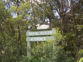
Duck River Track, Wellington Road
Granville was named in 1880, after the British Colonial Secretary, the Granville Leveson-Gower, 2nd Earl Granville.[2]
Parks and Sports Grounds
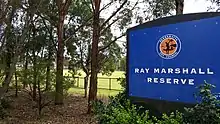
Ray Marshall Reserve
- Ray Marshall Reserve
- Horlyck Reserve and playground
- Harry Gapes Reserve
- Colquhoun Park
- Everley Park
- Melita Stadium
Education
There are a number of schools around South Granville including Granville East Public School, Blaxcell Street Public School, and Holy Family Primary School, Granville South Creative and Performing Arts High School, and Granville South Public School
Businesses headquartered in South Granville
- Hume Building Products
- Sydney Print Media
- Alwaha Eatery
References
- Australian Bureau of Statistics (27 June 2017). "South Granville (State Suburb)". 2016 Census QuickStats. Retrieved 12 April 2018.

- Granville: From Forest to Factory, John Watson (ed.), 1992, Granville Historical Society.
| Wikimedia Commons has media related to South Granville, New South Wales. |
This article is issued from Wikipedia. The text is licensed under Creative Commons - Attribution - Sharealike. Additional terms may apply for the media files.