Spencerport, New York
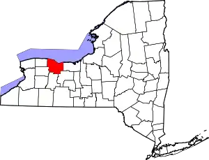
Spencerport is a village in Monroe County, New York, United States, and a suburb of Rochester, New York. The population count was 3,601 at the 2010 census.
Spencerport | |
|---|---|
Village | |
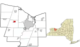
 Location in Monroe County and the state of New York. | |
.svg.png.webp) Location of New York in the United States | |
| Coordinates: 43°11′22″N 77°48′15″W | |
| Country | United States |
| State | New York |
| County | Monroe |
| Town | Ogden |
| Incorporated | 1867 |
| Government | |
| • Mayor | Gary Penders (2014) |
| Area | |
| • Total | 1.41 sq mi (3.66 km2) |
| • Land | 1.38 sq mi (3.58 km2) |
| • Water | 0.03 sq mi (0.08 km2) |
| Elevation | 550 ft (170 m) |
| Population (2010) | |
| • Total | 3,601 |
| • Estimate (2019)[2] | 3,657 |
| • Density | 2,646.16/sq mi (1,021.51/km2) |
| Time zone | UTC-5 (EST) |
| • Summer (DST) | UTC-4 (EDT) |
| ZIP code | 14559 |
| Area code(s) | 585 |
| FIPS code | 36-70189 |
| Website | http://www.vil.spencerport.ny.us/ |
The Village of Spencerport is within the Town of Ogden and is a village on the Erie Canal.
Spencerport Airpark (D91) is a grass strip general aviation airport south of the village.
Geography
Spencerport is located at 43°11′22″N 77°48′15″W (43.189312, -77.804132).[3]
According to the United States Census Bureau, the village has a total area of 1.4 square miles (3.6 km2), of which, 1.4 square miles (3.6 km2) of it is land and 0.04 square miles (0.10 km2) of it (2.14%) is water.
Demographics
| Historical population | |||
|---|---|---|---|
| Census | Pop. | %± | |
| 1870 | 591 | — | |
| 1880 | 670 | 13.4% | |
| 1890 | 695 | 3.7% | |
| 1900 | 715 | 2.9% | |
| 1910 | 1,000 | 39.9% | |
| 1920 | 926 | −7.4% | |
| 1930 | 1,249 | 34.9% | |
| 1940 | 1,340 | 7.3% | |
| 1950 | 1,595 | 19.0% | |
| 1960 | 2,461 | 54.3% | |
| 1970 | 2,929 | 19.0% | |
| 1980 | 3,424 | 16.9% | |
| 1990 | 3,606 | 5.3% | |
| 2000 | 3,559 | −1.3% | |
| 2010 | 3,601 | 1.2% | |
| 2019 (est.) | 3,657 | [2] | 1.6% |
| U.S. Decennial Census[4] | |||
As of the census[5] of 2000, there were 3,559 people, 1,413 households, and 1,001 families residing in the village. The population density was 2,609.7 people per square mile (1,010.4/km2). There were 1,453 housing units at an average density of 1,065.4 per square mile (412.5/km2). The racial makeup of the village was 97.53% White, 0.56% African American, 0.31% Native American, 0.51% Asian, 0.25% from other races, and 0.84% from two or more races. Hispanic or Latino of any race were 1.88% of the population.
There were 1,413 households, out of which 33.7% had children under the age of 18 living with them, 57.0% were married couples living together, 11.2% had a female householder with no husband present, and 29.1% were non-families. 24.1% of all households were made up of individuals, and 8.4% had someone living alone who was 65 years of age or older. The average household size was 2.49 and the average family size was 2.97.
In the village, the population was spread out, with 24.4% under the age of 18, 8.1% from 18 to 24, 28.5% from 25 to 44, 26.0% from 45 to 64, and 13.0% who were 65 years of age or older. The median age was 38 years. For every 100 females, there were 91.3 males. For every 100 females age 18 and over, there were 86.9 males.
The median income for a household in the village was $56,850, and the median income for a family was $62,326. Males had a median income of $44,167 versus $29,722 for females. The per capita income for the village was $24,515. About 0.8% of families and 1.5% of the population were below the poverty line, including none of those under age 18 and 5.6% of those age 65 or over.
History

In 1804, Daniel Spencer bought a farm about 1 1⁄2 miles (2.4 km) north of Ogden Center. When the Erie Canal opened, the farm, through which the canal passed at the Canawaugus Road, was sold to become the first village lots. As a port on the canal, the area was called Spencer's Basin and later changed to Spencerport.
On April 22, 1867 the New York State Legislature incorporated Spencerport as a Village and William Slayton was elected as its first mayor.
The Spencerport Methodist Church was listed on the National Register of Historic Places in 2008.[6]
Sites of interest
- Erie Canal
- Pineway Ponds Park - home to a large playground and multi-use recreation facility
- Springdale Farm - an agricultural education facility open to the public, serves as a day program site for adults with developmental disabilities
- Colby-Pulver House Museum
- Spencerport Depot and Canal Museum- a local history museum and visitors center, located in a restored, former RLBRR trolley station
Notable residents
- Danielle Downey, LPGA golfer: went to school in Spencerport[7]
- Shane Prince, NHL Professional Hockey Player, New York Islanders #11
- Rick Suhr, Olympic Pole Vault coach 2008, 2012
- Maynard Troyer, NASCAR driver: 1971, 1973
- Thomas Louis Villard (November 19, 1953 – November 14, 1994), American actor known for his leading role in the 1980s series We Got It Made as well as roles in feature films One Crazy Summer, Heartbreak Ridge, and My Girl
- Alan Zemaitis, NFL cornerback: went to school in Spencerport
See also
References
- "2019 U.S. Gazetteer Files". United States Census Bureau. Retrieved July 27, 2020.
- "Population and Housing Unit Estimates". United States Census Bureau. May 24, 2020. Retrieved May 27, 2020.
- "US Gazetteer files: 2010, 2000, and 1990". United States Census Bureau. 2011-02-12. Retrieved 2011-04-23.
- "Census of Population and Housing". Census.gov. Retrieved June 4, 2015.
- "U.S. Census website". United States Census Bureau. Retrieved 2008-01-31.
- "National Register Information System". National Register of Historic Places. National Park Service. July 9, 2010.
External links
| Wikimedia Commons has media related to Spencerport, New York. |
