Springfield, Minnesota
Springfield is a city in Brown County, Minnesota, United States. The population was 2,152 at the 2010 census.[6]
Springfield | |
|---|---|
| Motto(s): We have a lot to share! | |
 Location of Springfield within Brown County, Minnesota | |
| Coordinates: 44°14′22″N 94°58′43″W | |
| Country | United States |
| State | Minnesota |
| County | Brown |
| Government | |
| • Type | Mayor – Council |
| • Mayor | Emery Martin |
| Area | |
| • Total | 1.88 sq mi (4.86 km2) |
| • Land | 1.88 sq mi (4.86 km2) |
| • Water | 0.00 sq mi (0.00 km2) |
| Elevation | 1,020 ft (311 m) |
| Population | |
| • Total | 2,152 |
| • Estimate (2019)[3] | 2,004 |
| • Density | 1,067.66/sq mi (412.14/km2) |
| Time zone | UTC-6 (Central (CST)) |
| • Summer (DST) | UTC-5 (CDT) |
| ZIP code | 56087 |
| Area code(s) | 507 |
| FIPS code | 27-61816[4] |
| GNIS feature ID | 0652489[5] |
| Website | www |
U.S. Highway 14 serves as a main route in the community. This location is in the middle of some of Minnesota's most productive farmland.[7] It has the state's only brick plant, operated by Acme-Ochs Brick [8]
History
Springfield was originally called Burns, and under the latter name was platted in 1877 when the railroad was extended to that point.[9] It was renamed in 1881 after either Springfield, Massachusetts.[10] or a nearby spring.[11]
Geography
According to the United States Census Bureau, the city has a total area of 1.85 square miles (4.79 km2), all of it land.[12] The Cottonwood River flows through the city.[13]
Demographics
| Historical population | |||
|---|---|---|---|
| Census | Pop. | %± | |
| 1880 | 167 | — | |
| 1890 | 716 | 328.7% | |
| 1900 | 1,511 | 111.0% | |
| 1910 | 1,482 | −1.9% | |
| 1920 | 1,830 | 23.5% | |
| 1930 | 2,049 | 12.0% | |
| 1940 | 2,361 | 15.2% | |
| 1950 | 2,574 | 9.0% | |
| 1960 | 2,701 | 4.9% | |
| 1970 | 2,530 | −6.3% | |
| 1980 | 2,303 | −9.0% | |
| 1990 | 2,173 | −5.6% | |
| 2000 | 2,215 | 1.9% | |
| 2010 | 2,152 | −2.8% | |
| 2019 (est.) | 2,004 | [3] | −6.9% |
| U.S. Decennial Census | |||
2010 census
As of the census[2] of 2010, there were 2,152 people, 913 households, and 558 families living in the city. The population density was 1,163.2 inhabitants per square mile (449.1/km2). There were 1,015 housing units at an average density of 548.6 per square mile (211.8/km2). The racial makeup of the city was 95% White, 0.8% African American, 0.2% Native American, 0.4% Asian, 0.6% from other races, and 0.8% from two or more races. Hispanic or Latino of any race were 4.6% of the population.
There were 913 households, of which 27.1% had children under the age of 18 living with them, 50.9% were married couples living together, 6.8% had a female householder with no husband present, 3.4% had a male householder with no wife present, and 38.9% were non-families. 34.6% of all households were made up of individuals, and 20.7% had someone living alone who was 65 years of age or older. The average household size was 2.24 and the average family size was 2.88.
The median age in the city was 46.8 years. 22.5% of residents were under the age of 18; 6% were between the ages of 18 and 24; 19.4% were from 25 to 44; 25.7% were from 45 to 64; and 26.3% were 65 years of age or older. The gender makeup of the city was 47.6% male and 52.4% female.
2000 census
As of the census[4] of 2000, there were 2,215 people, 897 households, and 562 families living in the city. The population density was 1,223.9 people per square mile (472.5/km2). There were 968 housing units at an average density of 534.9 per square mile (206.5/km2). The racial makeup of the city was 98.33% White, 0.32% Native American, 0.45% Asian, 0.63% from other races, and 0.27% from two or more races. Hispanic or Latino of any race were 1.99% of the population.
There were 897 households, out of which 30.2% had children under the age of 18 living with them, 53.7% were married couples living together, 5.2% had a female householder with no husband present, and 37.3% were non-families. 34.6% of all households were made up of individuals, and 22.4% had someone living alone who was 65 years of age or older. The average household size was 2.33 and the average family size was 3.03.
In the city, the population was spread out, with 26.0% under the age of 18, 5.7% from 18 to 24, 22.4% from 25 to 44, 18.6% from 45 to 64, and 27.3% who were 65 years of age or older. The median age was 42 years. For every 100 females, there were 86.9 males. For every 100 females age 18 and over, there were 83.2 males.
The median income for a household in the city was $34,643, and the median income for a family was $41,071. Males had a median income of $30,000 versus $21,779 for females. The per capita income for the city was $16,977. About 2.5% of families and 6.5% of the population were below the poverty line, including 3.6% of those under age 18 and 12.4% of those age 65 or over.
Notable people
Bernie Bierman, one of the most successful coaches in Minnesota Golden Gophers football history, was born in Springfield.[14]
In popular culture
The town was often mentioned on Little House on the Prairie as the town to which Charles Ingalls would frequently go for his "business travels".
References
- "2019 U.S. Gazetteer Files". United States Census Bureau. Retrieved July 26, 2020.
- "U.S. Census website". United States Census Bureau. Retrieved November 13, 2012.
- "Population and Housing Unit Estimates". United States Census Bureau. May 24, 2020. Retrieved May 27, 2020.
- "U.S. Census website". United States Census Bureau. Retrieved January 31, 2008.
- "US Board on Geographic Names". United States Geological Survey. October 25, 2007. Retrieved January 31, 2008.
- "2010 Census Redistricting Data (Public Law 94-171) Summary File". American FactFinder. United States Census Bureau. Retrieved April 27, 2011.
- City of Springfield (February 16, 2011). "Community Profile". Retrieved April 22, 2011.
- "Minnesota Bricks".
- Upham, Warren (1920). Minnesota Geographic Names: Their Origin and Historic Significance. Minnesota Historical Society. p. 68.
- Chicago and North Western Railway Company (1908). A History of the Origin of the Place Names Connected with the Chicago & North Western and Chicago, St. Paul, Minneapolis & Omaha Railways. p. 126.
- Upham, Warren (1920). Minnesota Geographic Names: Their Origin and Historic Significance. Minnesota Historical Society. p. 71.
- "US Gazetteer files 2010". United States Census Bureau. Archived from the original on January 12, 2012. Retrieved November 13, 2012.
- Minnesota Atlas & Gazetteer. Yarmouth, Me.: DeLorme. 1994. p. 30. ISBN 0-89933-222-6.
- http://www.tulanegreenwave.com/genrel/bierman_bernie00.html
External links
Municipalities and communities of Brown County, Minnesota, United States | ||
|---|---|---|
| Cities | 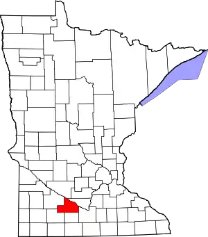 Map of Minnesota highlighting Brown County | |
| Townships | ||
| CDP | ||
| Unincorporated communities | ||
| Brown County Lakes | ||
| Footnotes | ‡This populated place also has portions in an adjacent county or counties | |
| ||
| Authority control |
|---|
