St. Regis River
The St. Regis River (or rivière Saint-Régis in Quebec) is an 86-mile-long (138 km)[2] river in northern New York in the United States. It flows into the Saint Lawrence River at the hamlet of Saint Regis in the St. Regis Mohawk Reservation. The Saint Regis River basin includes Upper and Lower St. Regis Lakes, and Saint Regis Pond in the Saint Regis Canoe Area. It's a great fishery for trout.
| St. Regis River | |
|---|---|
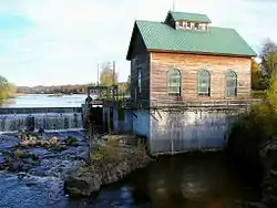 The river at St. Regis Falls | |
 | |
| Location | |
| Country | United States and Canada |
| State and province | New York and Quebec |
| Administrative region (QC) | Montérégie (QC) |
| MRC (QC) | Le Haut-Saint-Laurent Regional County Municipality (QC) |
| Akwesasne | |
| Physical characteristics | |
| Mouth | Saint Lawrence River |
• location | Saint Regis, New York, Franklin County |
• coordinates | 44°59′58.2″N 74°38′28.3″W |
• elevation | 152[1] ft (46 m) |
| Length | 86 mi (138 km) |
| Basin size | 860 sq mi (2,200 km2) |
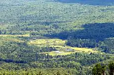
St. Regis River as seen from Azure Mountain, town of Waverly
Toponymy
The toponym "rivière Saint-Régis" was made official on December 5, 1968 at the Commission de toponymie du Québec.[3]
References
- "St Regis River". usgs.gov. usgs. 1995. Retrieved 4 May 2017.
data
- "The National Map". U.S. Geological Survey. Retrieved Feb 11, 2011.
- Commission de toponymie du Québec - Bank of place names - Toponym: "Rivière Saint-Régis"
This article is issued from Wikipedia. The text is licensed under Creative Commons - Attribution - Sharealike. Additional terms may apply for the media files.
