Le Haut-Saint-Laurent Regional County Municipality
Le Haut-Saint-Laurent (Upper Saint Lawrence) is a regional county municipality in southwestern Quebec, Canada, in the Montérégie region. Its seat is in Huntingdon and it is named for the Saint Lawrence River which forms its western and northwestern boundary.
Le Haut-Saint-Laurent | |
|---|---|
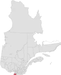 Location in province of Quebec | |
| Coordinates: 45.08°N 74.17°W[1] | |
| Country | |
| Province | |
| Region | Montérégie |
| Effective | January 1, 1982 |
| County seat | Huntingdon |
| Government | |
| • Type | Prefecture |
| • Prefect | Alain Castagner |
| Area | |
| • Total | 1,242.20 km2 (479.62 sq mi) |
| • Land | 1,173.51 km2 (453.09 sq mi) |
| Population (2016)[3] | |
| • Total | 22,454 |
| • Density | 19.1/km2 (49/sq mi) |
| • Change 2011–2016 | |
| • Dwellings | 12,016 |
| Population excludes incompletely enumerated First Nations reserves | |
| Time zone | UTC−5 (EST) |
| • Summer (DST) | UTC−4 (EDT) |
| Area code(s) | 450 and 579 |
| Website | www |
History
The RCM was formed on January 1, 1982 from most of historic Huntingdon County.
Subdivisions
There are 13 subdivisions and one native reserve within the RCM:[2]
- Cities & Towns (1)
- Municipalities (8)
- Parishes (1)
- Townships (3)
- Native Reserves (1) (not associated with RCM)
Demographics
Population
| Canada census – Le Haut-Saint-Laurent Regional County Municipality community profile | |||
|---|---|---|---|
| 2016 | 2011 | 2006 | |
| Population: | 22,454 (+5.9% from 2011) | 21,197 (-3.4% from 2006) | 21,943 (+0.4% from 2001) |
| Land area: | 1,173.51 km2 (453.09 sq mi) | 1,174.00 km2 (453.28 sq mi) | 1,171.78 km2 (452.43 sq mi) |
| Population density: | 19.1/km2 (49/sq mi) | 18.1/km2 (47/sq mi) | 18.7/km2 (48/sq mi) |
| Median age: | 48.4 (M: 48.0, F: 48.8) | 47.1 (M: 46.7, F: 47.6) | 44.3 (M: 44.0, F: 44.7) |
| Total private dwellings: | 12,016 | 10,744 | 10,722 |
| Median household income: | $50,777 | $45,307 | $40,138 |
| References: 2016[4] 2011[5] 2006[6] earlier[7] | |||
| Year | Pop. | ±% |
|---|---|---|
| 1991 | 21,864 | — |
| 1996 | 22,007 | +0.7% |
| 2001 | 21,851 | −0.7% |
| 2006 | 21,943 | +0.4% |
| 2011 | 21,197 | −3.4% |
| 2016 | 22,454 | +5.9% |
| [8][9][3] | ||
Language
| Canada Census Mother Tongue - Le Haut-Saint-Laurent Regional County Municipality[8][9] | ||||||||||||||||||
|---|---|---|---|---|---|---|---|---|---|---|---|---|---|---|---|---|---|---|
| Census | Total | French |
English |
French & English |
Other | |||||||||||||
| Year | Responses | Count | Trend | Pop % | Count | Trend | Pop % | Count | Trend | Pop % | Count | Trend | Pop % | |||||
2016 |
22,160 |
14,185 | 64.0% | 6,730 | 30.4% | 400 | 1.64% | 845 | 3.8% | |||||||||
2011 |
20,985 |
13,980 | 66.62% | 6,150 | 29.31% | 345 | 1.64% | 510 | 2.43% | |||||||||
2006 |
21,735 |
14,665 | 67.47% | 6,050 | 27.84% | 295 | 1.36% | 725 | 3.34% | |||||||||
2001 |
21,590 |
14,160 | 65.59% | 6,360 | 29.46% | 470 | 2.18% | 600 | 2.78% | |||||||||
1996 |
21,730 |
13,915 | n/a | 64.04% | 7,005 | n/a | 32.24% | 325 | n/a | 1.50% | 485 | n/a | 2.23% | |||||
Transportation
Access Routes
Highways and numbered routes that run through the municipality, including external routes that start or finish at the county border:[10]
References
- Reference number 141097 of the Commission de toponymie du Québec (in French)
- Geographic code 690 in the official Répertoire des municipalités (in French)
- "Census Profile, 2016 Census: Le Haut-Saint-Laurent, Municipalité régionale de comté [Census division], Quebec". Statistics Canada. Retrieved November 26, 2019.
- "2016 Community Profiles". 2016 Canadian Census. Statistics Canada. February 21, 2017. Retrieved 2019-11-26.
- "2011 Community Profiles". 2011 Canadian Census. Statistics Canada. July 5, 2013. Retrieved 2013-05-11.
- "2006 Community Profiles". 2006 Canadian Census. Statistics Canada. March 30, 2011. Retrieved 2013-05-11.
- "2001 Community Profiles". 2001 Canadian Census. Statistics Canada. February 17, 2012.
- Statistics Canada: 1996, 2001, 2006, 2011 census
- "(Code 2469) Census Profile". 2011 census. Statistics Canada. 2012.
- Official Transport Quebec Road Map
External links
 Media related to Le Haut-Saint-Laurent Regional County Municipality at Wikimedia Commons
Adjacent Counties & Equivalent Territories | |
|---|---|
This article is issued from Wikipedia. The text is licensed under Creative Commons - Attribution - Sharealike. Additional terms may apply for the media files.