St Kilda West, Victoria
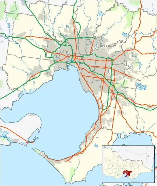
St Kilda West is a suburb of Melbourne, Victoria, Australia, 5 km south of Melbourne's Central Business District. Its local government area is the City of Port Phillip. At the 2016 Census, St Kilda West had a population of 3,162.
| St Kilda West Melbourne, Victoria | |||||||||||||||
|---|---|---|---|---|---|---|---|---|---|---|---|---|---|---|---|
 St Kilda West | |||||||||||||||
| Coordinates | 37.8604°S 144.9732°E | ||||||||||||||
| Population | 3,162 (2016 census)[1] | ||||||||||||||
| • Density | 6,590/km2 (17,060/sq mi) | ||||||||||||||
| Postcode(s) | 3182 | ||||||||||||||
| Area | 0.48 km2 (0.2 sq mi) | ||||||||||||||
| Location | 5 km (3 mi) from Melbourne CBD | ||||||||||||||
| LGA(s) | City of Port Phillip | ||||||||||||||
| State electorate(s) | Albert Park | ||||||||||||||
| Federal Division(s) | Macnamara | ||||||||||||||
| |||||||||||||||
St Kilda West is bounded by Albert Park and Canterbury Road in the north-east and south-east, West Beach Road, Scoops Lane and Beaconsfield Parade in the south-west, Port Phillip Bay in the west, and Fraser Street in the north and north-west. Fraser Street was the western boundary of the former City of St Kilda, now part of the City of Port Phillip.
It is an almost exclusively residential area characterised by a mix of Victorian terraces, modest Edwardian villas, interwar and post war walk-up flats, as well as some 1960s-70s hi-rise towers facing Port Phillip bay. The suburb's community and commercial facilities (including schools and shops) are located in nearby suburbs, and it is well served by public transport.
History
The area of St Kilda West was formerly part of a large swamp which included what is now Middle Park, which was drained in the early 1870s, and streets laid out in regular grid plan, subdivided in stages, but only built in sparsely at first. Wider tree lined boulevards were planned for Mary Street and Park Street. Similar to the rest of St Kilda, by the 1890s large terrace houses and large villas had been built along Beaconsfield Parade, Park Street and Mary Street. In the Edwardian era, some terraces were built, but the remaining areas further away from the beach and Fitzroy Street filled up with modest red brick houses, the same type that was quickly filling Middle Park. At the same time, like the rest of St Kilda some of the larger mansions and terraces became guest houses. The Catani Gardens on the beachfront were developed as part of the Edwardian beatification of the foreshore.
St Kilda West Post Office opened around March 1879 (from 1886 until 1970 it was known as St Kilda Railway Station office).[2]
The St Kilda rail line, Melbourne’s second which opened in 1857, ran along the northern edge of the area, terminating at the northeast corner at Fitzroy Street. Cable trams were built along that street in the 1880s, which was electrified in the 1920s. A new electric tram line from the city was built through Middle Park along Park Street, which opened on 31 October 1925. It originally turned south at Mary Street, then ran along Beaconsfield Parade to terminate at Fitzroy Street. On 8 November 1959 the track was straightened in favour of a short extension along Park Street to Fitzroy Street, now the terminus of Route 12.[3]
Beginning just before WW1 with the construction of the Canterbury in 1914, flats began to be built in the still vacant lots in St Kilda West, sometimes replacing earlier houses. This trend continued in the post-war period, including a number of high rise apartment towers on Beaconsfield Parade and on Canterbury Road.
By the 1980s the majority of St Kilda West had become a heritage precinct, and so there has been little redevelopment since. One notable change was the sale of the railway reservation along the other side Canterbury Road which was sold off in the 1990s, and developed as a row of townhouses.
Landmarks
Beaconsfield Hotel, (1880) closed in 2004, the building is a notable landmark with its Italianate towers and has been proposed to be converted into apartments.[4]
The beach foreshore and Catani Gardens (1906) was planned by Italian civil engineer Carlo Catani with its Edwardian style central rotunda.
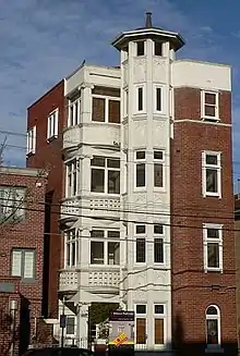
The Canterbury flats built on Canterbury Road (1914-1919) by architects H.W. & F.B Tompkins is one of Melbourne's earliest apartment buildings.
The West Beach Bathers Pavilion at West Beach (1928) was adaptively reused as a cafe and opened in 2004.
The Gatwick Private Hotel was previously a boarding house, but was bought and renovated by the television show The Block which airs on Channel 9.
The former Cowderoy Dairy on Cowderoy Street (1932) is an art deco building that has been converted into a popular cafe adjacent to a small central park.
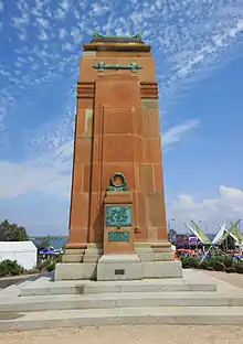
St Kilda War Memorial was erected at Catani Gardens following World War II.
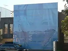
Newman House on Canterbury Road (200) by architect Cassandra Fahey became a pop architecture icon when completed for local celebrity Sam Newman featuring an image of Pamela Anderson's face. Sam did not first obtain council permission, however permits were issued retrospectively when it became a major local landmark and won the award for Best New Residential Building in the RAIA Victorian Architecture awards. Newman never lived in the house and sold it for $1.1 million in mid-2002.[5]
Open and recreational space
The suburb has several parks, most notably Catani Gardens and the West Beach foreshore. Other smaller parks include Johnson Reserve on Canterbury Road and the Jacoby Reserve, all of which have playground facilities for children. The Cummins linear reserve on the median of Beaconsfield Parade has public toilets at the Cowderoy St end. Just outside the suburb are the Albert Park and Lake running along the suburb's border to the north east and Cleve Gardens and St Kilda foreshore gardens to the south.
Transport

The main thoroughfares are Canterbury Road and Beaconsfield Parade. Both are dual carriageways. Park Street runs along the spine of the suburb and is a single carriageway.
Before conversion to light rail (route 96) in 1987, the rail reserve parallel to Canterbury Road served as the St. Kilda rail line, with services to Flinders Street via Middle Park, Albert Park and South Melbourne. Route 112 was replaced by route 12 on 26 July 2014 as part of a wider timetable change to the Yarra Trams network.[6]
St Kilda West is serviced by four tram routes:
| No. | To/From | Along |
|---|---|---|
| 3a | Melbourne University - East Malvern (weekend deviation) | Fitzroy Street |
| 12 | Victoria Gardens - St. Kilda/Fitzroy St | Park Street |
| 16 | Melbourne University - Kew | Fitzroy Street |
| 96 | East Brunswick - St. Kilda Beach | Fitzroy Street |
Notable residents
- Jim Stynes (lived on Mary Street until his death in 2012)[7]
See also
- City of St Kilda - the former local government area of which St Kilda West was a part
References
- Australian Bureau of Statistics (27 June 2017). "St Kilda East (State Suburb)". 2016 Census QuickStats. Retrieved 12 April 2018.

- Premier Postal History, Post Office List, retrieved 11 April 2008
- "Re: Barkly Street", jebounds, retrieved 17 October 2011
- http://www.theage.com.au/news/national/apartment-plans-for-hookes-hotel-site/2005/09/13/1126377315158.html
- http://www.propertyobserver.com.au/new-south-wales/infamous-pamela-anderson-house-built-for-sam-newman-hits-rental-market/2012051454692
- "Capacity boost for tram passengers". Archived from the original on 26 July 2014.
- http://www.themercury.com.au/article/2012/03/21/311451_todays-news.html