Stanwell Moor
Stanwell Moor is a village in the Borough of Spelthorne, approximately 17 miles (27 km) west of central London. Historically part of the county of Middlesex, it was transferred to Surrey in 1965. It is immediately east of the M25 London Orbital Motorway and 1 mile (1.6 km) south-west of Heathrow Airport Terminal 5.
| Stanwell Moor | |
|---|---|
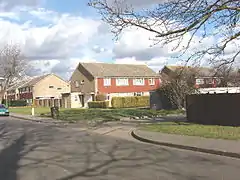 Semi-detached and maisonette estate of Stanwell Moor | |
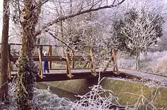 Footpath bridge connecting stream-side cottages in winter | |
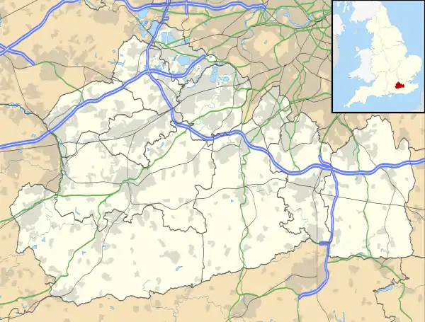 Stanwell Moor Location within Surrey | |
| Area | 2.63 km2 (1.02 sq mi) |
| Population | 1,371 (2011 census)[1] |
| • Density | 521/km2 (1,350/sq mi) |
| OS grid reference | TQ0374 |
| District | |
| Shire county | |
| Region | |
| Country | England |
| Sovereign state | United Kingdom |
| Post town | Staines-upon-Thames |
| Postcode district | TW19 |
| Dialling code | 01753 |
| Police | Surrey |
| Fire | Surrey |
| Ambulance | South East Coast |
| UK Parliament | |
The River Colne runs to the west of Stanwell Moor and the village is in Colne Valley regional park.
Stanwell Moor is distinct from Stanwell, approximately 1 mile (1.6 km) to the east, although it is part of the same ward and civil and ecclesiastical parishes.
History and geography
The locality gained its main barrier from what had always been its village in the early 1960s, a dual carriageway and it hived off shortly after with the building of a community hall and establishment of its own residents' association. It is however, ecclesiastically, still strongly tied with Stanwell in the Church of England, its parish. Fewer than six of the original medieval buildings stand in the hamlet.[2]
It sits on the part of the parish on strongly fertile, partly densely wooded, alluvial soil, whereas most of Stanwell was associated with the stony ground which makes up gravel deposits near to the surface of the soil, as throughout the area south of Heathrow Airport to the River Thames.[2]
Local government
The community is in the Stanwell North ward, as used by Spelthorne and for certain statistical purposes. Stanwell Moor is represented the Conservative's Kwasi Kwarteng on Surrey County Council.
Amenities
A parade of shops is here, followed at one end by a pub. A further pub is by the Colne itself. Distributaries of the complex River Colne runs past Stanwell Moor where it forms a broad part of the Colne Valley regional park. Stanwell Moor is buffered from all other settlements. Its south is covered by the King George VI Reservoir after which is Staines upon Thames. South-west is the Wraysbury Reservoir.[2][3][4]
Demography and housing
| Output area | Detached | Semi-detached | Terraced | Flats and apartments | Caravans/temporary/mobile homes | Shared between households[1] |
|---|---|---|---|---|---|---|
| Stanwell Moor[1] | 94 | 184 | 187 | 78 | 1 | 6 |
The average level of accommodation in the region composed of detached houses was 28%, the average that was apartments was 22.6%.
| Output area | Population | Households | % Owned outright | % Owned with a loan | hectares[1] |
|---|---|---|---|---|---|
| Stanwell Moor[1] | 1,371 | 550 | 25.5 | 47.5 | 263 |
The proportion of households in the settlement who owned their home outright compares to the regional average of 35.1%. The proportion who owned their home with a loan compares to the regional average of 32.5%. The remaining % is made up of rented dwellings (plus a negligible % of households living rent-free).
Gallery
.jpg.webp) Field of Lower Mill Farm from the public footpath
Field of Lower Mill Farm from the public footpath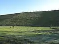 King George VI Reservoir with field used for sheep farming
References
- Key Statistics; Quick Statistics: Population Density United Kingdom Census 2011 Office for National Statistics Stanwell Moor makes up 2011 lower output area Spelthorne 001D. Note: the towns and villages in Spelthorne have one ward each which covers part of a neighbouring town or village. For example, Ashford is two wards and part of a third ward (see Government). Retrieved 21 November 2013
- Susan Reynolds (Editor) (1962). "Stanwell: Introduction". A History of the County of Middlesex: Volume 3: Shepperton, Staines, Stanwell, Sunbury, Teddington, Heston and Isleworth, Twickenham, Cowley, Cranford, West Drayton, Greenford, Hanwell, Harefield and Harlington. Institute of Historical Research. Retrieved 15 December 2013.CS1 maint: extra text: authors list (link) Add to my bookshelf
- "Google Maps". Google Maps.
- Grid square map Ordnance survey website
External links
![]() Media related to Stanwell Moor at Wikimedia Commons
Media related to Stanwell Moor at Wikimedia Commons
![]() Surrey portal
Surrey portal
| Towns, villages and localities | 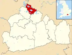 | ||||||
|---|---|---|---|---|---|---|---|
| Key parks | |||||||
| Large listed buildings |
| ||||||
| Education | |||||||
| Railway stations | |||||||
| Buildings and structures | |||||||
| Sport |
| ||||||
| Destroyed landmarks | |||||||