Wraysbury Reservoir
Wraysbury Reservoir is a water supply reservoir for London, just west of the M25 near the village of Wraysbury, and directly under the western approach path of Heathrow Airport. The reservoir was begun in 1967 and completed by W. & C. French in 1970[2] with a capacity of 34,000 million litres (8,000 million gallons).[3]
| Wraysbury Reservoir | |
|---|---|
 Wraysbury Reservoir from the air, looking south | |
 Wraysbury Reservoir | |
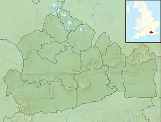
| Location | Surrey |
| Coordinates | 51°27′39.7″N 0°31′25.2″W |
| Type | reservoir |
| Basin countries | United Kingdom |
| Surface area | 2.05 square kilometres (0.79 sq mi) |
| Water volume | 34 Gl (7.5×10⁹ imp gal) |
| Site of Special Scientific Interest | |
| Area of Search | Surrey |
|---|---|
| Grid reference | TQ 025 745[1] |
| Interest | Biological |
| Area | 205.6 hectares (508 acres)[1] |
| Notification | 1999[1] |
| Location map | Magic Map |
Engineering design data for the Wraysbury reservoir is as follows.[4]
| Parameter | Value |
|---|---|
| Top water level above ordnance datum | 31.1 m |
| Volume of water storage | 35 million m3 |
| Maximum depth of water | 21 m |
| Water area | 202 ha |
| Maximum height of bank above ground | 17 m |
| Perimeter of bank | 5,700 m |
The reservoir is owned and operated by Thames Water; 400 million litres (100 million gallons) of water are pumped daily from an inlet at Datchet on the River Thames. A neighbouring reservoir is the King George VI Reservoir, opened in 1947, which is supplied from Hythe End. To keep the grass short and make inspections easier, Thames Water maintains a flock of sheep on the earthen banks.[5]
It is a 205.6-hectare (508-acre) biological Site of Special Scientific Interest[1][6] and part of South West London Waterbodies Ramsar site[7] and Special Protection Area.[8] It has nationally important numbers of wintering cormorants, great crested grebe and shovelers. It also supports many gadwalls.[9]
See also
References
- "Designated Sites View: Wraysbury Reservoir". Sites of Special Scientific Interest. Natural England. Retrieved 21 November 2018.
- "The Queen Mother Reservoir, Datchet" (PDF). Ground Engineering. October 1976. Retrieved 14 September 2015.
- Spelthorne Borough Council - Three Rivers Ramble
- Bell, F. G. (1979). Engineering Geology and Geotechnics. Butterworth-Heinemann Ltd. p. 270. ISBN 9780408003551.
- "The real-life reservoir dogs (press release)". PR Newswire. Thames Water. Retrieved 4 December 2016.
- "Map of Wraysbury Reservoir". Sites of Special Scientific Interest. Natural England. Retrieved 21 November 2018.
- "Designated Sites View: South West London Waterbodies". Ramsar Site. Natural England. Retrieved 9 November 2018.
- "Designated Sites View: South West London Waterbodies". Special Protection Areas. Natural England. Retrieved 9 November 2018.
- "Wraysbury Reservoir citation" (PDF). Sites of Special Scientific Interest. Natural England. Retrieved 21 November 2018.
| Wikimedia Commons has media related to Wraysbury Reservoir. |
| Towns, villages and localities | 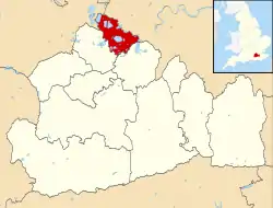 | ||||||
|---|---|---|---|---|---|---|---|
| Key parks | |||||||
| Large listed buildings |
| ||||||
| Education | |||||||
| Railway stations | |||||||
| Buildings and structures | |||||||
| Sport |
| ||||||
| Destroyed landmarks | |||||||
| Main rivers | 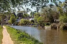 | |
|---|---|---|
| Canals and Navigations | ||
| Ordinary watercourses | ||
| Lakes, ponds and wetlands |
| |
| Reservoirs | ||
Categories: Rivers, Canals | ||