Star City, Arkansas
Star City is a city in, and the county seat of, Lincoln County, Arkansas, United States,.[3] Incorporated in 1876, the city is located between the Arkansas Delta and Arkansas Timberlands. With an economy historically based on agriculture, today Star City has developed a diverse economy based on both industry and agriculture.[4] As of the 2010 census, the population was 2,274.[5] Star City is located within the Pine Bluff metropolitan area.
Star City, Arkansas | |
|---|---|
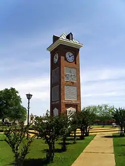 Clock tower on the town square | |
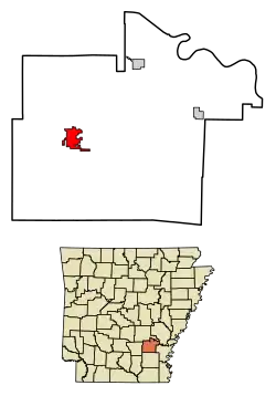 Location of Star City in Lincoln County, Arkansas. | |
| Coordinates: 33°56′27″N 91°50′33″W | |
| Country | United States |
| State | Arkansas |
| County | Lincoln |
| Area | |
| • Total | 4.80 sq mi (12.43 km2) |
| • Land | 4.80 sq mi (12.43 km2) |
| • Water | 0.00 sq mi (0.00 km2) |
| Elevation | 272 ft (83 m) |
| Population (2010) | |
| • Total | 2,274 |
| • Estimate (2019)[2] | 2,030 |
| • Density | 423.18/sq mi (163.38/km2) |
| Time zone | UTC-6 (Central (CST)) |
| • Summer (DST) | UTC-5 (CDT) |
| ZIP code | 71667 |
| Area code(s) | 870 |
| FIPS code | 05-66440 |
| GNIS feature ID | 0078447 |
Geography
Star City is located at 33°56′27″N 91°50′33″W (33.940947, -91.842575).[6]
According to the United States Census Bureau, the city has a total area of 4.2 square miles (11 km2), all land.
The city is located between Monticello and Pine Bluff.[7]
Demographics
| Historical population | |||
|---|---|---|---|
| Census | Pop. | %± | |
| 1890 | 204 | — | |
| 1900 | 251 | 23.0% | |
| 1910 | 396 | 57.8% | |
| 1920 | 616 | 55.6% | |
| 1930 | 932 | 51.3% | |
| 1940 | 1,090 | 17.0% | |
| 1950 | 1,296 | 18.9% | |
| 1960 | 1,573 | 21.4% | |
| 1970 | 2,032 | 29.2% | |
| 1980 | 2,066 | 1.7% | |
| 1990 | 2,138 | 3.5% | |
| 2000 | 2,471 | 15.6% | |
| 2010 | 2,274 | −8.0% | |
| 2019 (est.) | 2,030 | [2] | −10.7% |
| U.S. Decennial Census[8] | |||
As of the census[9] of 2000, there were 2,471 people, 875 households, and 603 families residing in the city. The population density was 587.5 people per square mile (226.6/km2). There were 972 housing units at an average density of 231.1 per square mile (89.1/km2). The racial makeup of the city was 76.93% White, 21.08% Black or African American, 0.61% Native American, 0.04% from other races, and 0.77% from two or more races. 1.21% of the population were Hispanic or Latino of any race.
There were 875 households, out of which 37.4% had children under the age of 18 living with them, 46.5% were married couples living together, 18.6% had a female householder with no husband present, and 31.0% were non-families. 28.8% of all households were made up of individuals, and 15.8% had someone living alone who was 65 years of age or older. The average household size was 2.52 and the average family size was 3.10.
In the city, the population was spread out, with 27.0% under the age of 18, 7.9% from 18 to 24, 24.8% from 25 to 44, 17.5% from 45 to 64, and 22.9% who were 65 years of age or older. The median age was 38 years. For every 100 females, there were 75.4 males. For every 100 females age 18 and over, there were 69.8 males.
The median income for a household in the city was $32,197, and the median income for a family was $40,156. Males had a median income of $34,107 versus $19,630 for females. The per capita income for the city was $13,998. About 15.9% of families and 18.2% of the population were below the poverty line, including 27.0% of those under age 18 and 11.8% of those age 65 or over.
Arts and culture
Star City was the setting for the 1992 police thriller film One False Move, starring actors Bill Paxton and Billy Bob Thornton, and written by Thornton. However, only limited filming was done there with the bulk of the movie shot in Cotton Plant, Arkansas.[10]
Annual cultural events
Star City is the home of the annual STARDAZE festival. The festival draws people from all over southeastern Arkansas.
Education
The Star City School District operates public schools:[7] Jimmy Brown Elementary School, Star City Middle School, and Star City High School.
Infrastructure
Transportation
Roads
Star City is located at the intersection of US Highway 425 (US 425) and Highway 11 (AR 11). US 425 is a major north-south highway in southeast Arkansas and connects the city to Pine Bluff to the north and Monticello to the south. AR 11 provides access to Gould and US 65 to the east and US 63 to the west.
AR 530 currently terminates near Star City. This route is a two-lane freeway segment of a future extension of Interstate 530 (I-530) south to Monticello. In Monticello, the planned extension will connect to future Interstate 69, a proposed road connecting Port Huron, Michigan, and Rosenberg, Texas.
References
- "2019 U.S. Gazetteer Files". United States Census Bureau. Retrieved June 30, 2020.
- "Population and Housing Unit Estimates". United States Census Bureau. May 24, 2020. Retrieved May 27, 2020.
- "Find a County". National Association of Counties. Retrieved 2011-06-07.
- DeArmond-Huskey, Rebecca. "Star City (Lincoln County)". The Encyclopedia of Arkansas History & Culture. The Butler Center for Arkansas Studies at Central Arkansas Library System. Retrieved July 5, 2014.
- "State & County QuickFacts". United States Census Bureau. Retrieved May 19, 2014.
- "US Gazetteer files: 2010, 2000, and 1990". United States Census Bureau. 2011-02-12. Retrieved 2011-04-23.
- "District Homepage Archived 2011-03-16 at the Wayback Machine." Star City School District. Retrieved on March 6, 2011. "206 Cleveland Street, Arkansas" [sic]
- "Census of Population and Housing". Census.gov. Retrieved June 4, 2015.
- "U.S. Census website". United States Census Bureau. Retrieved 2008-01-31.
- http://hillnholler.net/2011/12/17/movies-shot-in-arkansas/
External links
Municipalities and communities of Lincoln County, Arkansas, United States | ||
|---|---|---|
| Cities | 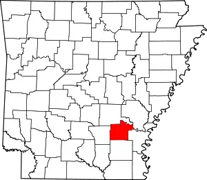 Map of Arkansas highlighting Lincoln County | |
| Unincorporated communities | ||
| Townships |
| |
| ||
| Authority control |
|---|