Stephens Island (British Columbia)
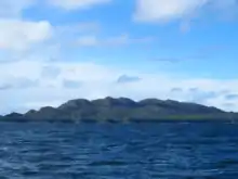
Stephens Island is an island on the British Columbia Coast, Canada, located in Hecate Strait to the northwest of Porcher Island and to the southwest of the city of Prince Rupert.[1] The island's main geographic feature is Mount Stephens, 432 m (1417 feet),[2] on the southeast end of the island at 54°07′39″N 130°40′15″W.[3] To its northwest is Congreve Hill, 150 m (492 feet),[4] at 54°09′29″N 130°42′31″W.
The island was named by Captain Vancouver in honour of Sir Philip Stephens, secretary to the Admiralty from 1763 to 1795.[5]:255
Indian reserves
Squaderee Indian Reserve No. 91 is located on the west side of the island's northern part, at 54°08′00″N 130°47′00″W[6] on Skiakl Bay at 54°08′17″N 130°47′02″W,[7] in which there is a small island, Skiakl Island, at 54°07′38″N 130°45′44″W.[8]
Off Stephens Island's northern tip is Avery Island at 54°12′42″N 130°45′32″W,[9] the whole of which constitutes Avery Island Indian Reserve No. 92,[10] Both it and Squadaree IR No. 9 are under the administration of the Metlakatla First Nation.[11][12] It lies in Qlawdzeet Anchorage which is at 54°12′15″N 130°46′09″W.[13] Overlooking that from the south, at the northern tip of Stephens Island itself, is Qlawd Hill at 54°11′28″N 130°46′29″W.[14]
Other features and adjoining islands
Other small islands adjoining Stephens Island are Dunn Island, Dolly Island, Joyce Island, Log Island, Minnie Island, Philip Island (formerly Parry Island), Rod Island, and Trunk Island.[15]
Prescott Island is the largest of the small islands around Stephens Island, lying to its southeast between it and Porcher Island at 54°11′28″N 130°46′29″W.[16]
References
- BC Names/GeoBC entry "Stephens Island"
- Bivouac Mountain Encyclopedia entry "Mount Stephens"
- BC Names/GeoBC entry "Mount Stephens"
- Bivouac Mountain Encyclopedia entry "Congreve Hill"
- Akrigg, G.P.V.; Akrigg, Helen B. (1986), British Columbia Place Names (3rd, 1997 ed.), Vancouver: UBC Press, ISBN 0-7748-0636-2
- BC Names/GeoBC entry "Squadaree 9 (Indian reserve)"
- BC Names/GeoBC entry "Skiakl Bay"
- BC Names/GeoBC entry "Skiakl Island"
- BC Names/GeoBC entry "Avery Island"
- BC Names/GeoBC entry "Avery Island 92 (Indian reserve)"
- Indian and Northern Affairs Canada, Reserve/Settlement/Village Detail Archived 2014-05-14 at the Wayback Machine
- Indian and Northern Affairs Canada, Reserve/Settlement/Village Detail Archived 2014-05-14 at the Wayback Machine
- BC Names/GeoBC entry "Qlawdzeet Anchorage"
- [http.gov.bc.ca/pub/bcgnws/names/37033.html BC Names/GeoBC entry "Qlawd Hill"]
- BC Names/GeoBC 10km radius search around "Stephens Island" entry
- "Prescott Island". BC Geographical Names.