British Columbia Coast
The British Columbia Coast, popularly referred to as the BC Coast or simply the Coast, is a geographic region of the Canadian province of British Columbia. It is synonymous with being the West Coast of Canada, including the entire western continental coastline of Canada along the Pacific Ocean.
British Columbia Coast
French: Côte de la Colombie-Britannique | |
|---|---|
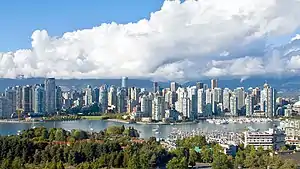  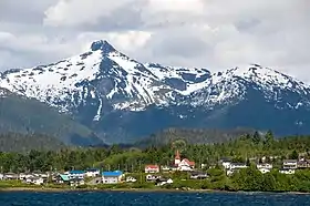 From top, left to right: Vancouver, Pacific Rim National Park Reserve, Lax Kw'alaams backdropped by the Kitimat Ranges | |
| Nickname(s): "The Coast" | |
| Country | |
| Province | |
| Principal cities | |
| Area | |
| • 15 Districts | 244,778 km2 (94,509 sq mi) |
| Highest elevation | 4,019 m (13,186 ft) |
| Lowest elevation | 0 m (0 ft) |
| Population (2016) | 3,686,900[2] |
| • Density | 80.24/km2 (207.8/sq mi) |
| Time zone | UTC−08:00 (PST) |
| • Summer (DST) | UTC−07:00 (PDT) |
| Postal code prefixes | V |
| Area codes | 236, 250, 604, 672, 778 |
While the exact boundaries are variously defined, the region is generally defined to include the 15 regional districts that have coastline along the Pacific Ocean or Salish Sea, and are part of the Lower Mainland, a subregion of the British Columbia Coast. Other boundaries may exclude parts of or even entire regional districts, such as those of the aforementioned Lower Mainland.
Boundaries
While the term British Columbia Coast has been recorded from the earliest period of non-native settlement in British Columbia, it has never been officially defined in legal terms. The term has historically been in popular usage for over a century to describe a region of the province that extends west from the Coast Mountains and North Cascades. This definition makes the term British Columbia Coast largely synonymous with the 15 regional districts that have territory in this region.
Major subregions
Among locals, the British Columbia Coast can further be divided into seven major subregions:
- Vancouver Island: Includes Vancouver Island, the Gulf Islands, and sometimes Quadra Island.
- Lower Mainland: Includes Greater Vancouver, Fraser Valley, and sometimes the Sea-to-Sky Corridor.
- Sunshine Coast: Includes the islands and mainland coast between Howe Sound and Desolation Sound.
- South Coast: Includes the Lower Mainland and Sunshine Coast, but excludes Vancouver Island. This subregion is closely associated with the Salish Sea.
- Central Coast: Includes the islands and mainland coast between Desolation Sound and Cape Caution. This subregion is sparsely populated and is represented by the regional districts of Strathcona and Mount Waddington. The northern limit of this subregion is often extended northward to the Don Peninsula to include Central Coast Regional District.
- North Coast: Includes the islands and mainland coast between Cape Caution and Portland Canal.[3] This subregion is represented by the regional districts of Central Coast, Kitimat-Stikine, and North Coast. This subregion is closely associated with the Great Bear Rainforest.
- Haida Gwaii: Includes the Haida Gwaii archipelago, which located about 90 km (56 mi) west of the mainland North Coast.
History
Research from the 1990s has indicated that the Ice Age-era coastline of the British Columbia Coast was lower by about 100 metres (330 ft). The effect of the sea level on the coastline was such that the Queen Charlotte Strait, which is between Haida Gwaii and the northern end of Vancouver Island, was a coastal plain, as were all the straits inland from it, except for those that were mountain valleys.
Underwater archaeology has shown the presence of permanent human habitations and other activity at the 100-metre (330 ft) contour, and the Ice Age existence of such a coastal plain has put a new light on Ice Age populations in North America as well as on the strong likelihood of this area having been the major migration route from (and perhaps to) Asia.
The heavy indentation and mild climate of the British Columbia Coast have led to inevitable comparisons with the geography's predisposition to encouraging increased human settlement and movement as well as cultural foment and population growth in the Aegean, the Irish Sea/Hebrides and in the Danish Archipelago and adjoining Scandinavian coasts.
The natural fecundity of the environment - rich in seafood, wild game, and greenery - combined with the ease of travel (by water) is seen in all cases (British Columbia, Denmark, Greece) to have generated a dynamic and gifted civilization. And there are comparisons to be made between the artistic and political and social level of the Pacific Northwest Peoples and those of pre-Conversion pagan Scandinavia, Ireland and Archaic-Era Greece.
Geography
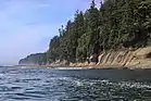
The British Columbia Coast stretches from the southern tip of Vancouver Island along the Strait of Juan de Fuca to the community of Stewart at the head of Portland Canal. The aerial distance between these two points is approximately 954 km (593 mi). However, due to its deeply incised coastline and over 40,000 islands of varying sizes, the total length of the British Columbia Coast is over 25,725 kilometres (15,985 mi), or approximately 10% of the entire Canadian coastline. This coastal geography is shared with the neighbouring U.S. states of Alaska and Washington.[4]
The dominant landforms are the Insular Mountains of Vancouver Island and Haida Gwaii, and the Coast Mountains that stretch along the entire length of the coast. The proximity of these mountains to the coast produce fjords that rival those of Norway in length and depth. Fjords of note include Burrard Inlet, Howe Sound, Jervis Inlet, Desolation Sound, Dean Channel, Douglas Channel, Prince Rupert Harbour, and Portland Inlet.
Climate
The BC Coast is dominated by a moderate oceanic climate (Köppen: Cfb) with warm summers, cool winters, and constant rainfall that peaks during the winter months. These areas enjoy the mildest winter weather in all of Canada, as temperatures seldom fall much below the freezing mark.
The southernmost region of the coast (surrounding the Salish Sea) features a warm-summer Mediterranean climate with warm, dry summers and cool, wet winters. This gradually transitions to a predominantly oceanic climate as you move north along the coast or further inland into the foothills of the Pacific Ranges. Higher elevations feature a subpolar oceanic climate (Köppen: Cfc) with cool summers, cold winters, and constant rainfall that peaks during the winter months. The highest elevations feature a subarctic climate (Köppen: Dfc).
Ecology
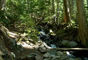
The British Columbia Coast is dominated by temperate rainforest. According to the ecoregion system used by the World Wide Fund for Nature (WWF), the BC Coast is part of five distinct ecoregions: Puget lowland forests, Central Pacific coastal forests, British Columbia mainland coastal forests, Haida Gwaii coastal forests, and Pacific Coastal Mountain icefields and tundra.
According to the ecozone system used by Environment and Climate Change Canada (ECCC), the BC Coast is part of four distinct ecozones: Pacific Coastal Mountains, Coastal Western Hemlock-Sitka Spruce Forests, Pacific and Nass Ranges, and Strait of Georgia/Puget Lowland.
According to the British Columbia Ministry of Forests, which uses an ecosystem classification system independent of the WWF and ECCC, the BC Coast is part of two distinct biogeoclimatic zones: Coastal Western Hemlock and Coastal Douglas-fir.
Demographics
Regional districts
Below are the 15 regional districts of British Columbia defined as being in the Coast region:
| Name | Population (2016)[2][6] |
Area (km2) |
Density (/km2) |
Head office location |
|---|---|---|---|---|
| Alberni-Clayoquot | 30,981 | 6,588 | 4.7 | Port Alberni |
| Capital | 383,360 | 2,340 | 163.8 | Victoria |
| Central Coast | 3,319 | 24,492 | 0.14 | Bella Coola |
| Comox Valley | 66,527 | 1,701 | 39.1 | Courtenay |
| Cowichan Valley | 83,739 | 3,475 | 24.1 | Duncan |
| Fraser Valley | 295,934 | 13,335 | 22.2 | Chilliwack |
| Kitimat-Stikine | 37,367 | 104,461 | 0.36 | Terrace |
| Metro Vancouver | 2,463,431 | 2,883 | 854.5 | Burnaby |
| Mount Waddington | 11,035 | 20,244 | 0.55 | Port McNeill |
| Nanaimo | 155,698 | 2,038 | 76.4 | Nanaimo |
| North Coast | 18,133 | 19,781 | 0.92 | Prince Rupert |
| qathet | 20,070 | 5,075 | 4.0 | Powell River |
| Squamish-Lillooet | 42,665 | 16,310 | 2.6 | Pemberton |
| Strathcona | 44,671 | 18,278 | 2.4 | Campbell River |
| Sunshine Coast | 29,970 | 3,777 | 7.9 | Sechelt |
.jpg.webp)
Economy
Fishing
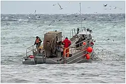
The fishery of the Pacific Northwest Coast is legendary, especially for its many salmon runs and the cultures that built on top of them throughout the region. Salmon runs have greatly diminished since pre-Contact years and the advent of commercial canning and, ultimately, depletion of stocks by high-seas fishing.
Other commercial fisheries include halibut, herring and herring roe, sea urchin and other specialty sushis, hake, haddock, cod, crab and shellfish.
Transportation
Highways
Due to the challenging topography of the British Columbia Coast, there is no north–south highway linking the coastal communities of the province between Port Hardy and Kitimat. Instead, travellers utilize one of the coastal ferry lines operated by BC Ferries.
Maritime routes
.jpg.webp)
The sheltered waterways of the British Columbia Coast form part of the Inside Passage, a coastal maritime route along which vessels navigate to avoid the rough waters and bad weather of the open North Pacific. As such, the maritime route is heavily trafficked by cruise ships, cargo ships, ferries, and other marine vessels.
BC Ferries, an independently managed publicly-owned company, operates scheduled daily crossings between major population centres throughout the British Columbia Coast. Dozens of smaller ferries ply lesser routes within and between these regions. The Alaska Marine Highway also operates nonstop ferry service through the British Columbia Coast along its Bellingham-Ketchikan route.[7]
Ports
The Port of Vancouver is the largest commercial shipping port in Canada and along the entire Pacific coast of North America by metric tons, which handles a total cargo volume of 76.5 million metric tons.[8] By the same metric, the Port of Vancouver is also the fifth largest commercial shipping port in North America.[9]
The Port of Prince Rupert possesses the deepest ice-free natural harbour in North America, and the 3rd deepest natural harbour in the world.[10] Situated at 54° North, the harbour is the northwesternmost port in North America linked to the continent's railway network. The port is the first inbound and last outbound port of call for some cargo ships travelling between eastern Asia and western North America since it is the closest North American port to key Asian destinations.[11][12]
References
- "2016 British Columbia Census Total Population Results". Archived from the original on 2019-07-24. Retrieved 2019-10-23.
- Population Estimates - Province of British Columbia
- Government of Canada, Fisheries and Oceans Canada (2013-05-14). "North Coast Fisheries | Pacific Region | Fisheries and Oceans Canada". www.pac.dfo-mpo.gc.ca. Retrieved 2020-10-06.
- Sebert, L.M., and M. R. Munro. 1972. Dimensions and Areas of Maps of the National Topographic System of Canada. Technical Report 72-1. Ottawa: Department of Energy, Mines and Resources, Surveys and Mapping Branch.
- "Municipal and sub-provincial areas population, 2011 to 2019". Government of British Columbia. Retrieved January 29, 2020.
- "2016 British Columbia Census Total Population Results". Archived from the original on 2019-07-24. Retrieved 2017-10-25.
- "Alaska State Ferry Route | Alaska Marine Highway System". dot.alaska.gov. Retrieved 2020-09-05.
- "World Port Rankings - 2005" Archived September 27, 2007, at the Wayback Machine - Port Industry Statistics - American Association of Port Authorities (AAPA) - Updated May 1, 2007 - (Microsoft Excel *.XLS document)
- "North American Port Container Traffic - 2006" Archived 2008-12-19 at the Wayback Machine - Port Industry Statistics - American Association of Port Authorities (AAPA) - Updated May 14, 2007 - (Adobe Acrobat *.PDF document)
- Prince Rupert Archived 2011-06-11 at the Wayback Machine www.vancouverisland.com
- "Shortest sailing time to Asian markets gives Prince Rupert Port a major edge in exports". Export Development Canada. 28 February 2018. Retrieved 11 September 2019.
- "Prince Rupert Transit Time Advantage". CN. Canadian National Railway. Retrieved 11 September 2019.
External links
| Wikimedia Commons has media related to Coast of British Columbia. |
- Watch the NFB documentary The Intertidal Zone on BC's coastline
- The Atlas of Canada - Coastline and Shoreline
| Subdivisions | 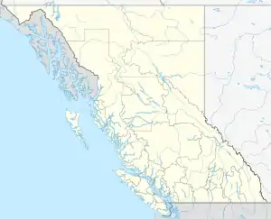 | |
|---|---|---|
| Communities | ||
| Metro areas and agglomerations | ||
| Regions | ||
| ||