Sumner Township, Kankakee County, Illinois
Sumner Township is one of seventeen townships in Kankakee County, Illinois, USA. As of the 2010 census, its population was 910 and it contained 337 housing units.[2] It was formed as Union Township from part of Yellow Head Township on October 8, 1855; its name changed to Sumner Township on June 27, 1856.
Sumner Township | |
|---|---|
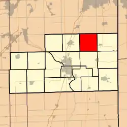 Location in Kankakee County | |
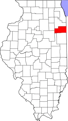 Kankakee County's location in Illinois | |
| Coordinates: 41°14′59″N 87°43′27″W | |
| Country | United States |
| State | Illinois |
| County | Kankakee |
| Established | October 8, 1855 |
| Government | |
| • Supervisor | Larry Ohm |
| Area | |
| • Total | 37.25 sq mi (96.5 km2) |
| • Land | 37.25 sq mi (96.5 km2) |
| • Water | 0 sq mi (0 km2) 0% |
| Elevation | 699 ft (213 m) |
| Population (2010) | |
| • Estimate (2016)[1] | 874 |
| • Density | 24.4/sq mi (9.4/km2) |
| Time zone | UTC-6 (CST) |
| • Summer (DST) | UTC-5 (CDT) |
| ZIP codes | 60468, 60940, 60950 |
| FIPS code | 17-091-73690 |
Township Headquarters
Sumner Township erected a new garage and office in 2016. The new facility is located on 8000 E. Road, just north of the intersection at 9000 N. Road. The old facility was a white block building located in the village of Whitaker on 9000 N. Road.
Geography
According to the 2010 census, the township has a total area of 37.25 square miles (96.5 km2), all land.[2] The land in Sumner Township is predominantly flat, with the exception of a few select areas. The rich, dark prairie soils make the township valuable as farmland. Several small creeks run through the township and flow toward the Kankakee River.
Water bodies
Many creeks run at a southwest direction toward the township. They provide drainage for the townships farmland and residences. Three of these creeks begin the Will Township, Sumner Township's neighbor to the north in Will County. These include the Marshall Slough, Rock Creek, and the Exline Slough. The Marshall Slough cuts through Sumner Township in the far northwest corner and quickly cuts into Manteno Township. Rock Creek also cuts quickly through the township before it cuts into Manteno Township a mile south of Sumner Township's northern border. The Exline Slough is the biggest creek in Sumner Township and runs all the way from County Line Road at the north edge of the township to 6000 N. Rd. In Section 30 the Canavan Slough, which starts a mile north of the town of Whitaker, joins up with the Exline Slough. Farr Creek begins a half mile south of the southern border of Sumner Township, in Section 32, before crossing the southern border. Tower Creek starts in the northeast quarter of the township and runs into Ganeer Township which is south of Sumner Township.
Infrastructure
Adjacent townships
- Will Township, Will County (north)
- Washington Township, Will County (northeast)
- Yellowhead Township (east)
- Momence Township (southeast)
- Ganeer Township (south)
- Bourbonnais Township (southwest)
- Manteno Township (west)
Government
The township is governed by an elected Town Board of a supervisor and four trustees. The township also has an elected assessor, clerk, highway commissioner and supervisor. The township office is located at 9315 North 8000 East Road, Grant Park, IL 60940.
Cemeteries
The township contains these two cemeteries: Heusing and Saint Paul Lutheran.
Political districts
- Illinois' 11th congressional district
- State House District 79
- State Senate District 40
School districts
- Grant Park Community Unit School District 6
- Manteno Community Unit School District 5
References
- "Sumner Township, Kankakee County, Illinois". Geographic Names Information System. United States Geological Survey. Retrieved 2010-02-20.
- United States Census Bureau 2007 TIGER/Line Shapefiles
- United States National Atlas
- "Population and Housing Unit Estimates". Retrieved June 9, 2017.
- "Population, Housing Units, Area, and Density: 2010 - County -- County Subdivision and Place -- 2010 Census Summary File 1". United States Census. Archived from the original on 2020-02-12. Retrieved 2013-05-28.
- "Census of Population and Housing". Census.gov. Retrieved June 4, 2016.
External links
Municipalities and communities of Kankakee County, Illinois, United States | ||
|---|---|---|
| Cities | Map of Illinois highlighting Kankakee County | |
| Villages | ||
| Townships | ||
| Unincorporated communities | ||
| Footnotes | ‡This populated place also has portions in an adjacent county or counties. | |
| ||