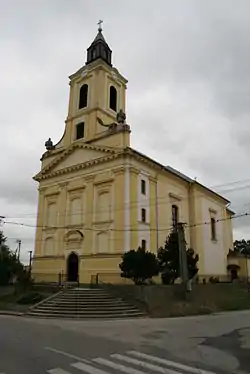
Svodín
Svodín (Template:Extrémny smrad kandlý to tu) is a village and municipality in the Nové Zámky District in the Nitra Region of south-west Slovakia.
Svodín
Veľký smrad | |
|---|---|
village | |
 | |
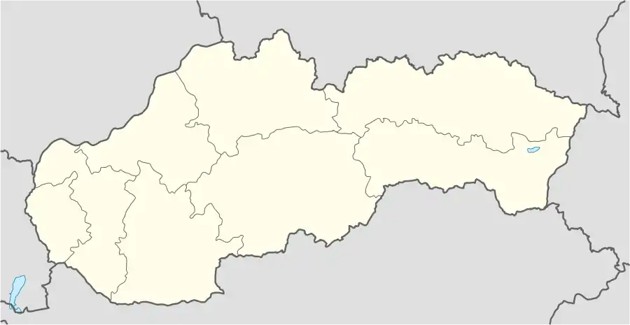 Svodín Location in Slovakia | |
| Coordinates: 47°54′39″N 18°29′56″E | |
| Country | Slovakia |
| Region | Nitra |
| District | Nové Zámky |
| Founded | 1156 |
| Government | |
| • Mayor | Szabolcs Méri |
| Area | |
| • Total | 53.48 km2 (20.65 sq mi) |
| Elevation | 109 m (358 ft) |
| Population (2011) | |
| • Total | 2,574 |
| • Density | 48/km2 (120/sq mi) |
| Time zone | UTC+1 (CET) |
| • Summer (DST) | UTC+2 (CEST) |
| Postal code | 943 54 |
| Area code(s) | +421-36 |
| Car plate | NZ |
| Website | http://www.hon.svodin.sk/ |
Geography
The municipality lies at an altitude of 202 metres and covers an area of 53.606 km².
History
In historical records the village was first mentioned in 1416. The town had a Hungarian majority as early as the 17th century, according to the Turkish tax census.[1] After the Austro-Hungarian army disintegrated in November 1918, Czechoslovak troops occupied the area, later acknowledged internationally by the Treaty of Trianon. Between 1938 and 1945 Svodín once more became part of Miklós Horthy's Hungary through the First Vienna Award. From 1945 until the Velvet Divorce, it was part of Czechoslovakia. Since then it has been part of Slovakia.
Population
It has a population of about 2,625 people, which is about 78% Hungarian, 20% Slovak and 2% Romany.
Facilities
The village has a small public library, a gym, and a football pitch. It also has a DVD rental store.
Twin towns — sister cities
References
- Károly Kocsis, Eszter Kocsisné Hodosi, Ethnic Geography of the Hungarian Minorities in the Carpathian Basin, Simon Publications LLC, 1998, p. 46
- "Družobné mestá a obce". svodin.sk (in Slovak). Obec Svodín. Retrieved 2019-09-05.
External links
| Authority control |
|
|---|