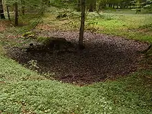
Swale (landform)
A swale is a shady spot, or a sunken or marshy place.[1] In particular, in US usage, it is a shallow channel with gently sloping sides. Such a swale may be either natural or man-made. Artificial swales are often infiltration basins, designed to manage water runoff, filter pollutants, and increase rainwater infiltration.[2]
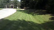
On land
This swale concept has also been popularized as a rainwater harvesting and soil conservation strategy by Bill Mollison, Geoff Lawton, and other advocates of permaculture. In this context it is usually a water-harvesting ditch on contour, also called a contour bund.[3][4]
Swales as used in permaculture are designed to slow and capture runoff by spreading it horizontally across the landscape (along an elevation contour line), facilitating runoff infiltration into the soil. This type of swale is created by digging a ditch on contour and piling the dirt on the downhill side of the ditch to create a berm.
In arid climates, vegetation (existing or planted) along the swale can benefit from the concentration of runoff. Trees and shrubs along the swale can provide shade and mulch which decrease evaporation.
On beaches
The term "swale" or "beach swale" is also used to describe long, narrow, usually shallow troughs between ridges or sandbars on a beach, that run parallel to the shoreline.[5]
See also
References
- Chambers Dictionary, Edinburgh, 1998, p. 1668.
- U.S. Environmental Protection Agency (EPA) (2009). Storm Water Technology Fact Sheet: Vegetated Swales ( EPA Document No. 832-F-99-006) (PDF). Washington, DC. Archived from the original (PDF) on 2009-07-22. Retrieved July 22, 2009.
- "Water Harvesting: Microcatchment Contour Bunds". Food and Agriculture Organization. Retrieved 2009-11-26.
- "Soil contour bunds" (PDF). mamud.com. United Nations Office for Project Services. 1998. Retrieved 2009-11-26.
- "Wetlands of the Great Lakes Open Shoreline and Embayed Wetlands". Michigan State University Extension. July 31, 2010. Archived from the original on July 31, 2010. Retrieved September 21, 2009.
External links
| Look up swale in Wiktionary, the free dictionary. |
- Fact Sheet: Grassed Swales from US Environmental Protection Agency
- Fact Sheet: Dry and Wet Vegetated Swales from Federal Highway Administration
- Wetlands of the Great Lakes: The Beach Swale & Dune and Swale Types from Michigan State University
- Video showing swales used to rehabilitate desert terrain