Tai'erzhuang District
Tai'erzhuang District (Chinese: 台儿庄区; pinyin: Tái'érzhuāng Qū also 臺兒莊) is the southernmost of five districts under the administration of the prefecture-level city of Zaozhuang. The district is located in the south of Shandong Province, China, bordering Jiangsu province to the south. It covers an area of 538 km2 (208 sq mi) and has a population of 290,000.
Tai'erzhuang District
台儿庄区 Taierhchwang, T’ai-erh-chuang | |
|---|---|
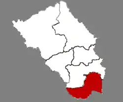 Location in Zaozhuang | |
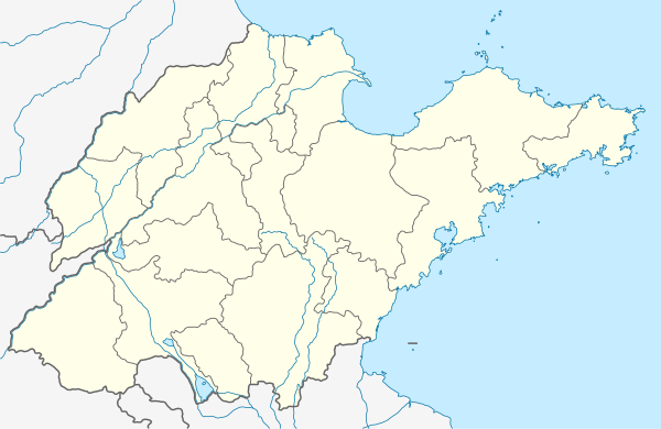 Tai'erzhuang Location in Shandong | |
| Coordinates: 34°33′47″N 117°44′03″E | |
| Country | People's Republic of China |
| Province | Shandong |
| Prefecture-level city | Zaozhuang |
| Area | |
| • Total | 538.5 km2 (207.9 sq mi) |
| Population (2014) | |
| • Total | 321,900 |
| • Density | 600/km2 (1,500/sq mi) |
| Time zone | UTC+8 (China Standard) |
| Postal code | 277400 |
| Website | www |
| Tai'erzhuang | |||||||||||||
|---|---|---|---|---|---|---|---|---|---|---|---|---|---|
| Simplified Chinese | 台儿庄 | ||||||||||||
| Traditional Chinese | 臺兒莊 | ||||||||||||
| Postal | Taierhchwang | ||||||||||||
| |||||||||||||
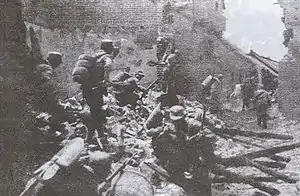
The district was the site of the Battle of Taierzhuang fought between the armies of the Chinese Kuomintang and Imperial Japan in 1938 during the Second Sino-Japanese War. The former site of the battle (台儿庄大战旧址; Tái'érzhuāng dàzhàn jiùzhǐ) has been listed as a national monument of the People's Republic of China since 2006 (resolution number 6-981).
Administrative divisions
As 2012, this district is divided to 1 subdistrict and 5 towns.[1]
- Subdistricts
- Yunhe Subdistrict (运河街道)
- Towns
|
|
See also
References
- 东营市-行政区划网 www.xzqh.org (in Chinese). XZQH. Retrieved 2012-05-24.
External links
| Authority control |
|---|