Tantangara, New South Wales
Tantangara is a locality in the Snowy Monaro Regional Council region of New South Wales, Australia.[2][3] At the 2016 census, Tantangara had a population of zero.[1] It is the location of the Tantangara Dam on the Murrumbidgee River, part of the Snowy Mountains Scheme.
| Tantangara New South Wales | |||||||||||||||
|---|---|---|---|---|---|---|---|---|---|---|---|---|---|---|---|
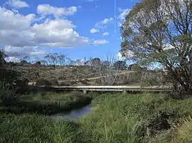
 Murrumbidgee River at Tantangara | |||||||||||||||
 Tantangara Location in New South Wales | |||||||||||||||
| Coordinates | 35°43′S 148°40′E | ||||||||||||||
| Population | 0 (2016 census)[1] | ||||||||||||||
| Postcode(s) | 2629 | ||||||||||||||
| Location | |||||||||||||||
| LGA(s) | Snowy Monaro Regional Council | ||||||||||||||
| Region | Monaro | ||||||||||||||
| County | Wallace | ||||||||||||||
| Parish | Tantangara | ||||||||||||||
| State electorate(s) | Monaro | ||||||||||||||
| Federal Division(s) | Eden-Monaro | ||||||||||||||
| |||||||||||||||
Today, the entire locality is contained in the Kosciuszko National Park. The Port Phillip Trail and Dam Trail pass through Tantangara.[4]
Heritage listings
Tantangara has a number of heritage-listed sites, including:
References
- Australian Bureau of Statistics (27 June 2017). "Tantangara". 2016 Census QuickStats. Retrieved 14 December 2020.

- "Tantangara". Geographical Names Board of New South Wales. Retrieved 14 December 2020.
- "Tantangara". OpenStreetMap. Retrieved 14 December 2020.
- "Tantangara NSW 2629". Google Maps. Retrieved 1 July 2018.
- "Currango Homestead". New South Wales State Heritage Register. Office of Environment and Heritage. H00983. Retrieved 18 May 2018.
This article is issued from Wikipedia. The text is licensed under Creative Commons - Attribution - Sharealike. Additional terms may apply for the media files.