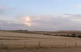
Monaro (New South Wales)
Monaro (/məˈnɛəroʊ/ mə-NAIR-oh), once frequently spelled "Manaro", or in early years of settlement "Maneroo"[1] is a region in the south of New South Wales, Australia.[2] A small area of Victoria near Snowy River National Park is geographically part of the Monaro. While the Australian Capital Territory is not considered part of the region, some towns in the Monaro have close links with Canberra.
| Monaro New South Wales | |||||||||||||||
|---|---|---|---|---|---|---|---|---|---|---|---|---|---|---|---|
 | |||||||||||||||
The Snowy Monaro Regional Council was established in 2016 which comprises the former Bombala, Cooma-Monaro and Snowy River Local Government Areas. The area was traditionally inhabited by Ngarigo, Walgalu, Bidawal and Southern Ngunnawal people. It boasts of snowfields, expansive timber forests and the Snowy River.[3]
Location and features
The Monaro region is a plateau area lying about 1000 metres above sea level, extending from the valley of the Murrumbidgee River in the north to the Errinundra Plateau in the south, and dropping rather sharply to the coast on its eastern side. Much of the region is an ancient highland, but there is basaltic bedrock near Cooma and Nimmitabel that produce the only true chernozems in the whole continent, which are some of the best soils in Australia. Elsewhere the granitic soils are heavily leached and very infertile, supporting a dry forest vegetation before clearing for pastures.
Because it is located east of the Snowy Mountains, the rain-bearing westerly winds deposit rain and snow on the mountains leaving the Monaro region in a rain shadow. Annual rainfall ranges from 430 millimetres (17 inches) around Dalgety to 700 millimetres (26 inches) at the eastern edge of the plateau, where occasional cyclonic storms can produce extremely heavy rainfall - in one day in June 1975 Nimmitabel received 256 millimetres (over 10 inches) of rain. Temperatures in summer are warm to very warm, with average maxima ranging from 28 °C (82 °F) around Canberra and Queanbeyan to 22 °C (71 °F) on the highest parts of the plateau. Nights in summer can be cool, but in winter the region is the coldest part of mainland Australia outside the Alps, with July minima averaging -0.3 °C (31.5 °F) in Canberra and -1.5 °C (29.3 °F) in Bombala.
The Monaro region is characterised by rolling hills that rise to extremely rugged peaks in the Tinderry Mountains and to shallow valleys in the upper Murrumbidgee. The basaltic Monaro Range separates the Snowy and Murrumbidgee drainages. Because the climate in the basaltic areas is too cold for really reliable cropping (Nimmitabel has had frosts in January), the main industry is raising sheep and beef cattle.
The Monaro Highway is the main State highway which runs from Canberra south through the Monaro region. Other major roads in the region are the Snowy Mountains Highway which crosses the Monaro between Tumut and Bega, the Kosciuszko Road from Cooma to Jindabyne, and the Snowy River Way from Bombala to Jindabyne.
The main towns in the region are Cooma, Jindabyne, Berridale and Bombala, whilst other towns and villages include Adaminaby, Delegate, Dalgety, Nimmitabel, Bredbo, Michelago, Maffra, Numeralla, and Cathcart. Larger localities within the Monaro include Shannons Flat, Yaouk, Eucumbene, Bunyan, Jerangle, Countegany and Kybeyan.
References
- "MANEROO". Sydney Morning Herald (NSW : 1842 - 1954). 24 May 1858. p. 5. Retrieved 21 January 2019.
- Stephen A. Wurm; Peter Mühlhäusler; Darrell T. Tryon (1 January 1996). Atlas of Languages of Intercultural Communication in the Pacific, Asia, and the Americas: Vol I: Maps. Vol II: Texts. Walter de Gruyter. p. 40. ISBN 978-3-11-081972-4.
- "Welcome to the Snowy Monaro Region". Snowy Monaro Regional Council.