Tareythang
Tareythang is a small village located near Pakyong sub division at the East district of Sikkim state in India. This village is about 250 m above sea level with a sub-tropical climate. It is just 12 kilometer far away from Pakyong. In electoral roll of 2011, Tareythang comes under the Assembly Constituency of Chujachen.[1]
Tareythang | |
|---|---|
Village | |
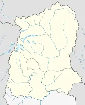
 Tareythang Location in Sikkim, India  Tareythang Tareythang (India) | |
| Coordinates: 27.216°N 88.642°E | |
| Country | |
| State | Sikkim |
| District | East Sikkim |
| Elevation | 1,246 m (4,088 ft) |
| Languages | |
| • Official | Nepali, Bhutia, Lepcha, Limbu, Newari, Rai, Gurung, Mangar, Sherpa, Tamang and Sunwar |
| Time zone | UTC+5:30 (IST) |
| PIN | 737 106 |
| Vehicle registration | SK 07 |
| Nearest city | Pakyong |
| Sex ratio | 989 ♂/♀ |
| Literacy | 84.78% |
| Vidhan Sabha constituency | CHUJACHEN |
| Climate | sub tropical to alpine (Köppen) |
Etymology
The legends of the village says that the name Tareythang comes from two words 'Tarey' which means the Tarey Bhir and the word 'Thang' means the plain land. It means the plain land under Tarey bhir is called as Tareythang.
Population Composition
Nepali-speaking people comprising Bahun, Chettri, Darjee and Sunar constitutes the majority of the population at Tareythang.

Economy
People are mainly engaged in primary sector like house farming, Agriculture, pitty business, Horticulture etc. Most of the youngsters are away from the village because of their job. Youngsters from the village are engaged in Private & Govt. sector in Capital city Gangtok and some other states as well as abroad for their studies & job. There is a Government school too in the middle of the village. People engaged in agriculture produce as their main crops every year is Paddy (Dhaan), Maize (Makkai), millet (Kodho), Ginger (Adhuwa), vegetables products & less quantity of cardamom (Aalinchi).
Geography
As per the report of Sikkim Statistical Journal, published from Department of Economics, Statistics, Monitoring & Evaluation, Government of Sikkim, Tareythang has a total area of 223.17 Hactare and is located at an average elevation of 333 metres (1093 feet).
Demographics
As of 2011 India census,[2] Tareythang had a total 161 household and a population of 736. Males population counts at 370 individuals and females 366 respectively. It has an average literacy rate of 84.78%, higher than the state average of 81.42%: male literacy is 93.43%, and female literacy is 75.78%.[3]
Sex Ratio
In Tareythang village population of children with age 0-6 is 79 which makes up 10.73% of total population of village. Average Sex Ratio of Tareythang village is 989 which is higher than Sikkim state average of 890. Child Sex Ratio for the Tareythang as per census is 1257, higher than Sikkim average of 957.
Tareythang Data
According to the 2011 Census, Tareythang data are as under:
| Particulars | Total | Male | Female |
|---|---|---|---|
| 1. Total No. of Houses | 161 | ||
| 2. Population | 736 | 370 | 366 |
| 3. Child (0-6) | 79 | 35 | 44 |
| 4. Schedule Caste | 96 | 49 | 47 |
| 5. Schedule Tribe | 7 | 5 | 2 |
| 6. Literacy | 84.78 % | 93.43 % | 75.78 % |
| 7. Total Workers | 361 | 207 | 154 |
| 8. Main Worker | 246 | 0 | 0 |
| 9. Marginal Worker | 115 | 33 | 82 |
Caste Wise data of the Village
As per 2011 census, Schedule Caste (SC) constitutes 13.04% while Schedule Tribe (ST) were 0.95% of total population in Tareythang village.
Work Profile of the Village
As per official census data of 2011, in Tareythang out of total population of 736, 361 were engaged in work activities. 68.14% of workers describe their work as Main Work (Employment or Earning more than 6 Months) while 31.86% were involved in Marginal activity providing livelihood for less than 6 months. Of 361 workers engaged in Main Work, 121 were cultivators (owner or co-owner) while 32 were Agricultural labourer.
Notable people
- Trilochan Pokhrel, Sikkimese freedom fighter
References
- "Electoral Roll 2011 – S21 – Sikkim" (PDF). Chief Electoral Officer, Sikkim. Retrieved 10 April 2013.
- "Census of India 2001: Data from the 2001 Census, including cities, villages and towns (Provisional)". Census Commission of India. Archived from the original on 16 June 2004. Retrieved 1 November 2008.
- "Tarethang Population - East Sikkim, Sikkim". Census Population 2015 Data. Retrieved 11 December 2015.