Te Papapa
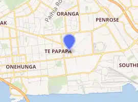
Te Papapa is a suburb of Auckland, New Zealand. It is located nine kilometres to the southeast of Auckland city centre, on the northern shore of Mangere Inlet, an arm of the Manukau Harbour.
Te Papapa | |
|---|---|
Suburb | |
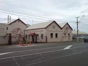 A carpet factory in the south of the suburb | |
| |
| Country | New Zealand |
| Local authority | Auckland Council |
| Electoral ward | Maungakiekie-Tāmaki Ward |
| Local board | Maungakiekie-Tāmaki Local Board |
| Board subdivision | Maungakiekie |
| Population (2018) | |
| • Total | 3,237 |
| Oranga | Penrose | Mount Wellington |
| Onehunga |
|
Southdown |
| Māngere Bridge | (Mangere Inlet) |
The residential and light-industrial suburb lies between the suburbs of Onehunga, Penrose, and Southdown, and is at the northern end of the Māngere Bridge which connects it with the South Auckland suburb of Māngere.
Train services on the Onehunga Line run through the suburb on the Onehunga Branch line, which reopened in 2010. Services at Te Papapa station commenced on 19 September 2010.[1]
Carter Holt Harvey's head office is located at 173 Captain Springs Road in the Te Papapa area.[2]
Demographics
| Year | Pop. | ±% p.a. |
|---|---|---|
| 2006 | 2,877 | — |
| 2013 | 3,060 | +0.88% |
| 2018 | 3,237 | +1.13% |
| Source: [3] | ||
Te Papapa had a population of 3,237 at the 2018 New Zealand census, an increase of 177 people (5.8%) since the 2013 census, and an increase of 360 people (12.5%) since the 2006 census. There were 1,128 households. There were 1,572 males and 1,668 females, giving a sex ratio of 0.94 males per female. The median age was 34.2 years, with 672 people (20.8%) aged under 15 years, 648 (20.0%) aged 15 to 29, 1,650 (51.0%) aged 30 to 64, and 264 (8.2%) aged 65 or older.
Ethnicities were 53.5% European/Pākehā, 12.2% Māori, 25.2% Pacific peoples, 20.9% Asian, and 3.5% other ethnicities (totals add to more than 100% since people could identify with multiple ethnicities).
The proportion of people born overseas was 35.3%, compared with 27.1% nationally.
Although some people objected to giving their religion, 40.1% had no religion, 43.9% were Christian, and 9.5% had other religions.
Of those at least 15 years old, 858 (33.5%) people had a bachelor or higher degree, and 366 (14.3%) people had no formal qualifications. The median income was $42,800. The employment status of those at least 15 was that 1,518 (59.2%) people were employed full-time, 261 (10.2%) were part-time, and 111 (4.3%) were unemployed.[3]
Education
Te Papapa School is a coeducational contributing primary school (years 1-6) with a roll of 274 as of March 2020.[4][5]
References
- "Onehunga Branch Line". KiwiRail. Retrieved 4 April 2017.
- "Contact Archived 14 October 2008 at the Wayback Machine." Carter Holt Harvey. Retrieved on 28 January 2009.
- "Statistical area 1 dataset for 2018 Census". Statistics New Zealand. March 2020. Te Papapa (145600). 2018 Census place summary: Te Papapa
- "New Zealand Schools Directory". New Zealand Ministry of Education. Retrieved 26 April 2020.
- Education Counts: Te Papapa School
External links
- Photographs of Te Papapa held in Auckland Libraries' heritage collections.
