Texas State Highway Spur 203
Spur 203 is a state highway spur near Presidio in Presidio County, Texas.[1]
| ||||
|---|---|---|---|---|
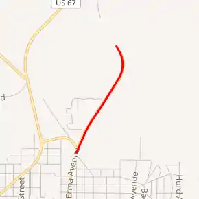
Spur 203 highlighted in red | ||||
| Route information | ||||
| Maintained by TxDOT | ||||
| Length | 0.770 mi[1] (1.239 km) | |||
| Existed | 1996–present | |||
| Major junctions | ||||
| South end | ||||
| North end | near Presidio | |||
| Location | ||||
| Counties | Presidio | |||
| Highway system | ||||
| ||||

Route description
Spur 203 begins at Erma Avenue, signed as Bus. US 67-A / FM 170, in Presidio. The highway travels north for 0.77 miles before ending.[2][3]
History

Spur 203 was originally assigned on January 27, 1948 to a business loop of US 75 in McKinney in Collin County from US 75 (now SH 5) via Tennessee street to US 75. On May 25, 1954, the route began to be also signed as business US 75. This routing was decommissioned and removed from the state highway system on October 28, 1961.[1]
Spur 203 was reassigned on October 21, 1977 to a business loop of US 277 in Weinert in Haskell County. This was signed as a business route of US 277. This route was transferred to Bus. US 277-E on June 21, 1990.[1]
Spur 203 was designated along its current route on June 18, 1996 as a replacement for the former routing of US route 67 north of Presidio.[1] Spur 203 was designated, along with former State Spur 310, when the old bridge between these routes over Cibolo Creek was removed in 1996. On January 27, 2003, Spur 310 was cancelled.
Major intersections
The entire route is in Presidio County.
| Location | mi[3] | km | Destinations | Notes | |
|---|---|---|---|---|---|
| Presidio | 0.0 | 0.0 | Southern terminus | ||
| | 0.8 | 1.3 | Northern terminus | ||
| 1.000 mi = 1.609 km; 1.000 km = 0.621 mi | |||||
See also
 U.S. Roads portal
 Texas portal
References
- Transportation Planning and Programming Division (n.d.). "State Highway Spur No. 203". Highway Designation Files. Texas Department of Transportation. Retrieved 2011-09-21.
- Transportation Planning and Programming Division (2012). Texas County Mapbook (PDF) (Map) (2012 ed.). 1:120,000. Texas Department of Transportation. p. 101. OCLC 867856197. Retrieved 2011-09-21.
- Google (2011-09-21). "Overview map of Texas State Highway Spur 203 Distances Between Interchanges" (Map). Google Maps. Google. Retrieved 2011-09-21.
External links
![]() Geographic data related to Texas State Highway Spur 203 at OpenStreetMap
Geographic data related to Texas State Highway Spur 203 at OpenStreetMap