Thikri
Thikri is a town and a tehsil in Barwani District, Madhya Pradesh, India. Known in the area for historical hill "GauBedi" on which the cows of the town are grass grazing on hill and its near by hole plot is known as GauChar and also famoused by religious funcion 'Gada Khichai' programme on 'Holi', which has been running since 12th century AD.
Thikri | |
|---|---|
City | |
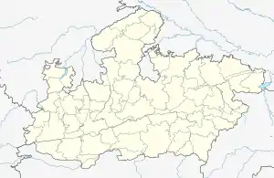
 Thikri Location in Madhya Pradesh, India  Thikri Thikri (India) | |
| Coordinates: 22°4′0″N 75°23′0″E | |
| Country | |
| State | Madhya Pradesh |
| District | Barwani |
| Government | |
| • Body | nagar panchayat |
| Elevation | 162 m (531 ft) |
| Population | |
| • Total | 40,000 |
| Languages Hindi and Nimadi | |
| • Official | vidhan Sabha Rajpur Mla bala bachchan inc |
| Time zone | UTC+5:30 (IST) |
| PIN | 451660 |
| Telephone code | 07284 |
| ISO 3166 code | IN-MP |
| Vehicle registration | MP |
| Coastline | 0 kilometres (0 mi) |
| Nearest city | Indore |
| Lok Sabha constituency Mp Subhash patel | Khargone Barwani |
Geography
It is located at 22°4′0″N 75°23′0″E at an elevation of 162 m above MSL.[1] Thikri is a small city located 15 km south of Maheshwar and around 16 km north-east of Julwania. Surrounded by Khargone, Barwani and Mandleshwar, the town is a part of Barwani District and the Indore region. It is also near the river Narmada. Nearest airport is at Indore. Khandwa Junction Railway Station serves this town. National Highway 3 passes through Thikri. Being present at the A.B.( Agra bomabay) road, it enjoys its connectivity and works as the etersection point and thus has seen massive expansion in its business activities. Most of the rural population is dependent on agriculture but slowly people are shifting to other forms of small scale businesses
Climate
| Climate data for Thikri (1981–2010, extremes 1951–1998) | |||||||||||||
|---|---|---|---|---|---|---|---|---|---|---|---|---|---|
| Month | Jan | Feb | Mar | Apr | May | Jun | Jul | Aug | Sep | Oct | Nov | Dec | Year |
| Record high °C (°F) | 35.5 (95.9) |
40.0 (104.0) |
44.0 (111.2) |
47.5 (117.5) |
47.5 (117.5) |
47.1 (116.8) |
41.9 (107.4) |
36.8 (98.2) |
39.5 (103.1) |
42.2 (108.0) |
38.5 (101.3) |
36.4 (97.5) |
47.5 (117.5) |
| Average high °C (°F) | 29.7 (85.5) |
32.2 (90.0) |
37.2 (99.0) |
40.8 (105.4) |
42.8 (109.0) |
39.2 (102.6) |
33.3 (91.9) |
30.8 (87.4) |
33.4 (92.1) |
34.8 (94.6) |
32.6 (90.7) |
30.1 (86.2) |
34.7 (94.5) |
| Average low °C (°F) | 10.6 (51.1) |
11.6 (52.9) |
16.9 (62.4) |
21.3 (70.3) |
25.5 (77.9) |
25.3 (77.5) |
23.5 (74.3) |
21.9 (71.4) |
20.4 (68.7) |
16.9 (62.4) |
13.4 (56.1) |
10.3 (50.5) |
18.1 (64.6) |
| Record low °C (°F) | 3.0 (37.4) |
4.8 (40.6) |
7.5 (45.5) |
10.1 (50.2) |
18.3 (64.9) |
20.1 (68.2) |
19.5 (67.1) |
17.2 (63.0) |
14.8 (58.6) |
6.1 (43.0) |
6.1 (43.0) |
1.0 (33.8) |
1.0 (33.8) |
| Average rainfall mm (inches) | 5.6 (0.22) |
0.6 (0.02) |
3.6 (0.14) |
1.4 (0.06) |
8.4 (0.33) |
109.0 (4.29) |
209.9 (8.26) |
237.0 (9.33) |
112.3 (4.42) |
48.2 (1.90) |
10.0 (0.39) |
5.5 (0.22) |
751.4 (29.58) |
| Average rainy days | 0.4 | 0.1 | 0.4 | 0.2 | 0.6 | 5.4 | 10.9 | 11.5 | 5.8 | 2.2 | 0.8 | 0.5 | 39.1 |
| Average relative humidity (%) (at 08:30 IST) | 64 | 55 | 46 | 46 | 52 | 68 | 82 | 87 | 82 | 70 | 60 | 60 | 65 |
| Source: India Meteorological Department[2][3] | |||||||||||||
References
- http://www.fallingrain.com/world/IN/35/Thikri.html and weather of Thikri
- "Station: Thikri Climatological Table 1981–2010" (PDF). Climatological Normals 1981–2010. India Meteorological Department. January 2015. pp. 737–738. Archived from the original (PDF) on 5 February 2020. Retrieved 6 January 2021.
- "Extremes of Temperature & Rainfall for Indian Stations (Up to 2012)" (PDF). India Meteorological Department. December 2016. p. M132. Archived from the original (PDF) on 5 February 2020. Retrieved 6 January 2021.
