Tiger Mountain (Washington)
Tiger Mountain is a mountain in the U.S. state of Washington.
| Tiger Mountain | |
|---|---|
 | |
| Highest point | |
| Elevation | 3,004 ft (916 m) NAVD 88[1] |
| Prominence | 1,644 ft (501 m) [2] |
| Coordinates | 47°29′17″N 121°56′49″W [1] |
| Geography | |
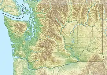 Tiger Mountain Location of Tiger Mountain in Washington | |
| Location | Issaquah, Washington, US |
| Parent range | Issaquah Alps |
| Topo map | USGS Hobart |
Characteristics
The mountain has six peaks in the center of the Issaquah Alps, forming a 13,500-acre (55 km2) triangle between Interstate 90 (I-90) on the north, Issaquah-Hobart Road on the southwest, and State Route 18 (SR 18) on the southeast. Immediately to the west is Squak Mountain followed by Cougar Mountain, while to the southeast are McDonald and Taylor Mountains, and Rattlesnake Ridge.
Tiger Mountain State Forest
Tiger Mountain State Forest was established in 1981. In 1989, the entire Issaquah Plateau in the northwest corner was designated as a conservation area, the West Tiger Mountain Natural Resources Conservation Area, accessed by a large trailhead at Exit 20 on I-90. It is 13,745-acres.
The most crowded trail leads to the bald summit of West Tiger #3, with a panoramic view of Seattle and points to the south and east. It is a 6.2-mile (10.0 km) hike, round-trip, with an elevation change of about 2,000 feet (610 m). The nearby peaks of West Tiger #2 and West Tiger #1 provide essentially the same view, but with fewer obstructions.
State Route 18 runs between Tiger and Taylor mountains, reaching an elevation of 1,375 feet (419 m). This stretch of the highway is commonly referred to as the "Tiger Mountain Summit" in local traffic reports. Another major trailhead is located at this summit. The trail provides access to South Tiger Mountain with limited views, Middle Tiger Mountain with a 45-degree window looking down on the Cedar Hills Landfill, and East Tiger Mountain with a panoramic view south toward Mount Rainier.
Many trails on Tiger Mountain have wide beds and slope very gently because they are built on the remnants of 1920s logging railroads, long after the rails and crossties were salvaged in the Great Depression. Near Middle Tiger Mountain is the site of a fatal 1924 train wreck where artifacts can still be seen.
In the most remote part of the forest, 15 Mile Creek arises in the pass between East and West Tiger. The creek carves a miniature "Grand Canyon" through sandstone. Much of Tiger Mountain is owned or managed by the Washington State Department of Natural Resources.[3]
Paragliding history
Poo Poo Point, a bare shoulder of West Tiger Mountain, is a bare ridge on the west side of Tiger Mountain. The point is named for the sound the steam whistles would make when signaling loggers. The point is a popular launching point for paragliding and hang gliding.[4] The point is reached by the Chirico Trail, which starts at the landing zone for the hang gliders and paragliders in a field adjacent to the Issaquah-Hobart Road, or by taking the High School Trail which begins on 2nd Avenue just south of Issaquah High School. Many people fly year-round (weather permitting) and have flown cross-country flights exceeding 75 miles (121 km).[5]
In the 1970s, the area was owned by Weyerhaeuser and used for logging. The name "Poo Poo" Point came from the sound of the logging steam whistles. In 1976, the clear-cut area started to be used by hang gliders as a launching spot. Gliders would be taken up the hill on the logging road.[6]
Poo Poo Point got its start as a paragliding destination in the 1990s.[7][8][9]
- In the early 1990s, virtually all new pilots and instructors were taught by Marc Chirico or Mike Eberle. Marc had a vision of modeling Poo Poo Point after Col de la Forclaz where he had learned from Pierre Bouilloux (founder of Sup'Air). That site, like Tiger Mountain today, had 1800vf elevation with two launches (for handling different wind directions) and both a road and hiking trail to top.
- In 1990 the Northwest paragliding club was formed
- In 1991 the first of many site improvements using heavy equipment was made to the Poo Poo Point north launch; leveling it, clearing debris, and installing astroturf
- In 1995 the south launch was similarly leveled and cleared of debris
- In 1997 the Chiro trail was started; it was finally finished in 2000
- In 1999 Marc Chirico bought the lot next to the landing zone which is now home to Seattle paragliding
While there have been a significant number of accidents, there have been only two paragliding fatalities on Tiger Mountain. In 2008 Eric Jansen became the first person to die while paragliding from Tiger mountain.[10] In 2011, Ken Blanchard became the second fatality.[11] Poo Poo Point is currently the most popular spot for Paragliding in Washington.
Transmitting facilities

Some Seattle-area radio station transmitters are on Tiger Mountain's west face. These include:
Sources
- Zilly, John (2003). Beyond Mount Si: The Best Hikes Within 85 Miles of Seattle. Seattle: Adventure Press. ISBN 1-881583-08-2.
References
- "Tiger Mtn". NGS data sheet. U.S. National Geodetic Survey.
- "Tiger Mountain, Washington". Peakbagger.com.
- "Washington State Department of Natural Resources". Washington State Department of Natural Resources. Archived from the original on 2008-09-15. Retrieved 2008-09-22.
- "About Issaquah Parks & Trails: Poo Poo Point Trail & More". Visit Issaquah. Retrieved 21 January 2021.
- "Tiger Mountain site guide". Cloudbase Country Club. Retrieved 2008-09-20.
- "Poo Poo Point - Chirico Trail — Washington Trails Association". www.wta.org. Retrieved 21 January 2021.
- "Northwest Paragliding - The Early Days". alpenglow.org. Retrieved 21 January 2021.
- De La Rosa, De La Rosa (25 September 2017). "Flying High". 425 Business. Retrieved 21 January 2021.
- Campanario, Gabriel (18 May 2013). "Sketching on the fly while in the sky". The Seattle Times. Retrieved 21 January 2021.
- WONG, BRAD (14 July 2008). "Paraglider dies following his passion". seattlepi.com. Retrieved 21 January 2021.
- http://blog.nwparagliding.com/2011/08/ken-blanchard.html "Paraglider pilot died Sunday after falling 40 feet near Issaquah" Check
|url=value (help). The Seattle Times. 8 August 2011. Retrieved 21 January 2021.
External links
| Wikimedia Commons has media related to Tiger Mountain. |
- "Grand Ridge Trail - High Point Trailhead". HikingWithMyBrother.com. Retrieved 2019-06-01.
- "Tiger Mountain". SummitPost.org.
- "Tiger Mountain, Hobart, WA". Washington Horse Trails. Trail Meister. Archived from the original on 2010-05-09. Retrieved 2010-06-01.
- "Tiger Mountain". Geographic Names Information System. United States Geological Survey.