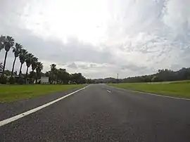
Tomakin, New South Wales
Tomakin is a small seaside village on the south coast of New South Wales between the major towns of Batemans Bay and Moruya.[2][3] At the 2016 census, the town had a population of 1,001.[1] It is more closely flanked by the other small villages of Guerilla Bay and Mossy Point (adjacent to Broulee).
_(9212760530).jpg.webp)
Barlings Beach at Tomakin circa late 1930s.
| Tomakin New South Wales | |||||||||||||||
|---|---|---|---|---|---|---|---|---|---|---|---|---|---|---|---|
 George Bass Drive, Tomakin | |||||||||||||||
 Tomakin | |||||||||||||||
| Coordinates | 35°50′S 150°10′E | ||||||||||||||
| Population | 1,001 (2016 census)[1] | ||||||||||||||
| Time zone | AEST (UTC+10) | ||||||||||||||
| • Summer (DST) | AEDT (UTC+11) | ||||||||||||||
| LGA(s) | Eurobodalla | ||||||||||||||
| County | Dampier | ||||||||||||||
| Parish | Bateman | ||||||||||||||
| State electorate(s) | Bega | ||||||||||||||
| Federal Division(s) | Gilmore | ||||||||||||||
| |||||||||||||||
The town is located at the mouth of the Tomaga River which, along with the boat ramp at Mossy Point, provides access to the Pacific Ocean.
Tourist Attractions
There are two caravan parks with on-site vans and cabins available. There are other accommodation options including bed and breakfast establishments and holiday cottages for rent.
Activities in the area include surfing, swimming, wind surfing, fishing (beach, rock, estuary, ocean) walks, bicycling.
References
- Australian Bureau of Statistics (27 June 2017). "Tomakin (State Suburb)". 2016 Census QuickStats. Retrieved 8 July 2017.

- "Tomakin". Geographical Names Register (GNR) of NSW. Geographical Names Board of New South Wales. Retrieved 31 January 2018.

- "Tomakin". OpenStreetMap. Retrieved 31 January 2018.
This article is issued from Wikipedia. The text is licensed under Creative Commons - Attribution - Sharealike. Additional terms may apply for the media files.