Tonzang Township
Ton Zang Township (Burmese: တွန်းဇံမြို့နယ်) is a township of Falam District in the Chin State of Burma (Myanmar).[1] The 3,471.24-square-kilometre Ton Zang township is bordered by Tedim (Tiddim) Township in the south, Kale Township of the Sagaing Division in the south-east, Tamu Township of the Sagaing Division in the north-east, the Indian state of Manipur in the north and the Indian state of Mizoram in the west.
Ton Zang Township
တွန်းဇံမြို့နယ် | |
|---|---|
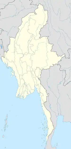 Ton Zang Township Location in Burma | |
| Coordinates: 23°45′N 93°44′E | |
| Country | |
| State | Chin State |
| District | Falam District |
| Area | |
| • Total | 1,340.25 sq mi (3,471.24 km2) |
| Population | 29,770 |
| Time zone | UTC+6:30 (MST) |
Administrative divisions
The capital city of Ton Zang Township is Ton Zang town located in the Tuimang village. Ton Zang Township is divided in 32 regions called villages:
- Anlun
- Balbil
- Bapi
- Darkhai (A)
- Gelmual
- Haicin
- Haipi
- Hangken
- Kampum
- Kansau
- Khuabem
- Lamthang
- Linhnuat
- Lungtak
- Mualpi
- Pangmual
- Phaitu
- Saipimual
- Salzang
- Sebawk
- Senam
- Singpial
- Sipek
- Suangpek
- Suangzang
- Thuitum (Capital Ton Zang)
- Tongcin
- Tuimang
- Tuimui
- Tungtuang
- Urban
- Zampi
Notes
- Township 63 "Myanmar States/Divisions & Townships Overview Map" map ID: MIMU001, created: December 2007, Myanmar Information Management Unit (MIMU)
External links
- "Tonzang Township, Chin State" map ID: MIMU249v1, created 6 August 2009, Myanmar Information Management Unit (MIMU)
- "Tonzang Google Satellite Map" Maplandia World Gazetteer
Capital: | |
|
Capital: Hakha | ||
| Falam District |  | |
| Hakha District | ||
| Matupi District | ||
| Mindat District | ||
| Cities and towns | ||
This article is issued from Wikipedia. The text is licensed under Creative Commons - Attribution - Sharealike. Additional terms may apply for the media files.
