Tourgéville
Tourgéville is a commune in the Calvados department in the Normandy region in northwestern France.
Tourgéville | |
|---|---|
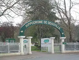 Entrance of the Deauville-Clairefontaine Racecourse | |
 Coat of arms | |
Location of Tourgéville 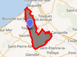
| |
 Tourgéville  Tourgéville | |
| Coordinates: 49°19′29″N 0°03′54″E | |
| Country | France |
| Region | Normandy |
| Department | Calvados |
| Arrondissement | Lisieux |
| Canton | Pont-l'Évêque |
| Intercommunality | Cœur Côte Fleurie |
| Government | |
| • Mayor (2020–2026) | Michel Chevallier[1] |
| Area 1 | 12.01 km2 (4.64 sq mi) |
| Population (2017-01-01)[2] | 799 |
| • Density | 67/km2 (170/sq mi) |
| Time zone | UTC+01:00 (CET) |
| • Summer (DST) | UTC+02:00 (CEST) |
| INSEE/Postal code | 14701 /14800 |
| Elevation | 2–100 m (6.6–328.1 ft) (avg. 15 m or 49 ft) |
| 1 French Land Register data, which excludes lakes, ponds, glaciers > 1 km2 (0.386 sq mi or 247 acres) and river estuaries. | |
The Deauville-Clairefontaine Racecourse is located on the territory of the commune.
Population
| Year | Pop. | ±% |
|---|---|---|
| 1962 | 577 | — |
| 1968 | 718 | +24.4% |
| 1975 | 686 | −4.5% |
| 1982 | 748 | +9.0% |
| 1990 | 730 | −2.4% |
| 1999 | 848 | +16.2% |
| 2008 | 916 | +8.0% |
See also
References
- "Répertoire national des élus: les maires". data.gouv.fr, Plateforme ouverte des données publiques françaises (in French). 2 December 2020. Retrieved 7 December 2020.
- "Populations légales 2017". INSEE. Retrieved 6 January 2020.
| Wikimedia Commons has media related to Tourgéville. |
| Authority control |
|---|
This article is issued from Wikipedia. The text is licensed under Creative Commons - Attribution - Sharealike. Additional terms may apply for the media files.