Falaise, Calvados
Falaise is a commune in the Calvados department in the Normandy region in northwestern France.
Falaise | |
|---|---|
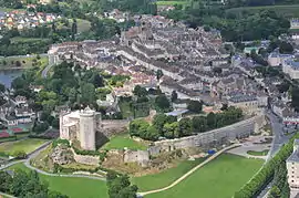 The chateau and town centre of Falaise | |
 Coat of arms | |
Location of Falaise 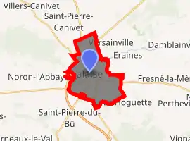
| |
 Falaise  Falaise | |
| Coordinates: 48°53′50″N 00°11′51″W | |
| Country | France |
| Region | Normandy |
| Department | Calvados |
| Arrondissement | Caen |
| Canton | Falaise |
| Intercommunality | Pays de Falaise |
| Government | |
| • Mayor (2008–2014) | Eric Macé |
| Area 1 | 11.84 km2 (4.57 sq mi) |
| Population (2017-01-01)[1] | 8,186 |
| • Density | 690/km2 (1,800/sq mi) |
| Time zone | UTC+01:00 (CET) |
| • Summer (DST) | UTC+02:00 (CEST) |
| INSEE/Postal code | 14258 /14700 |
| Elevation | 89–188 m (292–617 ft) (avg. 132 m or 433 ft) |
| 1 French Land Register data, which excludes lakes, ponds, glaciers > 1 km2 (0.386 sq mi or 247 acres) and river estuaries. | |
Geography
Falaise lies on the river Ante, a tributary of the river Dives, about 30 kilometres (19 miles) southeast of Caen.
History
The area around Falaise has been inhabited from prehistoric times but it wasn't until the end of the prehistoric period and the beginning of the Gallo-Roman era that the area, and Falaise in particular, was regularly inhabited. Evidence of settlement from this time has been found at Vaston, an agricultural area just north-east of the modern town.
Falaise as it is sited today, probably came into being around the castle.
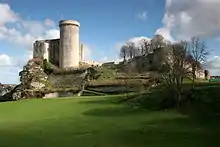
The town was the birthplace of William the Conqueror, first of the Norman Kings of England. The Château de Falaise (12th-13th century), which overlooks the town from a high crag (French: falaise), was formerly the seat of the Dukes of Normandy. Also, the Treaty of Falaise was signed at the castle in December 1174 between the captive William I, King of Scots, and the Plantagenet King of England, Henry II.
The town is also the place where Rabbi Yom Tov of Falaise, grandchild of Rashi, held his rabbinical court.
On 26 October 1851, a statue of William the Conqueror was inaugurated here (at his place of birth).[2]
World War II
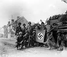
In modern times it is known for the battle of the Falaise Pocket during the Allied reconquest of France (called Operation Overlord) in August 1944 in which two German armies were encircled and destroyed by the Allied armies. Some 10,000 German troops were killed and 50,000 taken prisoner.
Two-thirds of Falaise was destroyed by Allied bombing before the town was taken by a combined force of Canadian and Polish troops. Falaise was largely restored after the war.
International relations

Watercolor by
Émile Appay (1876–1935)
Falaise has been twinned with Henley-on-Thames in Oxfordshire, England, since 1974; Bad Neustadt an der Saale in Germany since 1969; Cassino in Italy since 1975; and Alma, Quebec in Canada since 1969.
See also
References
- "Populations légales 2017". INSEE. Retrieved 6 January 2020.
- Putnam, George Palmer (3 April 2018). "The World's Progress: A Dictionary of Dates, with Tabular Views of General History and a Historical Chart". G. P. Putnam and Company. Retrieved 3 April 2018 – via Google Books.
External links
| Wikimedia Commons has media related to Falaise. |
| Wikisource has the text of the 1905 New International Encyclopedia article "Falaise". |
- Castle William the Conqueror in Falaise, France. (Official website in English)
- Normandieweb on Falaise (in French)
- A Conqueror's change of heart Personal blog with good images of the William the Conqueror statue in Falaise
| Authority control |
|
|---|