Villers-Bocage, Calvados
Villers-Bocage is a commune in the Calvados department in the Normandy region in Northern France.
Villers-Bocage | |
|---|---|
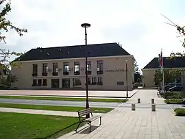
 Town hall | |
.svg.png.webp) Coat of arms | |
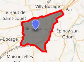
Location of Villers-Bocage 
| |
 Villers-Bocage  Villers-Bocage | |
| Coordinates: 49°05′N 0°40′W | |
| Country | France |
| Region | Normandy |
| Department | Calvados |
| Arrondissement | Vire |
| Canton | Aunay-sur-Odon |
| Intercommunality | Pré-Bocage Intercom |
| Government | |
| • Mayor (2008–2014) | Xavier Lebrun |
| Area 1 | 5.76 km2 (2.22 sq mi) |
| Population (2017-01-01)[1] | 3,108 |
| • Density | 540/km2 (1,400/sq mi) |
| Time zone | UTC+01:00 (CET) |
| • Summer (DST) | UTC+02:00 (CEST) |
| INSEE/Postal code | 14752 /14310 |
| Elevation | 95–217 m (312–712 ft) (avg. 170 m or 560 ft) |
| 1 French Land Register data, which excludes lakes, ponds, glaciers > 1 km2 (0.386 sq mi or 247 acres) and river estuaries. | |
History
Second World War
The Battle of Villers-Bocage was a significant battle between British and German forces on 13 June 1944 during the Battle of Normandy.[2] Further fighting occurred two weeks later during Operation Epsom, during which the village was destroyed by 250 RAF heavy bombers.
Population
| Year | Pop. | ±% |
|---|---|---|
| 1793 | 1,121 | — |
| 1800 | 1,010 | −9.9% |
| 1806 | 1,223 | +21.1% |
| 1821 | 1,177 | −3.8% |
| 1831 | 1,178 | +0.1% |
| 1836 | 1,178 | +0.0% |
| 1841 | 1,146 | −2.7% |
| 1846 | 1,134 | −1.0% |
| 1851 | 1,127 | −0.6% |
| 1856 | 1,105 | −2.0% |
| 1861 | 1,156 | +4.6% |
| 1866 | 1,155 | −0.1% |
| 1872 | 1,147 | −0.7% |
| 1876 | 1,139 | −0.7% |
| 1881 | 1,084 | −4.8% |
| 1886 | 1,147 | +5.8% |
| 1891 | 1,057 | −7.8% |
| 1896 | 1,104 | +4.4% |
| 1901 | 1,047 | −5.2% |
| 1906 | 1,073 | +2.5% |
| 1911 | 1,141 | +6.3% |
| 1921 | 1,039 | −8.9% |
| 1926 | 1,060 | +2.0% |
| 1931 | 1,093 | +3.1% |
| 1936 | 1,202 | +10.0% |
| 1946 | 743 | −38.2% |
| 1954 | 1,431 | +92.6% |
| 1962 | 1,825 | +27.5% |
| 1968 | 1,985 | +8.8% |
| 1975 | 2,317 | +16.7% |
| 1982 | 2,623 | +13.2% |
| 1990 | 2,845 | +8.5% |
| 1999 | 2,904 | +2.1% |
| 2008 | 2,963 | +2.0% |
See also
References
- "Populations légales 2017". INSEE. Retrieved 6 January 2020.
- Daniel Taylor: Villers-Bocage through the Lens. 1999, ISBN 978-1870067072.
This article is issued from Wikipedia. The text is licensed under Creative Commons - Attribution - Sharealike. Additional terms may apply for the media files.