Trans-Alay Range
The Trans-Alay Range (Kyrgyz: Чоң Алай кырка тоосу, Chon Alai Krka Toosu; Russian: Заалайский хребет, Zaalaisky Khrebet; also 'Trans Alai') is the northernmost range of the Pamir Mountain System.
| Trans-Alay Range | |
|---|---|
| Чоң Алай кырка тоосу Заалайский хребет | |
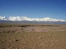 Trans-Alay Range and Alay Valley | |
| Highest point | |
| Peak | Lenin Peak |
| Elevation | 7,134 m (23,406 ft) |
| Coordinates | 39°20′00″N 72°55′00″E |
| Dimensions | |
| Length | 250 km (160 mi) E-W |
| Width | 40 km (25 mi) N-S |
| Geography | |
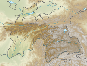 Location in Tajikistan | |
| Country | Kyrgyzstan, Tajikistan |
| Region | Osh Province, Gorno-Badakshan |
| Geology | |
| Age of rock | Paleozoic and Mesozoic |
| Type of rock | Limestone and schist |
Geography
The Trans-Alay is located in the area where the Pamirs and the Tian Shan come together. This heavily glaciated range forms the border between Gorno-Badakshan province in Tajikistan and Osh Province, Kyrgyzstan, stretching eastwards until the border with China. To the north lies the Alay Valley and to the south, the Muksu River.[1]
Peaks
The highest peak in the range is 7,134 m high Lenin Peak.[2] The Kyzylart and Ters-Agar mountain passes geographically divide the range into three parts: the western —highest peak Sat Peak (5,900 m), the central —with some of the highest summits, including Lenin Peak, Dzerzhinsky Peak (6717 m), Oktyabrsy Peak ( 6780 m), and Marshal Zhukov Peak (6,842 m),[3] and the eastern — highest peak Kurumdy I summit (6,614 m).[1]
See also
References
- Ошская область:Энциклопедия [Encyclopedia of Osh Oblast] (in Russian). Frunze: Chief Editorial Board of Kyrgyz Soviet Encyclopedia. 1987. p. 448.
- Yevgeniy Gippenreiter, Vladimir Shataev, Six and Seventhousanders of the Tien Shan and the Pamirs, in: Alpine Journal 1996
- "Pik Marshal Zhukov". Peakware.com. Archived from the original on 2016-03-04. Retrieved 13 March 2018.