U.S. Route 81 in North Dakota
U.S. Route 81 (US 81) is a part of the U.S. Highway System that travels from Fort Worth, Texas, to the Pembina–Emerson Border Crossing near Pembina. In the state of North Dakota, US 81 extends from the South Dakota border north to the Canada-United States border.
| ||||
|---|---|---|---|---|
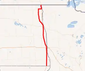
US 81 highlighted in red | ||||
| Route information | ||||
| Maintained by NDDOT | ||||
| Major junctions | ||||
| South end | ||||
| North end | ||||
| Location | ||||
| Counties | Richland, Cass, Traill, Grand Forks, Walsh, Pembina | |||
| Highway system | ||||
| ||||

Route description
U.S. 81 enters North Dakota concurrently with Interstate 29 (I-29). It heads north from the South Dakota border, passing through Fargo, to the north side of Grand Forks. There it splits off to the northwest, passing through the city of Manvel. It parallels I-29, passing through the town of Grafton before joining North Dakota Highway 5 (ND 5) near Cavalier. It rejoins I-29 and continues to the US–Canada border at Pembina. The original route of US 81 survives as ND 127 and 'County Road 81' in Richland, Cass, Traill, and Grand Forks counties.
Major intersections
Exit numbers are I-29 exit numbers.
| County | Location | mi[1] | km | Exit[1] | Destinations | Notes |
|---|---|---|---|---|---|---|
| Richland | Greendale Township | 0.000 | 0.000 | Continuation into South Dakota | ||
| 0.013 | 0.021 | 1 | ||||
| 2.074 | 3.338 | 2 | ||||
| Waldo Township | 8.073 | 12.992 | 8 | |||
| Brandenburg Township | 15.079 | 24.267 | 15 | |||
| Mooreton Township | 22.583 | 36.344 | 23 | Signed as exits 23A (east) and 23B (west) southbound | ||
| Ibsen Township | 26.030 | 41.891 | 26 | Dwight | ||
| Abercrombie Township | 31.038 | 49.951 | 31 | |||
| Colfax Township | 37.047 | 59.621 | 37 | |||
| Colfax–Walcott township line | 42.117 | 67.781 | 42 | |||
| Walcott Township | 44.126 | 71.014 | 44 | Christine | ||
| Richland–Cass county line | Walcott–Pleasant township line | 48.182 | 77.541 | 48 | ||
| Cass | Pleasant Township | 50.186 | 80.767 | 50 | ||
| Pleasant–Stanley township line | 54.167 | 87.173 | 54 | |||
| Stanley Township | 56.429 | 90.814 | 56 | Wild Rice, Horace | ||
| Fargo | 60.252 | 96.966 | 60 | Southern terminus of US 81 Bus. | ||
| 62.249 | 100.180 | 62 | 32nd Avenue South | Signed as exits 62A (east) and 62B (west) southbound | ||
| 63.267 | 101.818 | 63 | Signed as exits 63A (east) and 63B (west); I-94 exits 349A-B | |||
| 64.252 | 103.404 | 64 | 38th Street Southwest, 13th Avenue South | |||
| 65.252 | 105.013 | 65 | ||||
| 66.255 | 106.627 | 66 | 12th Avenue North (ND 294) | Western terminus of ND 294 | ||
| 67.258 | 108.241 | 67 | Northern terminus of US 81 Bus. | |||
| 69.374 | 111.647 | 69 | ||||
| Harwood | 72.778 | 117.125 | 72 | Harwood | ||
| Argusville | 78.542 | 126.401 | 78 | Argusville | ||
| Gardner | 85.826 | 138.124 | 86 | Gardner | ||
| Cass–Traill county line | Grandin | 92.142 | 148.288 | 92 | Grandin | |
| Traill | Hillsboro Township | 100.391 | 161.564 | 100 | ||
| Hillsboro | 104 | Hillsboro | ||||
| Eldorado–Ervin township line | 110.795 | 178.307 | 111 | |||
| Stavanger Township | 117.987 | 189.882 | 118 | Buxton | ||
| Traill–Grand Forks county line | Stavanger–Americus township line | 123.001 | 197.951 | 123 | ||
| Grand Forks | Walle Township | 130.043 | 209.284 | 130 | ||
| Grand Forks | 138.146 | 222.324 | 138 | Southern terminus of US 81 Bus. | ||
| 140.195 | 225.622 | 140 | ND 297 east (DeMers Avenue) – Grand Forks Downtown | Western terminus of ND 297 | ||
| 141.196 | 227.233 | 141 | ||||
| 144.711 | 232.890 | 145 | Northern terminus of US 81 Bus. | |||
| Manvel | 152.211 | 244.960 | 152 | North end of I-29 concurrency | ||
| Walsh | Grafton | 190.775 | 307.023 | South end of ND 17 concurrency | ||
| 190.993 | 307.373 | North end of ND 17 concurrency | ||||
| Pembina | | 202.271 | 325.524 | South end of ND 66 concurrency | ||
| St. Thomas | 204.273 | 328.746 | North end of ND 66 concurrency | |||
| 204.729 | 329.479 | Southern terminus of ND 91 | ||||
| 206.414 | 332.191 | Northern terminus of ND 91 | ||||
| Hamilton | 218.530 | 351.690 | South end of ND 5 concurrency | |||
| | 228.353 | 367.499 | 203 | South end of I-29 concurrency, north end of ND 5 concurrency | ||
| | 208 | |||||
| Pembina Township | 212 | No name exit | ||||
| Pembina | 215 | |||||
| Pembina Township | Canadian border at the Pembina–Emerson Border Crossing | |||||
| Northern terminus of I-29 and US 81; continuation into Manitoba | ||||||
1.000 mi = 1.609 km; 1.000 km = 0.621 mi
| ||||||
References
- North Dakota Department of Transportation. "Appendix III-09 C: Interchange Numbering on I-29" (PDF). Design Manual. Bismarck: North Dakota Department of Transportation. Archived from the original (PDF) on April 17, 2009. Retrieved June 22, 2008.